Property Record
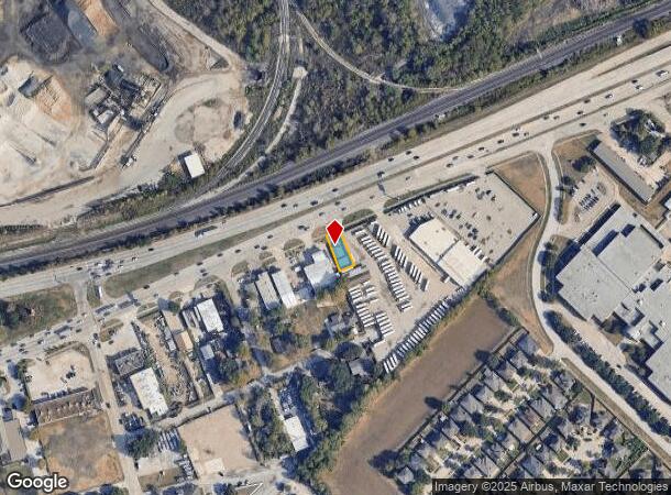
2003 Highway 90 A, Missouri City, TX 77489


NEARBY LISTINGS FOR SALE OR LEASE
Property Detail
2003 Highway 90 A
Houston-The Woodlands-Sugar Land, TX
M N Brown
2250-00-001-0702-907
M N BROWN, BLOCK 1, LOT 7 (48.7 X 100), ACRES 0.112
Commercialnec
Fort Bend
X
Texas
48157C0285M
7
2024
0.10 AC
2025
Stafford
671300
Houston
1,066 SF
DEMOGRAPHICS near 2003 Highway 90 A
1 Mile
3 Mile
5 Mile
2024 Total Population
7,224
102,819
349,199
2029 Population
8,594
118,271
386,507
Pop Growth 2024-2029
+ 18.96%
+ 15.03%
+ 10.68%
Average Age
38
39
38
2024 Total Households
2,285
36,054
122,924
HH Growth 2024-2029
+ 19.56%
+ 15.52%
+ 10.98%
Median Household Inc
$63,475
$64,908
$57,366
Avg Household Size
3.10
2.80
2.80
2024 Avg HH Vehicles
2.00
2.00
2.00
Median Home Value
$176,394
$198,239
$228,371
Median Year Built
1987
1987
1983
Nearby Places
- Restaurants
- Banks
- Shops
- Fitness
- Groceries
PUBLIC TRANSPORTATION
AIRPORT
William P Hobby
DRIVE
WALK
Distance
William P Hobby
31 min
19.7 mi
George Bush Intcntl/Houston
DRIVE
WALK
Distance
George Bush Intcntl/Houston
48 min
35.6 mi
Freight Ports
Port of Houston
DRIVE
WALK
Distance
Port of Houston
32 min
21.8 mi
SALE & LEASE HISTORY
LISTING DATE
SALE/LEASE

Sep 23, 2020
For Sale
Nov 05, 2020
For Sale
Jun 13, 2018
For Lease
Jan 02, 2020
For Lease
Nearby Properties
Address
Land Use
TOTAL SIZE
Lot Size
Zoning
Address
Land Use
TOTAL SIZE
Lot Size
Zoning
7.46 AC
Address
Land Use
TOTAL SIZE
Lot Size
Zoning
257,051 SF
64.85 AC
Address
Land Use
TOTAL SIZE
Lot Size
Zoning
109,083 SF
20.81 AC
Address
Land Use
TOTAL SIZE
Lot Size
Zoning
12.98 AC
Address
Land Use
TOTAL SIZE
Lot Size
Zoning
11.58 AC
Address
Land Use
TOTAL SIZE
Lot Size
Zoning
12.08 AC
Address
Land Use
TOTAL SIZE
Lot Size
Zoning
552,900 SF
27.86 AC
Address
Land Use
TOTAL SIZE
Lot Size
Zoning
816,006 SF
40.26 AC
Address
Land Use
TOTAL SIZE
Lot Size
Zoning
967,659 SF
75.03 AC
Address
Land Use
TOTAL SIZE
Lot Size
Zoning
344,620 SF
53.65 AC
STHQZ
Address
Land Use
TOTAL SIZE
Lot Size
Zoning
32,520 SF
34.98 AC
Address
Land Use
TOTAL SIZE
Lot Size
Zoning
35.85 AC
Address
Land Use
TOTAL SIZE
Lot Size
Zoning
85,273 SF
11.63 AC
Y
Address
Land Use
TOTAL SIZE
Lot Size
Zoning
428,538 SF
45.50 AC
Address
Land Use
TOTAL SIZE
Lot Size
Zoning
93,310 SF
13.41 AC
Address
Land Use
TOTAL SIZE
Lot Size
Zoning
14,038 SF
23.83 AC
Address
Land Use
TOTAL SIZE
Lot Size
Zoning
176,377 SF
40.41 AC
SM
Address
Land Use
TOTAL SIZE
Lot Size
Zoning
Address
Land Use
TOTAL SIZE
Lot Size
Zoning
127,458 SF
14.21 AC
Address
Land Use
TOTAL SIZE
Lot Size
Zoning
12.22 AC
Address
Land Use
TOTAL SIZE
Lot Size
Zoning
88,682 SF
10.52 AC
ASY
Address
Land Use
TOTAL SIZE
Lot Size
Zoning
382,505 SF
21.68 AC
Address
Land Use
TOTAL SIZE
Lot Size
Zoning
154,586 SF
10.93 AC
SY
Address
Land Use
TOTAL SIZE
Lot Size
Zoning
1,712 SF
17.93 AC
SM
Address
Land Use
TOTAL SIZE
Lot Size
Zoning
19.55 AC
S
Address
Land Use
TOTAL SIZE
Lot Size
Zoning
490,720 SF
26.78 AC
S
Address
Land Use
TOTAL SIZE
Lot Size
Zoning
304,006 SF
11.14 AC
Address
Land Use
TOTAL SIZE
Lot Size
Zoning
Address
Land Use
TOTAL SIZE
Lot Size
Zoning
383,515 SF
12.61 AC
Address
Land Use
TOTAL SIZE
Lot Size
Zoning
88,560 SF
10.25 AC
QZ
The World's #1 Commercial Real Estate Marketplace
Connect with us
© 2025 CoStar Group
The information above has been obtained from sources believed reliable. While we do not doubt its accuracy we have not verified it and make no guarantee, warranty or representation about it. It is your responsibility to independently confirm its accuracy and completeness. Any projections, opinions, assumptions, or estimates used are for example only and do not represent the current or future performance of the property. The value of this transaction to you depends on tax and other factors which should be evaluated by your tax, financial, and legal advisors. You and your advisors should conduct a careful, independent investigation of the property to determine to your satisfaction the suitability of the property for your needs.