Property Record
2003 Phillips St, Hempstead, TX 77445


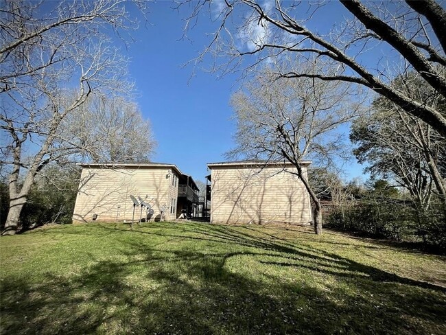
Property Detail
2003 Phillips St
9966
ABS A312400 A-124 GEORGE A DENNETT TRACT 3-1 ACRES .4104
Apartment
WALLER
B and X Area of moderate flood hazard, usually the area between the limits of the 100-year and 500-year floods.
Texas
2024
0.41 AC
2025
Waller County
680501
Houston
7,844 SF
Houston-Pasadena-The Woodlands, TX
NEARBY LISTINGS FOR SALE OR LEASE
DEMOGRAPHICS near 2003 Phillips St
1 mile
3 mile
5 mile
2025 Total Population
719
4,667
12,058
2030 Population
799
5,170
13,298
Pop Growth 2025-2030
+ 11.13%
+ 10.78%
+ 10.28%
Average Age
37
37
38
2025 Total Households
270
1,715
4,397
HH Growth 2025-2030
+ 11.48%
+ 10.73%
+ 10.17%
Median Household Inc
$27,500
$37,004
$50,861
Avg Household Size
2.70
2.70
2.70
2025 Avg HH Vehicles
2.00
2.00
2.00
Median Home Value
$310,606
$311,055
$248,118
Median Year Built
1991
1991
1987
Nearby Places
Map Layers
Map Styles
 Street
 Aerial
Transit
 Traffic
 Biking
Places
Listings with unknown addresses are not visible on the map
- Restaurants
- Banks
- Shops
- Fitness
- Groceries
SALE & LEASE HISTORY
LISTING DATE
SALE/LEASE

Apr 23, 2025
For Sale
Nearby Properties
Address
Land Use
TOTAL SIZE
Lot Size
Zoning
Address
Land Use
TOTAL SIZE
Lot Size
Zoning
315.67 AC
Address
Land Use
TOTAL SIZE
Lot Size
Zoning
Address
Land Use
TOTAL SIZE
Lot Size
Zoning
218,106 SF
8.72 AC
Address
Land Use
TOTAL SIZE
Lot Size
Zoning
239,994 SF
71.50 AC
Address
Land Use
TOTAL SIZE
Lot Size
Zoning
767 SF
26.68 AC
Address
Land Use
TOTAL SIZE
Lot Size
Zoning
257,734 SF
18.32 AC
Address
Land Use
TOTAL SIZE
Lot Size
Zoning
436.70 AC
Address
Land Use
TOTAL SIZE
Lot Size
Zoning
162,668 SF
39.99 AC
Address
Land Use
TOTAL SIZE
Lot Size
Zoning
140,211 SF
4.53 AC
Address
Land Use
TOTAL SIZE
Lot Size
Zoning
84,596 SF
4.17 AC
Address
Land Use
TOTAL SIZE
Lot Size
Zoning
76,137 SF
15 AC
Address
Land Use
TOTAL SIZE
Lot Size
Zoning
97,294 SF
14.51 AC
Address
Land Use
TOTAL SIZE
Lot Size
Zoning
62,526 SF
3.10 AC
Address
Land Use
TOTAL SIZE
Lot Size
Zoning
402 SF
66.22 AC
Address
Land Use
TOTAL SIZE
Lot Size
Zoning
80,364 SF
25 AC
Address
Land Use
TOTAL SIZE
Lot Size
Zoning
111.30 AC
Address
Land Use
TOTAL SIZE
Lot Size
Zoning
227,400 SF
14.05 AC
Address
Land Use
TOTAL SIZE
Lot Size
Zoning
27,860 SF
8.29 AC
Address
Land Use
TOTAL SIZE
Lot Size
Zoning
283,081 SF
16.35 AC
Address
Land Use
TOTAL SIZE
Lot Size
Zoning
40.85 AC
Address
Land Use
TOTAL SIZE
Lot Size
Zoning
33,798 SF
6.08 AC
Address
Land Use
TOTAL SIZE
Lot Size
Zoning
43,184 SF
4.56 AC
Address
Land Use
TOTAL SIZE
Lot Size
Zoning
127,162 SF
11 AC
Address
Land Use
TOTAL SIZE
Lot Size
Zoning
12,496 SF
47.19 AC
Address
Land Use
TOTAL SIZE
Lot Size
Zoning
32,040 SF
17.29 AC
Address
Land Use
TOTAL SIZE
Lot Size
Zoning
30,000 SF
3.98 AC
Address
Land Use
TOTAL SIZE
Lot Size
Zoning
9,420 SF
1.92 AC
Address
Land Use
TOTAL SIZE
Lot Size
Zoning
8,600 SF
5.29 AC
Address
Land Use
TOTAL SIZE
Lot Size
Zoning
60.32 AC
The World's #1 Commercial Real Estate Marketplace
Connect with us
© 2026 CoStar Group
The information above has been obtained from sources believed reliable. While we do not doubt its accuracy we have not verified it and make no guarantee, warranty or representation about it. It is your responsibility to independently confirm its accuracy and completeness. Any projections, opinions, assumptions, or estimates used are for example only and do not represent the current or future performance of the property. The value of this transaction to you depends on tax and other factors which should be evaluated by your tax, financial, and legal advisors. You and your advisors should conduct a careful, independent investigation of the property to determine to your satisfaction the suitability of the property for your needs.