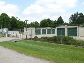
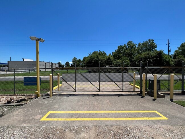
Property Record
20030 Cook Rd, Tomball, TX 77377

Property Detail
20030 Cook Rd
0460420010082
TR 42A ABST 942 S YOUNG
Publicstorage
HARRIS
B and X Area of moderate flood hazard, usually the area between the limits of the 100-year and 500-year floods.
Texas
2025
0.94 AC
2025
Northwest Outlier
555600
Houston
10,200 SF
Houston-Pasadena-The Woodlands, TX
NEARBY LISTINGS FOR SALE OR LEASE
-
-
View all Tomball listings for sale on LoopNet.com
DEMOGRAPHICS near 20030 Cook Rd
1 mile
3 mile
5 mile
2025 Total Population
1,843
16,859
71,751
2030 Population
2,149
18,975
78,757
Pop Growth 2025-2030
+ 16.60%
+ 12.55%
+ 9.76%
Average Age
40
39
37
2025 Total Households
633
5,403
22,624
HH Growth 2025-2030
+ 17.06%
+ 12.86%
+ 10.11%
Median Household Inc
$134,500
$135,009
$122,253
Avg Household Size
2.90
3.10
3.10
2025 Avg HH Vehicles
2.00
2.00
2.00
Median Home Value
$476,890
$475,366
$369,785
Median Year Built
2011
2010
2009
Nearby Places
Map Layers
Map Styles
 Street
 Aerial
Layers
 Traffic
 Biking
Places
Listings with unknown addresses are not visible on the map
- Restaurants
- Banks
- Shops
- Fitness
- Groceries
PUBLIC TRANSPORTATION
AIRPORT
George Bush Intcntl/Houston
Drive
Walk
Distance
George Bush Intcntl/Houston
40 min
31.8 mi
Freight Ports
Port of Houston
Drive
Walk
Distance
Port of Houston
60 min
42.5 mi
SALE & LEASE HISTORY
LISTING DATE
SALE/LEASE

May 20, 2024
For Sale
Feb 23, 2024
For Sale
Nearby Properties
Address
Land Use
TOTAL SIZE
Lot Size
Zoning
Address
Land Use
TOTAL SIZE
Lot Size
Zoning
326,902 SF
15.45 AC
Address
Land Use
TOTAL SIZE
Lot Size
Zoning
280.90 AC
Address
Land Use
TOTAL SIZE
Lot Size
Zoning
123,400 SF
15.08 AC
Address
Land Use
TOTAL SIZE
Lot Size
Zoning
55,800 SF
25.95 AC
Address
Land Use
TOTAL SIZE
Lot Size
Zoning
210.95 AC
Address
Land Use
TOTAL SIZE
Lot Size
Zoning
27,542 SF
4.44 AC
Address
Land Use
TOTAL SIZE
Lot Size
Zoning
74,400 SF
6.43 AC
Address
Land Use
TOTAL SIZE
Lot Size
Zoning
56,396 SF
29.96 AC
Address
Land Use
TOTAL SIZE
Lot Size
Zoning
57,059 SF
83.47 AC
Address
Land Use
TOTAL SIZE
Lot Size
Zoning
157.95 AC
Address
Land Use
TOTAL SIZE
Lot Size
Zoning
62,322 SF
15.82 AC
Address
Land Use
TOTAL SIZE
Lot Size
Zoning
39,320 SF
6.46 AC
Address
Land Use
TOTAL SIZE
Lot Size
Zoning
48,100 SF
6.13 AC
Address
Land Use
TOTAL SIZE
Lot Size
Zoning
83,930 SF
4.74 AC
Address
Land Use
TOTAL SIZE
Lot Size
Zoning
76.78 AC
Address
Land Use
TOTAL SIZE
Lot Size
Zoning
17,248 SF
5.10 AC
Address
Land Use
TOTAL SIZE
Lot Size
Zoning
113,545 SF
8.24 AC
Address
Land Use
TOTAL SIZE
Lot Size
Zoning
85,700 SF
6 AC
Address
Land Use
TOTAL SIZE
Lot Size
Zoning
6,729 SF
98.17 AC
Address
Land Use
TOTAL SIZE
Lot Size
Zoning
24,324 SF
2.29 AC
Address
Land Use
TOTAL SIZE
Lot Size
Zoning
924 SF
96.75 AC
Address
Land Use
TOTAL SIZE
Lot Size
Zoning
81.64 AC
Address
Land Use
TOTAL SIZE
Lot Size
Zoning
94.79 AC
Address
Land Use
TOTAL SIZE
Lot Size
Zoning
Address
Land Use
TOTAL SIZE
Lot Size
Zoning
20,581 SF
14.85 AC
Address
Land Use
TOTAL SIZE
Lot Size
Zoning
3,428 SF
12.76 AC
Address
Land Use
TOTAL SIZE
Lot Size
Zoning
113.94 AC
Address
Land Use
TOTAL SIZE
Lot Size
Zoning
48.33 AC
Address
Land Use
TOTAL SIZE
Lot Size
Zoning
52.94 AC
Address
Land Use
TOTAL SIZE
Lot Size
Zoning
The World's #1 Commercial Real Estate Marketplace
Connect with us
© 2026 CoStar Group
The information above has been obtained from sources believed reliable. While we do not doubt its accuracy we have not verified it and make no guarantee, warranty or representation about it. It is your responsibility to independently confirm its accuracy and completeness. Any projections, opinions, assumptions, or estimates used are for example only and do not represent the current or future performance of the property. The value of this transaction to you depends on tax and other factors which should be evaluated by your tax, financial, and legal advisors. You and your advisors should conduct a careful, independent investigation of the property to determine to your satisfaction the suitability of the property for your needs.