Property Record
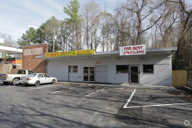
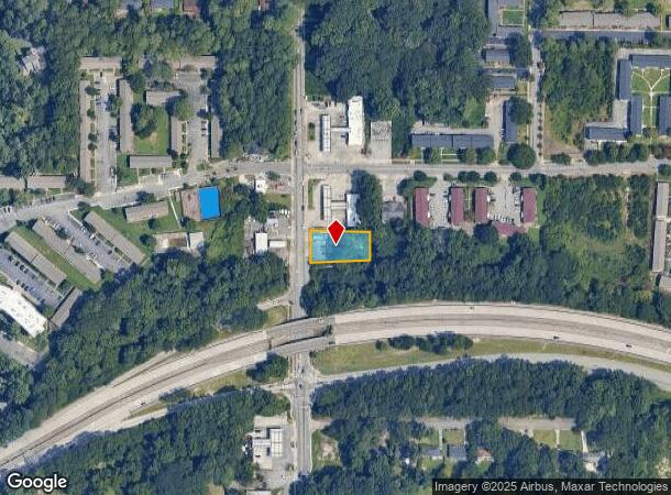
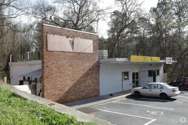
2006 Delowe Dr Sw, Atlanta, GA 30311
This Property Is For Sale
NEARBY LISTINGS FOR SALE OR LEASE
Property Detail
2006 Delowe Dr Sw
14-0167-0004-022-0
KA CROWN PIZZA & HAIR CITY AN
Storebuilding
Fulton
AE
Georgia
13121C0354F
0.36 AC
2024
College Park/SW Atl
2025
Atlanta
007603
Atlanta-Sandy Springs-Roswell, GA
2,272 SF
DEMOGRAPHICS near 2006 Delowe Dr Sw
1 Mile
3 Mile
5 Mile
2024 Total Population
13,108
79,262
223,528
2029 Population
13,698
82,168
233,368
Pop Growth 2024-2029
+ 4.50%
+ 3.67%
+ 4.40%
Average Age
39
40
38
2024 Total Households
5,877
33,952
91,184
HH Growth 2024-2029
+ 4.54%
+ 3.79%
+ 4.54%
Median Household Inc
$28,041
$47,911
$45,208
Avg Household Size
2.20
2.30
2.30
2024 Avg HH Vehicles
1.00
1.00
1.00
Median Home Value
$166,148
$254,518
$244,412
Median Year Built
1966
1962
1970
Nearby Places
Map Layers
Map Styles
 Street
 Aerial
- Restaurants
- Banks
- Shops
- Fitness
- Groceries
PUBLIC TRANSPORTATION
COMMUTER RAIL
Atlanta (Crescent - Amtrak)
DRIVE
WALK
Distance
Atlanta (Crescent - Amtrak)
18 min
9.6 mi
AIRPORT
Hartsfield - Jackson Atlanta International
DRIVE
WALK
Distance
Hartsfield - Jackson Atlanta International
15 min
8.2 mi
Freight Ports
Georgia Ports - Savannah
DRIVE
WALK
Distance
Georgia Ports - Savannah
278 min
247.5 mi
Nearby Properties
Address
Land Use
TOTAL SIZE
Lot Size
Zoning
Address
Land Use
TOTAL SIZE
Lot Size
Zoning
11.74 AC
I1
Address
Land Use
TOTAL SIZE
Lot Size
Zoning
541,508 SF
110.88 AC
I1
Address
Land Use
TOTAL SIZE
Lot Size
Zoning
196,294 SF
0.49 AC
R1
Address
Land Use
TOTAL SIZE
Lot Size
Zoning
857,294 SF
101.10 AC
I1
Address
Land Use
TOTAL SIZE
Lot Size
Zoning
293,935 SF
8.47 AC
I2
Address
Land Use
TOTAL SIZE
Lot Size
Zoning
817,277 SF
21.04 AC
R3
Address
Land Use
TOTAL SIZE
Lot Size
Zoning
5,459 SF
12.97 AC
C1
Address
Land Use
TOTAL SIZE
Lot Size
Zoning
3,411,710 SF
25.97 AC
RG3
Address
Land Use
TOTAL SIZE
Lot Size
Zoning
282,610 SF
11.20 AC
C1
Address
Land Use
TOTAL SIZE
Lot Size
Zoning
425,270 SF
201.84 AC
I1
Address
Land Use
TOTAL SIZE
Lot Size
Zoning
274,442 SF
20.33 AC
RG2
Address
Land Use
TOTAL SIZE
Lot Size
Zoning
3,268,352 SF
23.31 AC
RG2
Address
Land Use
TOTAL SIZE
Lot Size
Zoning
135,211 SF
51.76 AC
OI
Address
Land Use
TOTAL SIZE
Lot Size
Zoning
563,256 SF
22.69 AC
I1
Address
Land Use
TOTAL SIZE
Lot Size
Zoning
3,289,702 SF
16.23 AC
C1C
Address
Land Use
TOTAL SIZE
Lot Size
Zoning
28.58 AC
Address
Land Use
TOTAL SIZE
Lot Size
Zoning
4.25 AC
R3
Address
Land Use
TOTAL SIZE
Lot Size
Zoning
6,834,480 SF
9.85 AC
RG3
Address
Land Use
TOTAL SIZE
Lot Size
Zoning
689,523 SF
34.32 AC
I1
Address
Land Use
TOTAL SIZE
Lot Size
Zoning
1,352,250 SF
3.18 AC
C2
Address
Land Use
TOTAL SIZE
Lot Size
Zoning
35.10 AC
R1
Address
Land Use
TOTAL SIZE
Lot Size
Zoning
2,002,026 SF
17.51 AC
RLC
Address
Land Use
TOTAL SIZE
Lot Size
Zoning
2,963,779 SF
10.07 AC
C1
Address
Land Use
TOTAL SIZE
Lot Size
Zoning
154,200 SF
3.09 AC
I2
Address
Land Use
TOTAL SIZE
Lot Size
Zoning
764,659 SF
51.57 AC
C1
Address
Land Use
TOTAL SIZE
Lot Size
Zoning
279,108 SF
6.06 AC
C2
Address
Land Use
TOTAL SIZE
Lot Size
Zoning
79,988 SF
4.05 AC
I1
Address
Land Use
TOTAL SIZE
Lot Size
Zoning
38.04 AC
I1
Address
Land Use
TOTAL SIZE
Lot Size
Zoning
910 SF
28.75 AC
R1
Address
Land Use
TOTAL SIZE
Lot Size
Zoning
1,699,720 SF
7.94 AC
C1
The World's #1 Commercial Real Estate Marketplace
Connect with us
© 2025 CoStar Group
The information above has been obtained from sources believed reliable. While we do not doubt its accuracy we have not verified it and make no guarantee, warranty or representation about it. It is your responsibility to independently confirm its accuracy and completeness. Any projections, opinions, assumptions, or estimates used are for example only and do not represent the current or future performance of the property. The value of this transaction to you depends on tax and other factors which should be evaluated by your tax, financial, and legal advisors. You and your advisors should conduct a careful, independent investigation of the property to determine to your satisfaction the suitability of the property for your needs.