Property Record
2004 E Blackstock Rd, Roebuck, SC 29376
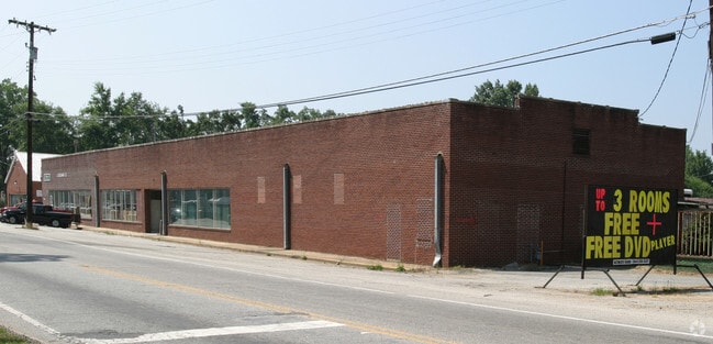


Property Detail
2004 E Blackstock Rd
Spartanburg, SC
PARCEL 1 GRIFFIN GEAR INC SURVEY PB 168-442 DB 132B-486 DB 132B-488 DB 132B-490
6-29-14-016.00
SPARTANBURG
Commercialnec
South Carolina
B and X Area of moderate flood hazard, usually the area between the limits of the 100-year and 500-year floods.
6-7
2024
4.68 AC
2025
Lower Spartanburg Cty
023803
Greenville/Spartanburg
1,876 SF
NEARBY LISTINGS FOR SALE OR LEASE
DEMOGRAPHICS near 2004 E Blackstock Rd
1 mile
3 mile
5 mile
2025 Total Population
2,391
21,046
66,310
2030 Population
2,677
23,516
74,113
Pop Growth 2025-2030
+ 11.96%
+ 11.74%
+ 11.77%
Average Age
40
39
40
2025 Total Households
912
8,202
26,275
HH Growth 2025-2030
+ 11.95%
+ 11.78%
+ 11.82%
Median Household Inc
$62,517
$61,865
$58,890
Avg Household Size
2.50
2.50
2.40
2025 Avg HH Vehicles
2.00
2.00
2.00
Median Home Value
$234,022
$244,875
$240,302
Median Year Built
1995
1991
1986
Nearby Places
Map Layers
Map Styles
 Street
 Aerial
Transit
 Traffic
 Biking
Places
Listings with unknown addresses are not visible on the map
- Restaurants
- Banks
- Shops
- Fitness
- Groceries
PUBLIC TRANSPORTATION
COMMUTER RAIL
Spartanburg Amtrak Station (Crescent - Amtrak)
Drive
Walk
Distance
Spartanburg Amtrak Station (Crescent - Amtrak)
13 min
6.4 mi
AIRPORT
Greenville Spartanburg International
Drive
Walk
Distance
Greenville Spartanburg International
32 min
20.0 mi
Freight Ports
North Charleston Terminal
Drive
Walk
Distance
North Charleston Terminal
211 min
188.6 mi
SALE & LEASE HISTORY
LISTING DATE
SALE/LEASE

May 29, 2025
For Sale
Nearby Properties
Address
Land Use
TOTAL SIZE
Lot Size
Zoning
Address
Land Use
TOTAL SIZE
Lot Size
Zoning
2,112 SF
5.26 AC
Address
Land Use
TOTAL SIZE
Lot Size
Zoning
2,297 SF
42.76 AC
Address
Land Use
TOTAL SIZE
Lot Size
Zoning
3,072 SF
5.60 AC
Address
Land Use
TOTAL SIZE
Lot Size
Zoning
2,176 SF
20.63 AC
Address
Land Use
TOTAL SIZE
Lot Size
Zoning
1,475 SF
9.27 AC
Address
Land Use
TOTAL SIZE
Lot Size
Zoning
10,216 SF
3.03 AC
Address
Land Use
TOTAL SIZE
Lot Size
Zoning
7,406 SF
0.74 AC
Address
Land Use
TOTAL SIZE
Lot Size
Zoning
20,844 SF
15 AC
Address
Land Use
TOTAL SIZE
Lot Size
Zoning
3,884 SF
10.50 AC
Address
Land Use
TOTAL SIZE
Lot Size
Zoning
1,861 SF
155.78 AC
Address
Land Use
TOTAL SIZE
Lot Size
Zoning
4,007 SF
Address
Land Use
TOTAL SIZE
Lot Size
Zoning
9,941 SF
7.04 AC
Address
Land Use
TOTAL SIZE
Lot Size
Zoning
3,813 SF
1.24 AC
Address
Land Use
TOTAL SIZE
Lot Size
Zoning
9,594 SF
Address
Land Use
TOTAL SIZE
Lot Size
Zoning
12.76 AC
Address
Land Use
TOTAL SIZE
Lot Size
Zoning
3,272 SF
Address
Land Use
TOTAL SIZE
Lot Size
Zoning
3,204 SF
0.25 AC
Address
Land Use
TOTAL SIZE
Lot Size
Zoning
3,335 SF
0.33 AC
Address
Land Use
TOTAL SIZE
Lot Size
Zoning
2,985 SF
0.14 AC
Address
Land Use
TOTAL SIZE
Lot Size
Zoning
3,372 SF
0.16 AC
Address
Land Use
TOTAL SIZE
Lot Size
Zoning
3,105 SF
0.16 AC
Address
Land Use
TOTAL SIZE
Lot Size
Zoning
1,152 SF
5.11 AC
Address
Land Use
TOTAL SIZE
Lot Size
Zoning
38,100 SF
9.74 AC
Address
Land Use
TOTAL SIZE
Lot Size
Zoning
2,476 SF
0.16 AC
Address
Land Use
TOTAL SIZE
Lot Size
Zoning
2,454 SF
0.38 AC
Address
Land Use
TOTAL SIZE
Lot Size
Zoning
2,551 SF
0.74 AC
Address
Land Use
TOTAL SIZE
Lot Size
Zoning
2,429 SF
1.33 AC
Address
Land Use
TOTAL SIZE
Lot Size
Zoning
3,234 SF
0.88 AC
Address
Land Use
TOTAL SIZE
Lot Size
Zoning
2,718 SF
0.46 AC
Address
Land Use
TOTAL SIZE
Lot Size
Zoning
209,570 SF
24.36 AC
The World's #1 Commercial Real Estate Marketplace
Connect with us
© 2026 CoStar Group
The information above has been obtained from sources believed reliable. While we do not doubt its accuracy we have not verified it and make no guarantee, warranty or representation about it. It is your responsibility to independently confirm its accuracy and completeness. Any projections, opinions, assumptions, or estimates used are for example only and do not represent the current or future performance of the property. The value of this transaction to you depends on tax and other factors which should be evaluated by your tax, financial, and legal advisors. You and your advisors should conduct a careful, independent investigation of the property to determine to your satisfaction the suitability of the property for your needs.