Property Record
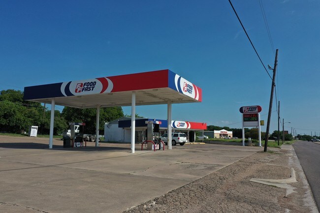
2004 N 3Rd St, Temple, TX 76501


Property Detail
2004 N 3Rd St
44436
TEMPLE ORIGINAL, BLOCK 0C9, LOT PT BLK, (78.60 X 78.57 X 99.80 X 61.85 X 77.32 X 74.55 X 133.55), ACRES .522
Commercialnec
Bell
COMB
Texas
B and X Area of moderate flood hazard, usually the area between the limits of the 100-year and 500-year floods.
1.04 AC
2025
Temple
2025
Killeen/Temple/Fort Hood
020600
Killeen-Temple, TX
1,845 SF
NEARBY LISTINGS FOR SALE OR LEASE
DEMOGRAPHICS near 2004 N 3Rd St
1 mile
3 mile
5 mile
2025 Total Population
7,221
33,831
65,444
2030 Population
7,660
36,059
69,775
Pop Growth 2025-2030
+ 6.08%
+ 6.59%
+ 6.62%
Average Age
39
38
39
2025 Total Households
2,756
13,661
27,369
HH Growth 2025-2030
+ 6.10%
+ 6.61%
+ 6.71%
Median Household Inc
$67,709
$53,137
$60,861
Avg Household Size
2.60
2.40
2.30
2025 Avg HH Vehicles
2.00
2.00
2.00
Median Home Value
$174,601
$178,889
$222,097
Median Year Built
1959
1974
1983
Nearby Places
Map Layers
Map Styles
 Street
 Aerial
Transit
 Traffic
 Biking
Places
Listings with unknown addresses are not visible on the map
- Restaurants
- Banks
- Shops
- Fitness
- Groceries
PUBLIC TRANSPORTATION
COMMUTER RAIL
Drive
Walk
Distance
5 min
1.8 mi
AIRPORT
Killeen Municipal
Drive
Walk
Distance
Killeen Municipal
32 min
25.2 mi
Robert Gray AAF
Drive
Walk
Distance
Robert Gray AAF
51 min
39.1 mi
Waco Regional
Drive
Walk
Distance
Waco Regional
54 min
40.9 mi
SALE & LEASE HISTORY
LISTING DATE
SALE/LEASE

Jun 09, 2017
For Sale
Dec 27, 2019
For Sale
Nearby Properties
Address
Land Use
TOTAL SIZE
Lot Size
Zoning
Address
Land Use
TOTAL SIZE
Lot Size
Zoning
274,710 SF
38.05 AC
C
Address
Land Use
TOTAL SIZE
Lot Size
Zoning
1,546,481 SF
111.97 AC
MF2
Address
Land Use
TOTAL SIZE
Lot Size
Zoning
86,326 SF
8.70 AC
MF1
Address
Land Use
TOTAL SIZE
Lot Size
Zoning
77,450 SF
16.51 AC
Address
Land Use
TOTAL SIZE
Lot Size
Zoning
Address
Land Use
TOTAL SIZE
Lot Size
Zoning
Address
Land Use
TOTAL SIZE
Lot Size
Zoning
71,378 SF
13.75 AC
Address
Land Use
TOTAL SIZE
Lot Size
Zoning
71,378 SF
14.37 AC
A
Address
Land Use
TOTAL SIZE
Lot Size
Zoning
Address
Land Use
TOTAL SIZE
Lot Size
Zoning
188,072 SF
9.51 AC
C
Address
Land Use
TOTAL SIZE
Lot Size
Zoning
Address
Land Use
TOTAL SIZE
Lot Size
Zoning
612,900 SF
38.68 AC
Address
Land Use
TOTAL SIZE
Lot Size
Zoning
1,088 SF
Address
Land Use
TOTAL SIZE
Lot Size
Zoning
159,250 SF
0.85 AC
CA
Address
Land Use
TOTAL SIZE
Lot Size
Zoning
81,608 SF
11.15 AC
2F
Address
Land Use
TOTAL SIZE
Lot Size
Zoning
155,262 SF
10 AC
MF2
Address
Land Use
TOTAL SIZE
Lot Size
Zoning
176,542 SF
11.50 AC
COMB
Address
Land Use
TOTAL SIZE
Lot Size
Zoning
71,382 SF
59.32 AC
Address
Land Use
TOTAL SIZE
Lot Size
Zoning
147,052 SF
6.93 AC
MF2
Address
Land Use
TOTAL SIZE
Lot Size
Zoning
105,238 SF
12.33 AC
GR
Address
Land Use
TOTAL SIZE
Lot Size
Zoning
117,017 SF
64.64 AC
Address
Land Use
TOTAL SIZE
Lot Size
Zoning
1,088 SF
Address
Land Use
TOTAL SIZE
Lot Size
Zoning
154,068 SF
11.33 AC
Address
Land Use
TOTAL SIZE
Lot Size
Zoning
150,382 SF
9.48 AC
MF2
Address
Land Use
TOTAL SIZE
Lot Size
Zoning
48,248 SF
14 AC
SCHL
Address
Land Use
TOTAL SIZE
Lot Size
Zoning
45,000 SF
0.18 AC
CA
Address
Land Use
TOTAL SIZE
Lot Size
Zoning
Address
Land Use
TOTAL SIZE
Lot Size
Zoning
Address
Land Use
TOTAL SIZE
Lot Size
Zoning
246,008 SF
21.53 AC
Address
Land Use
TOTAL SIZE
Lot Size
Zoning
69,689 SF
59.75 AC
The World's #1 Commercial Real Estate Marketplace
Connect with us
© 2026 CoStar Group
The information above has been obtained from sources believed reliable. While we do not doubt its accuracy we have not verified it and make no guarantee, warranty or representation about it. It is your responsibility to independently confirm its accuracy and completeness. Any projections, opinions, assumptions, or estimates used are for example only and do not represent the current or future performance of the property. The value of this transaction to you depends on tax and other factors which should be evaluated by your tax, financial, and legal advisors. You and your advisors should conduct a careful, independent investigation of the property to determine to your satisfaction the suitability of the property for your needs.