Property Record
2010 Wilmington Hwy, Jacksonville, NC 28540


NEARBY LISTINGS FOR SALE OR LEASE
-
-
View all Jacksonville listings for sale on LoopNet.com
Property Detail
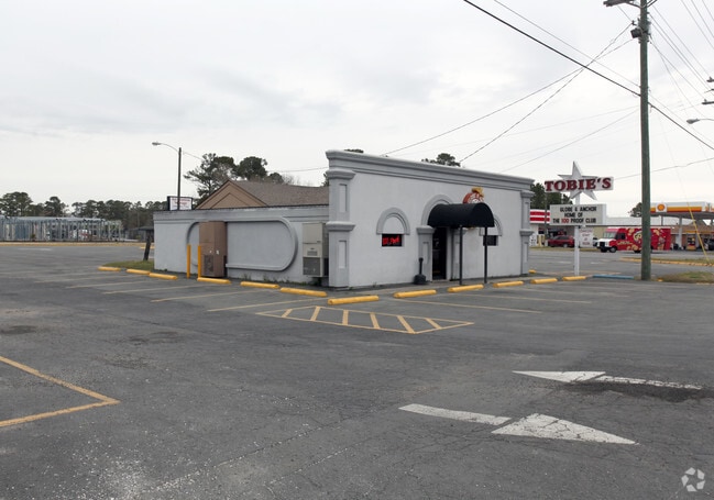
2010 Wilmington Hwy
031378
US 17
Bartavern
Onslow
X
North Carolina
3720435600J
0.33 AC
2025
North Carolina Southeast Area
2025
Other Market Areas
001102
Jacksonville, NC
1,600 SF
DEMOGRAPHICS near 2010 Wilmington Hwy
1 Mile
3 Mile
5 Mile
2024 Total Population
2,951
16,826
49,915
2029 Population
3,095
17,714
52,223
Pop Growth 2024-2029
+ 4.88%
+ 5.28%
+ 4.62%
Average Age
29
31
32
2024 Total Households
768
4,795
16,095
HH Growth 2024-2029
+ 6.12%
+ 6.34%
+ 5.39%
Median Household Inc
$40,217
$48,381
$50,813
Avg Household Size
2.30
2.40
2.50
2024 Avg HH Vehicles
2.00
2.00
2.00
Median Home Value
$149,717
$161,277
$165,789
Median Year Built
1982
1985
1982
Nearby Places
Map Layers
Map Styles
 Street
 Aerial
- Restaurants
- Banks
- Shops
- Fitness
- Groceries
PUBLIC TRANSPORTATION
AIRPORT
Albert J Ellis
DRIVE
WALK
Distance
Albert J Ellis
28 min
14.5 mi
Freight Ports
Port of Morehead City
DRIVE
WALK
Distance
Port of Morehead City
73 min
47.7 mi
Nearby Properties
Address
Land Use
TOTAL SIZE
Lot Size
Zoning
Address
Land Use
TOTAL SIZE
Lot Size
Zoning
189,717 SF
1.93 AC
DTB
Address
Land Use
TOTAL SIZE
Lot Size
Zoning
38,147 SF
3.14 AC
DTB
Address
Land Use
TOTAL SIZE
Lot Size
Zoning
94,547 SF
6.37 AC
DTB
Address
Land Use
TOTAL SIZE
Lot Size
Zoning
211,186 SF
22.08 AC
CC
Address
Land Use
TOTAL SIZE
Lot Size
Zoning
93,849 SF
60 AC
HB
Address
Land Use
TOTAL SIZE
Lot Size
Zoning
94,263 SF
5.88 AC
DTB
Address
Land Use
TOTAL SIZE
Lot Size
Zoning
464 SF
458.49 AC
H-IN
Address
Land Use
TOTAL SIZE
Lot Size
Zoning
79,581 SF
35 AC
O+I
Address
Land Use
TOTAL SIZE
Lot Size
Zoning
2,480 SF
11.59 AC
RMF-HD
Address
Land Use
TOTAL SIZE
Lot Size
Zoning
11,064 SF
17.85 AC
RMF-HD
Address
Land Use
TOTAL SIZE
Lot Size
Zoning
140,403 SF
15.78 AC
CC
Address
Land Use
TOTAL SIZE
Lot Size
Zoning
58,570 SF
8.95 AC
DTB
Address
Land Use
TOTAL SIZE
Lot Size
Zoning
36,567 SF
25.60 AC
HB
Address
Land Use
TOTAL SIZE
Lot Size
Zoning
18,480 SF
93 AC
IND
Address
Land Use
TOTAL SIZE
Lot Size
Zoning
22,128 SF
12.38 AC
OI
Address
Land Use
TOTAL SIZE
Lot Size
Zoning
67,945 SF
2.35 AC
DTB
Address
Land Use
TOTAL SIZE
Lot Size
Zoning
29,117 SF
25.52 AC
CC
Address
Land Use
TOTAL SIZE
Lot Size
Zoning
29,476 SF
4.95 AC
CC
Address
Land Use
TOTAL SIZE
Lot Size
Zoning
37,601 SF
7.60 AC
DTB
Address
Land Use
TOTAL SIZE
Lot Size
Zoning
4,788 SF
21.71 AC
OI
Address
Land Use
TOTAL SIZE
Lot Size
Zoning
10,001 SF
5.86 AC
CC
Address
Land Use
TOTAL SIZE
Lot Size
Zoning
21,789 SF
10.04 AC
OI
Address
Land Use
TOTAL SIZE
Lot Size
Zoning
30,036 SF
6.41 AC
CC
Address
Land Use
TOTAL SIZE
Lot Size
Zoning
15,950 SF
10.50 AC
CC
Address
Land Use
TOTAL SIZE
Lot Size
Zoning
1,500 SF
27.43 AC
DTB
Address
Land Use
TOTAL SIZE
Lot Size
Zoning
11,860 SF
20.63 AC
HB
Address
Land Use
TOTAL SIZE
Lot Size
Zoning
22,213 SF
35.49 AC
OI
Address
Land Use
TOTAL SIZE
Lot Size
Zoning
8,298 SF
6.04 AC
CC
Address
Land Use
TOTAL SIZE
Lot Size
Zoning
15,000 SF
1.72 AC
CC
Address
Land Use
TOTAL SIZE
Lot Size
Zoning
6,032 SF
7.89 AC
HB
The World's #1 Commercial Real Estate Marketplace
Connect with us
© 2026 CoStar Group
The information above has been obtained from sources believed reliable. While we do not doubt its accuracy we have not verified it and make no guarantee, warranty or representation about it. It is your responsibility to independently confirm its accuracy and completeness. Any projections, opinions, assumptions, or estimates used are for example only and do not represent the current or future performance of the property. The value of this transaction to you depends on tax and other factors which should be evaluated by your tax, financial, and legal advisors. You and your advisors should conduct a careful, independent investigation of the property to determine to your satisfaction the suitability of the property for your needs.