Property Record
2005 E Main Rd, Portsmouth, RI 02871
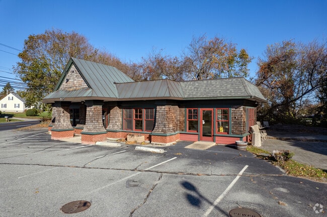


Property Detail
2005 E Main Rd
Commercialbuilding
Newport
C
Rhode Island
B and X Area of moderate flood hazard, usually the area between the limits of the 100-year and 500-year floods.
0.41 AC
2025
Newport County
2025
Providence
040102
Providence-Warwick, RI-MA
1,624 SF
PORT-000042-000000-000002
NEARBY LISTINGS FOR SALE OR LEASE
DEMOGRAPHICS near 2005 E Main Rd
1 mile
3 mile
5 mile
2025 Total Population
3,693
13,183
31,723
2030 Population
3,520
12,680
31,177
Pop Growth 2025-2030
(4.68%)
(3.82%)
(1.72%)
Average Age
47
47
45
2025 Total Households
1,438
5,369
12,829
HH Growth 2025-2030
(3.89%)
(2.96%)
(3.29%)
Median Household Inc
$149,625
$131,269
$116,796
Avg Household Size
2.50
2.40
2.40
2025 Avg HH Vehicles
2.00
2.00
2.00
Median Home Value
$750,994
$714,270
$641,050
Median Year Built
1970
1969
1975
Nearby Places
Map Layers
Map Styles
 Street
 Aerial
Layers
 Traffic
 Biking
Places
Listings with unknown addresses are not visible on the map
- Restaurants
- Banks
- Shops
- Fitness
- Groceries
PUBLIC TRANSPORTATION
AIRPORT
Rhode Island Tf Green International
Drive
Walk
Distance
Rhode Island Tf Green International
51 min
30.5 mi
Freight Ports
Port of Davisville, RI
Drive
Walk
Distance
Port of Davisville, RI
45 min
23.9 mi
SALE & LEASE HISTORY
LISTING DATE
SALE/LEASE

Oct 23, 2020
For Sale
Nov 16, 2022
For Lease
Nearby Properties
Address
Land Use
TOTAL SIZE
Lot Size
Zoning
Address
Land Use
TOTAL SIZE
Lot Size
Zoning
42 AC
R20
Address
Land Use
TOTAL SIZE
Lot Size
Zoning
13,478 SF
1 AC
HI
Address
Land Use
TOTAL SIZE
Lot Size
Zoning
120.20 AC
HI
Address
Land Use
TOTAL SIZE
Lot Size
Zoning
157,806 SF
36.80 AC
R30
Address
Land Use
TOTAL SIZE
Lot Size
Zoning
26.66 AC
R20
Address
Land Use
TOTAL SIZE
Lot Size
Zoning
9.01 AC
R20
Address
Land Use
TOTAL SIZE
Lot Size
Zoning
23.78 AC
WD
Address
Land Use
TOTAL SIZE
Lot Size
Zoning
16 AC
WD
Address
Land Use
TOTAL SIZE
Lot Size
Zoning
Address
Land Use
TOTAL SIZE
Lot Size
Zoning
38 AC
OS
Address
Land Use
TOTAL SIZE
Lot Size
Zoning
6 AC
HI
Address
Land Use
TOTAL SIZE
Lot Size
Zoning
74,293 SF
10.77 AC
TC
Address
Land Use
TOTAL SIZE
Lot Size
Zoning
367.97 AC
OS
Address
Land Use
TOTAL SIZE
Lot Size
Zoning
44,815 SF
5 AC
R20
Address
Land Use
TOTAL SIZE
Lot Size
Zoning
48,351 SF
10.75 AC
R20
Address
Land Use
TOTAL SIZE
Lot Size
Zoning
44.80 AC
R20
Address
Land Use
TOTAL SIZE
Lot Size
Zoning
39,116 SF
1 AC
R30
Address
Land Use
TOTAL SIZE
Lot Size
Zoning
1 AC
R60
Address
Land Use
TOTAL SIZE
Lot Size
Zoning
44 AC
R60
Address
Land Use
TOTAL SIZE
Lot Size
Zoning
60,480 SF
3.88 AC
R20
Address
Land Use
TOTAL SIZE
Lot Size
Zoning
4 AC
R30
Address
Land Use
TOTAL SIZE
Lot Size
Zoning
5.85 AC
LI
Address
Land Use
TOTAL SIZE
Lot Size
Zoning
10.46 AC
R20
Address
Land Use
TOTAL SIZE
Lot Size
Zoning
33,916 SF
5.75 AC
TC
Address
Land Use
TOTAL SIZE
Lot Size
Zoning
244 AC
R60/HI
Address
Land Use
TOTAL SIZE
Lot Size
Zoning
R60/HI
Address
Land Use
TOTAL SIZE
Lot Size
Zoning
2.81 AC
C
Address
Land Use
TOTAL SIZE
Lot Size
Zoning
103.81 AC
R30
Address
Land Use
TOTAL SIZE
Lot Size
Zoning
18,773 SF
1 AC
R60
Address
Land Use
TOTAL SIZE
Lot Size
Zoning
13.80 AC
R20
The World's #1 Commercial Real Estate Marketplace
Connect with us
© 2026 CoStar Group
The information above has been obtained from sources believed reliable. While we do not doubt its accuracy we have not verified it and make no guarantee, warranty or representation about it. It is your responsibility to independently confirm its accuracy and completeness. Any projections, opinions, assumptions, or estimates used are for example only and do not represent the current or future performance of the property. The value of this transaction to you depends on tax and other factors which should be evaluated by your tax, financial, and legal advisors. You and your advisors should conduct a careful, independent investigation of the property to determine to your satisfaction the suitability of the property for your needs.