Property Record
2005 Frye Ave, Hickory, NC 28602


NEARBY LISTINGS FOR SALE OR LEASE
-
-
View all Hickory listings for lease on LoopNet.com
Property Detail
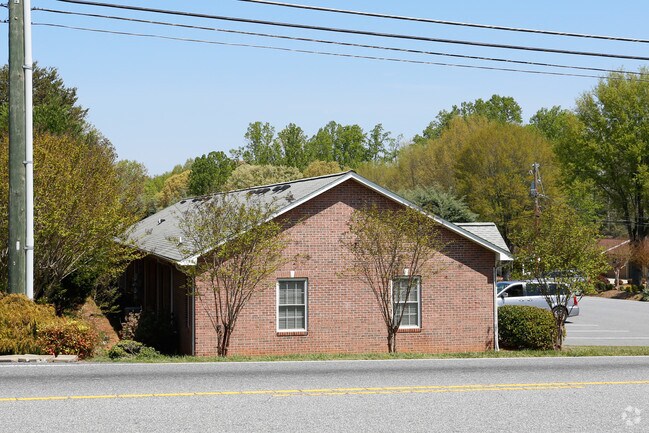
2005 Frye Ave
2791156321370000
PLAT 11-4
Officebuilding
Catawba
X
North Carolina
3710279100J
0.57 AC
2024
Catawba County
2025
Charlotte
011101
Hickory-Lenoir-Morganton, NC
4,200 SF
DEMOGRAPHICS near 2005 Frye Ave
1 Mile
3 Mile
5 Mile
2024 Total Population
2,050
15,642
44,931
2029 Population
2,126
16,345
46,645
Pop Growth 2024-2029
+ 3.71%
+ 4.49%
+ 3.81%
Average Age
42
41
41
2024 Total Households
777
6,109
18,171
HH Growth 2024-2029
+ 3.73%
+ 4.49%
+ 3.80%
Median Household Inc
$71,884
$55,953
$53,628
Avg Household Size
2.50
2.50
2.30
2024 Avg HH Vehicles
2.00
2.00
2.00
Median Home Value
$183,921
$162,287
$169,169
Median Year Built
1983
1979
1976
Nearby Places
Map Layers
Map Styles
 Street
 Aerial
- Restaurants
- Banks
- Shops
- Fitness
- Groceries
SALE & LEASE HISTORY
LISTING DATE
SALE/LEASE

Apr 14, 2017
For Lease
Nearby Properties
Address
Land Use
TOTAL SIZE
Lot Size
Zoning
Address
Land Use
TOTAL SIZE
Lot Size
Zoning
146,932 SF
27.08 AC
C-3
Address
Land Use
TOTAL SIZE
Lot Size
Zoning
22.70 AC
R-2
Address
Land Use
TOTAL SIZE
Lot Size
Zoning
73,702 SF
13.37 AC
C-2
Address
Land Use
TOTAL SIZE
Lot Size
Zoning
84,090 SF
10.51 AC
R-2
Address
Land Use
TOTAL SIZE
Lot Size
Zoning
28.27 AC
R-20
Address
Land Use
TOTAL SIZE
Lot Size
Zoning
101,568 SF
22.78 AC
C-3
Address
Land Use
TOTAL SIZE
Lot Size
Zoning
173,730 SF
16.80 AC
IND
Address
Land Use
TOTAL SIZE
Lot Size
Zoning
272,735 SF
21.83 AC
IND
Address
Land Use
TOTAL SIZE
Lot Size
Zoning
59,716 SF
30.60 AC
IND
Address
Land Use
TOTAL SIZE
Lot Size
Zoning
52,540 SF
6.27 AC
C-3
Address
Land Use
TOTAL SIZE
Lot Size
Zoning
95,509 SF
C-3
Address
Land Use
TOTAL SIZE
Lot Size
Zoning
85,988 SF
9.67 AC
ED
Address
Land Use
TOTAL SIZE
Lot Size
Zoning
53,552 SF
8.83 AC
CC-1
Address
Land Use
TOTAL SIZE
Lot Size
Zoning
14,850 SF
2.19 AC
CC-1
Address
Land Use
TOTAL SIZE
Lot Size
Zoning
57,622 SF
6.89 AC
C-3
Address
Land Use
TOTAL SIZE
Lot Size
Zoning
41,444 SF
11.62 AC
C-3
Address
Land Use
TOTAL SIZE
Lot Size
Zoning
29.21 AC
R-2
Address
Land Use
TOTAL SIZE
Lot Size
Zoning
19,795 SF
3.26 AC
OI
Address
Land Use
TOTAL SIZE
Lot Size
Zoning
52,646 SF
11.52 AC
C-3
Address
Land Use
TOTAL SIZE
Lot Size
Zoning
44,046 SF
4.61 AC
R-4
Address
Land Use
TOTAL SIZE
Lot Size
Zoning
41,920 SF
6.35 AC
C-3
Address
Land Use
TOTAL SIZE
Lot Size
Zoning
53,226 SF
7.19 AC
CC-2
Address
Land Use
TOTAL SIZE
Lot Size
Zoning
64,928 SF
24.49 AC
ED
Address
Land Use
TOTAL SIZE
Lot Size
Zoning
6,595 SF
7.68 AC
OI
Address
Land Use
TOTAL SIZE
Lot Size
Zoning
14,261 SF
5.47 AC
C-3
Address
Land Use
TOTAL SIZE
Lot Size
Zoning
47,172 SF
4.12 AC
C-3
Address
Land Use
TOTAL SIZE
Lot Size
Zoning
10,612 SF
1.38 AC
CC-1
Address
Land Use
TOTAL SIZE
Lot Size
Zoning
117,420 SF
13.57 AC
IND
Address
Land Use
TOTAL SIZE
Lot Size
Zoning
5.66 AC
R-1
Address
Land Use
TOTAL SIZE
Lot Size
Zoning
3,840 SF
6 AC
R-4
The World's #1 Commercial Real Estate Marketplace
Connect with us
© 2025 CoStar Group
The information above has been obtained from sources believed reliable. While we do not doubt its accuracy we have not verified it and make no guarantee, warranty or representation about it. It is your responsibility to independently confirm its accuracy and completeness. Any projections, opinions, assumptions, or estimates used are for example only and do not represent the current or future performance of the property. The value of this transaction to you depends on tax and other factors which should be evaluated by your tax, financial, and legal advisors. You and your advisors should conduct a careful, independent investigation of the property to determine to your satisfaction the suitability of the property for your needs.