Property Record
2005-2035 Linglestown Rd, Harrisburg, PA 17110

NEARBY LISTINGS FOR SALE OR LEASE
Property Detail
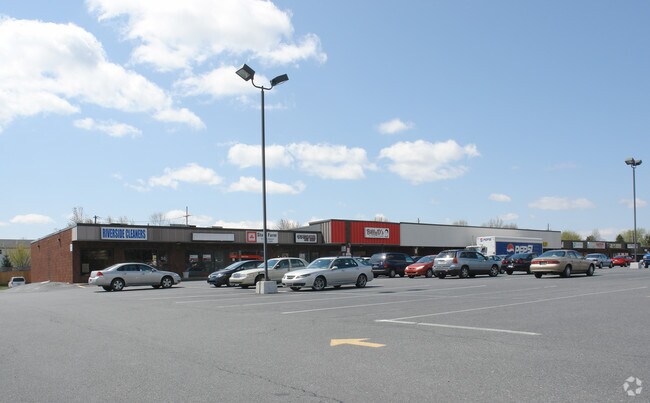
2005-2035 Linglestown Rd
Stripcommercialcenter
Dauphin
X
Pennsylvania
42043C0330D
5.04 AC
2025
Harrisburg Area East
2025
Philadelphia
021904
Harrisburg-Carlisle, PA
25,106 SF
62-013-098
DEMOGRAPHICS near 2005-2035 Linglestown Rd
1 Mile
3 Mile
5 Mile
2024 Total Population
7,445
37,681
142,964
2029 Population
7,603
38,715
147,332
Pop Growth 2024-2029
+ 2.12%
+ 2.74%
+ 3.06%
Average Age
45
42
40
2024 Total Households
3,329
15,759
60,403
HH Growth 2024-2029
+ 2.22%
+ 2.78%
+ 3.19%
Median Household Inc
$94,405
$82,022
$62,827
Avg Household Size
2.20
2.30
2.30
2024 Avg HH Vehicles
2.00
2.00
2.00
Median Home Value
$217,500
$227,584
$182,671
Median Year Built
1994
1982
1964
Nearby Places
Map Layers
Map Styles
 Street
 Aerial
- Restaurants
- Banks
- Shops
- Fitness
- Groceries
PUBLIC TRANSPORTATION
COMMUTER RAIL
DRIVE
WALK
Distance
13 min
6.5 mi
AIRPORT
Harrisburg International
DRIVE
WALK
Distance
Harrisburg International
24 min
14.6 mi
SALE & LEASE HISTORY
LISTING DATE
SALE/LEASE

Sep 25, 2016
For Lease
Feb 27, 2018
For Lease
Nearby Properties
Address
Land Use
TOTAL SIZE
Lot Size
Zoning
Address
Land Use
TOTAL SIZE
Lot Size
Zoning
615,797 SF
59.70 AC
Address
Land Use
TOTAL SIZE
Lot Size
Zoning
3,025 SF
274.13 AC
Address
Land Use
TOTAL SIZE
Lot Size
Zoning
638,721 SF
47.78 AC
Address
Land Use
TOTAL SIZE
Lot Size
Zoning
125,255 SF
26.65 AC
Address
Land Use
TOTAL SIZE
Lot Size
Zoning
192,390 SF
43.19 AC
Address
Land Use
TOTAL SIZE
Lot Size
Zoning
242,534 SF
47.26 AC
Address
Land Use
TOTAL SIZE
Lot Size
Zoning
2,129 SF
19.90 AC
Address
Land Use
TOTAL SIZE
Lot Size
Zoning
228,141 SF
42.50 AC
Address
Land Use
TOTAL SIZE
Lot Size
Zoning
112,388 SF
38.01 AC
Address
Land Use
TOTAL SIZE
Lot Size
Zoning
226,101 SF
46.29 AC
Address
Land Use
TOTAL SIZE
Lot Size
Zoning
2,823 SF
36.87 AC
Address
Land Use
TOTAL SIZE
Lot Size
Zoning
1,989 SF
16.62 AC
Address
Land Use
TOTAL SIZE
Lot Size
Zoning
665,098 SF
14 AC
Address
Land Use
TOTAL SIZE
Lot Size
Zoning
Address
Land Use
TOTAL SIZE
Lot Size
Zoning
9.88 AC
Address
Land Use
TOTAL SIZE
Lot Size
Zoning
51,300 SF
11.36 AC
Address
Land Use
TOTAL SIZE
Lot Size
Zoning
246,276 SF
27.26 AC
Address
Land Use
TOTAL SIZE
Lot Size
Zoning
24.77 AC
Address
Land Use
TOTAL SIZE
Lot Size
Zoning
880 SF
18.68 AC
Address
Land Use
TOTAL SIZE
Lot Size
Zoning
1,920 SF
38.44 AC
Address
Land Use
TOTAL SIZE
Lot Size
Zoning
114,044 SF
23.13 AC
Address
Land Use
TOTAL SIZE
Lot Size
Zoning
29,125 SF
11.77 AC
Address
Land Use
TOTAL SIZE
Lot Size
Zoning
11,928 SF
8.40 AC
Address
Land Use
TOTAL SIZE
Lot Size
Zoning
66,864 SF
26.25 AC
Address
Land Use
TOTAL SIZE
Lot Size
Zoning
78,525 SF
15.50 AC
Address
Land Use
TOTAL SIZE
Lot Size
Zoning
3,192 SF
17.32 AC
Address
Land Use
TOTAL SIZE
Lot Size
Zoning
21,944 SF
12.40 AC
Address
Land Use
TOTAL SIZE
Lot Size
Zoning
19,558 SF
12.50 AC
Address
Land Use
TOTAL SIZE
Lot Size
Zoning
10,044 SF
12.94 AC
Address
Land Use
TOTAL SIZE
Lot Size
Zoning
8,230 SF
7.82 AC
The World's #1 Commercial Real Estate Marketplace
Connect with us
© 2025 CoStar Group
The information above has been obtained from sources believed reliable. While we do not doubt its accuracy we have not verified it and make no guarantee, warranty or representation about it. It is your responsibility to independently confirm its accuracy and completeness. Any projections, opinions, assumptions, or estimates used are for example only and do not represent the current or future performance of the property. The value of this transaction to you depends on tax and other factors which should be evaluated by your tax, financial, and legal advisors. You and your advisors should conduct a careful, independent investigation of the property to determine to your satisfaction the suitability of the property for your needs.