Property Record
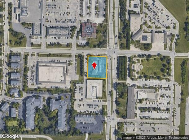
2005 N Calhoun Rd, Brookfield, WI 53005

NEARBY LISTINGS FOR SALE OR LEASE
Property Detail
2005 N Calhoun Rd
Milwaukee-Waukesha-West Allis, WI
Certified Surv Map 7966
BRC-1089-995
PARCEL 1 CSM 7966 PART NE1/4 SEC 21 T7N R20E 35,000 SQ FT .80349 ACRES RECORDED 3-8-96 DOC 2106603 VOL 69 PAGES 25-27
Commercialnec
Waukesha
X
Wisconsin
55133C0217H
1
2024
0.80 AC
2024
Brookfield/New Berlin
201205
Milwaukee/Madison
DEMOGRAPHICS near 2005 N Calhoun Rd
1 Mile
3 Mile
5 Mile
2024 Total Population
5,989
52,302
121,020
2029 Population
6,291
54,977
124,783
Pop Growth 2024-2029
+ 5.04%
+ 5.11%
+ 3.11%
Average Age
44
43
43
2024 Total Households
2,288
20,589
50,219
HH Growth 2024-2029
+ 5.20%
+ 5.22%
+ 3.01%
Median Household Inc
$118,550
$109,712
$94,734
Avg Household Size
2.60
2.50
2.40
2024 Avg HH Vehicles
2.00
2.00
2.00
Median Home Value
$429,696
$391,100
$339,003
Median Year Built
1979
1978
1973
Nearby Places
Map Layers
Map Styles
 Street
 Aerial
- Restaurants
- Banks
- Shops
- Fitness
- Groceries
PUBLIC TRANSPORTATION
AIRPORT
General Mitchell International
DRIVE
WALK
Distance
General Mitchell International
34 min
18.8 mi
Nearby Properties
Address
Land Use
TOTAL SIZE
Lot Size
Zoning
Address
Land Use
TOTAL SIZE
Lot Size
Zoning
19.44 AC
Address
Land Use
TOTAL SIZE
Lot Size
Zoning
24.46 AC
Address
Land Use
TOTAL SIZE
Lot Size
Zoning
19.25 AC
Address
Land Use
TOTAL SIZE
Lot Size
Zoning
19.44 AC
Address
Land Use
TOTAL SIZE
Lot Size
Zoning
4.54 AC
Address
Land Use
TOTAL SIZE
Lot Size
Zoning
12.50 AC
Address
Land Use
TOTAL SIZE
Lot Size
Zoning
20.02 AC
Address
Land Use
TOTAL SIZE
Lot Size
Zoning
Address
Land Use
TOTAL SIZE
Lot Size
Zoning
34.31 AC
Address
Land Use
TOTAL SIZE
Lot Size
Zoning
17.45 AC
Address
Land Use
TOTAL SIZE
Lot Size
Zoning
10.48 AC
Address
Land Use
TOTAL SIZE
Lot Size
Zoning
Address
Land Use
TOTAL SIZE
Lot Size
Zoning
7.20 AC
Address
Land Use
TOTAL SIZE
Lot Size
Zoning
Address
Land Use
TOTAL SIZE
Lot Size
Zoning
19.44 AC
Address
Land Use
TOTAL SIZE
Lot Size
Zoning
Address
Land Use
TOTAL SIZE
Lot Size
Zoning
Address
Land Use
TOTAL SIZE
Lot Size
Zoning
21.87 AC
Address
Land Use
TOTAL SIZE
Lot Size
Zoning
3.55 AC
Address
Land Use
TOTAL SIZE
Lot Size
Zoning
4.79 AC
Address
Land Use
TOTAL SIZE
Lot Size
Zoning
4.53 AC
Address
Land Use
TOTAL SIZE
Lot Size
Zoning
Address
Land Use
TOTAL SIZE
Lot Size
Zoning
Address
Land Use
TOTAL SIZE
Lot Size
Zoning
Address
Land Use
TOTAL SIZE
Lot Size
Zoning
11.34 AC
Address
Land Use
TOTAL SIZE
Lot Size
Zoning
13.14 AC
Address
Land Use
TOTAL SIZE
Lot Size
Zoning
Address
Land Use
TOTAL SIZE
Lot Size
Zoning
3.48 AC
Address
Land Use
TOTAL SIZE
Lot Size
Zoning
16.79 AC
Address
Land Use
TOTAL SIZE
Lot Size
Zoning
10.41 AC
The World's #1 Commercial Real Estate Marketplace
Connect with us
© 2025 CoStar Group
The information above has been obtained from sources believed reliable. While we do not doubt its accuracy we have not verified it and make no guarantee, warranty or representation about it. It is your responsibility to independently confirm its accuracy and completeness. Any projections, opinions, assumptions, or estimates used are for example only and do not represent the current or future performance of the property. The value of this transaction to you depends on tax and other factors which should be evaluated by your tax, financial, and legal advisors. You and your advisors should conduct a careful, independent investigation of the property to determine to your satisfaction the suitability of the property for your needs.