Property Record
2005 North St, Ashburn, GA 31714
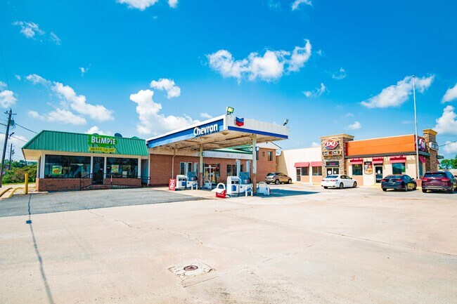
Property Detail
2005 North St
025-019
LD2 LL165 1.58 ACRES
Restaurantdrivein
Turner
002
Georgia
B and X Area of moderate flood hazard, usually the area between the limits of the 100-year and 500-year floods.
1.58 AC
2025
Georgia South Area
2025
Other Market Areas
970201
Tifton, GA
2,564 SF
NEARBY LISTINGS FOR SALE OR LEASE
DEMOGRAPHICS near 2005 North St
1 mile
3 mile
5 mile
2025 Total Population
69
4,827
6,616
2030 Population
69
4,825
6,624
Pop Growth 2025-2030
0.00%
(0.04%)
+ 0.12%
Average Age
43
40
40
2025 Total Households
29
1,925
2,527
HH Growth 2025-2030
0.00%
+ 0.16%
+ 0.08%
Median Household Inc
$71,249
$33,571
$36,519
Avg Household Size
2.50
2.40
2.40
2025 Avg HH Vehicles
2.00
2.00
2.00
Median Home Value
$131,250
$91,754
$95,395
Median Year Built
1968
1972
1972
Nearby Places
Map Layers
Map Styles
 Street
 Aerial
Layers
 Traffic
 Biking
Places
Listings with unknown addresses are not visible on the map
- Restaurants
- Banks
- Shops
- Fitness
- Groceries
PUBLIC TRANSPORTATION
AIRPORT
Southwest Georgia Regional
Drive
Walk
Distance
Southwest Georgia Regional
67 min
42.9 mi
SALE & LEASE HISTORY
LISTING DATE
SALE/LEASE

Sep 11, 2020
For Sale
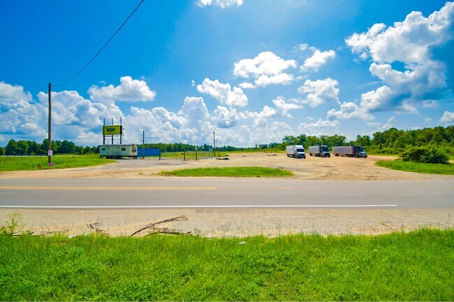
Nearby Properties
Address
Land Use
TOTAL SIZE
Lot Size
Zoning
Address
Land Use
TOTAL SIZE
Lot Size
Zoning
4,610 SF
12.71 AC
002
Address
Land Use
TOTAL SIZE
Lot Size
Zoning
39,456 SF
6.86 AC
005
Address
Land Use
TOTAL SIZE
Lot Size
Zoning
54,750 SF
18.65 AC
004
Address
Land Use
TOTAL SIZE
Lot Size
Zoning
51,250 SF
5 AC
INDUSTRIAL
Address
Land Use
TOTAL SIZE
Lot Size
Zoning
45,800 SF
10 AC
007
Address
Land Use
TOTAL SIZE
Lot Size
Zoning
2.10 AC
001
Address
Land Use
TOTAL SIZE
Lot Size
Zoning
7,875 SF
2.05 AC
002
Address
Land Use
TOTAL SIZE
Lot Size
Zoning
13,553 SF
12.08 AC
003
Address
Land Use
TOTAL SIZE
Lot Size
Zoning
2,050 SF
4.92 AC
002
Address
Land Use
TOTAL SIZE
Lot Size
Zoning
2,834 SF
13.10 AC
002
Address
Land Use
TOTAL SIZE
Lot Size
Zoning
2,146 SF
3.67 AC
002
Address
Land Use
TOTAL SIZE
Lot Size
Zoning
8,958 SF
8.66 AC
002
Address
Land Use
TOTAL SIZE
Lot Size
Zoning
23,200 SF
12.99 AC
004
Address
Land Use
TOTAL SIZE
Lot Size
Zoning
1.66 AC
001
Address
Land Use
TOTAL SIZE
Lot Size
Zoning
15,400 SF
1.37 AC
002
Address
Land Use
TOTAL SIZE
Lot Size
Zoning
10,293 SF
1.19 AC
002
Address
Land Use
TOTAL SIZE
Lot Size
Zoning
13,155 SF
2.76 AC
002
Address
Land Use
TOTAL SIZE
Lot Size
Zoning
6,447 SF
10 AC
007
Address
Land Use
TOTAL SIZE
Lot Size
Zoning
4.82 AC
001
Address
Land Use
TOTAL SIZE
Lot Size
Zoning
19,800 SF
9.58 AC
002
Address
Land Use
TOTAL SIZE
Lot Size
Zoning
15,402 SF
1.29 AC
002
Address
Land Use
TOTAL SIZE
Lot Size
Zoning
6,560 SF
5 AC
004
Address
Land Use
TOTAL SIZE
Lot Size
Zoning
816 SF
6.26 AC
004
Address
Land Use
TOTAL SIZE
Lot Size
Zoning
5.07 AC
001
Address
Land Use
TOTAL SIZE
Lot Size
Zoning
6,732 SF
1.39 AC
002
Address
Land Use
TOTAL SIZE
Lot Size
Zoning
7,602 SF
2.27 AC
002
Address
Land Use
TOTAL SIZE
Lot Size
Zoning
9,136 SF
2.35 AC
002
Address
Land Use
TOTAL SIZE
Lot Size
Zoning
19,661 SF
4.44 AC
002
Address
Land Use
TOTAL SIZE
Lot Size
Zoning
1.33 AC
001
Address
Land Use
TOTAL SIZE
Lot Size
Zoning
3,296 SF
0.97 AC
002
The World's #1 Commercial Real Estate Marketplace
Connect with us
© 2026 CoStar Group
The information above has been obtained from sources believed reliable. While we do not doubt its accuracy we have not verified it and make no guarantee, warranty or representation about it. It is your responsibility to independently confirm its accuracy and completeness. Any projections, opinions, assumptions, or estimates used are for example only and do not represent the current or future performance of the property. The value of this transaction to you depends on tax and other factors which should be evaluated by your tax, financial, and legal advisors. You and your advisors should conduct a careful, independent investigation of the property to determine to your satisfaction the suitability of the property for your needs.