Property Record
2005 Winward Rd, Davenport, FL 33896


NEARBY LISTINGS FOR SALE OR LEASE
Property Detail
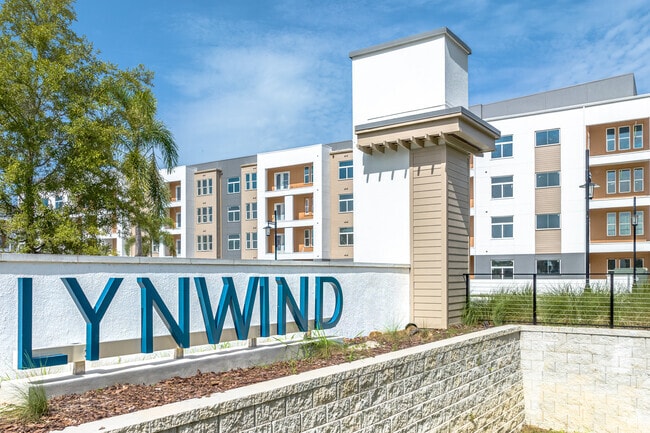
2005 Winward Rd
27-26-02-000000-043040
Alameda Heights
Multifamilydwelling
OMM NE COR OF SW1/4 OF SEC S00-00-02W ALONG W LINE THEREOF 705 FT TO POB S89-59-58E 50 FT NELY ALONG CURVE 39.31 FT S89-54-13E 478.51 FT N00-05- 47E 10 FT S89-54-13E 76.37 FT ELY ALONG CURVE 228.87 FTS76-02-24E 704.66 FT SELY ALONG CURVE 92.48 FT SEL
AE
Polk
12105C0230H
Florida
2024
27.48 AC
2025
North Polk
012506
Tampa/St Petersburg
434,491 SF
Lakeland-Winter Haven, FL
DEMOGRAPHICS near 2005 Winward Rd
1 Mile
3 Mile
5 Mile
2024 Total Population
8,233
39,577
85,332
2029 Population
10,135
49,676
107,044
Pop Growth 2024-2029
+ 23.10%
+ 25.52%
+ 25.44%
Average Age
36
38
39
2024 Total Households
3,060
14,496
31,671
HH Growth 2024-2029
+ 22.91%
+ 25.45%
+ 25.39%
Median Household Inc
$61,892
$62,717
$69,081
Avg Household Size
2.60
2.70
2.70
2024 Avg HH Vehicles
2.00
2.00
2.00
Median Home Value
$260,998
$281,061
$282,763
Median Year Built
2004
2007
2008
Nearby Places
Map Layers
Map Styles
 Street
 Aerial
- Restaurants
- Banks
- Shops
- Fitness
- Groceries
PUBLIC TRANSPORTATION
COMMUTER RAIL
Poinciana (SunRail - Florida Department of Transportation)
DRIVE
WALK
Distance
Poinciana (SunRail - Florida Department of Transportation)
13 min
8.0 mi
AIRPORT
Orlando International
DRIVE
WALK
Distance
Orlando International
40 min
28.3 mi
Freight Ports
Port of Tampa Bay
DRIVE
WALK
Distance
Port of Tampa Bay
75 min
62.1 mi
Nearby Properties
Address
Land Use
TOTAL SIZE
Lot Size
Zoning
Address
Land Use
TOTAL SIZE
Lot Size
Zoning
736,399 SF
23.59 AC
OPD
Address
Land Use
TOTAL SIZE
Lot Size
Zoning
417,544 SF
62.60 AC
Address
Land Use
TOTAL SIZE
Lot Size
Zoning
295,034 SF
14.25 AC
Address
Land Use
TOTAL SIZE
Lot Size
Zoning
422,457 SF
17.46 AC
Address
Land Use
TOTAL SIZE
Lot Size
Zoning
425,752 SF
19.52 AC
Address
Land Use
TOTAL SIZE
Lot Size
Zoning
436,302 SF
27.87 AC
Address
Land Use
TOTAL SIZE
Lot Size
Zoning
480,104 SF
12.37 AC
Address
Land Use
TOTAL SIZE
Lot Size
Zoning
302,226 SF
135.83 AC
Address
Land Use
TOTAL SIZE
Lot Size
Zoning
412,886 SF
10.72 AC
Address
Land Use
TOTAL SIZE
Lot Size
Zoning
335,536 SF
11.97 AC
Address
Land Use
TOTAL SIZE
Lot Size
Zoning
329,700 SF
12.09 AC
Address
Land Use
TOTAL SIZE
Lot Size
Zoning
360,801 SF
8.24 AC
Address
Land Use
TOTAL SIZE
Lot Size
Zoning
352,892 SF
19.23 AC
Address
Land Use
TOTAL SIZE
Lot Size
Zoning
336,042 SF
20.77 AC
Address
Land Use
TOTAL SIZE
Lot Size
Zoning
256,589 SF
15.37 AC
OPD
Address
Land Use
TOTAL SIZE
Lot Size
Zoning
216,296 SF
16.37 AC
Address
Land Use
TOTAL SIZE
Lot Size
Zoning
338,315 SF
59.58 AC
Address
Land Use
TOTAL SIZE
Lot Size
Zoning
236,745 SF
26.56 AC
Address
Land Use
TOTAL SIZE
Lot Size
Zoning
164,106 SF
7.13 AC
Address
Land Use
TOTAL SIZE
Lot Size
Zoning
228,683 SF
13.54 AC
RC
Address
Land Use
TOTAL SIZE
Lot Size
Zoning
108,948 SF
10.62 AC
OPD
Address
Land Use
TOTAL SIZE
Lot Size
Zoning
41,812 SF
162.70 AC
OAC
Address
Land Use
TOTAL SIZE
Lot Size
Zoning
88,884 SF
3.34 AC
Address
Land Use
TOTAL SIZE
Lot Size
Zoning
148,436 SF
10.27 AC
Address
Land Use
TOTAL SIZE
Lot Size
Zoning
62,808 SF
7.09 AC
OPD
Address
Land Use
TOTAL SIZE
Lot Size
Zoning
87,848 SF
14.44 AC
OAC
Address
Land Use
TOTAL SIZE
Lot Size
Zoning
98,712 SF
11.90 AC
Address
Land Use
TOTAL SIZE
Lot Size
Zoning
72,476 SF
2.70 AC
Address
Land Use
TOTAL SIZE
Lot Size
Zoning
47,972 SF
3.05 AC
OPUD
The World's #1 Commercial Real Estate Marketplace
Connect with us
© 2026 CoStar Group
The information above has been obtained from sources believed reliable. While we do not doubt its accuracy we have not verified it and make no guarantee, warranty or representation about it. It is your responsibility to independently confirm its accuracy and completeness. Any projections, opinions, assumptions, or estimates used are for example only and do not represent the current or future performance of the property. The value of this transaction to you depends on tax and other factors which should be evaluated by your tax, financial, and legal advisors. You and your advisors should conduct a careful, independent investigation of the property to determine to your satisfaction the suitability of the property for your needs.