Property Record
2006 F St, Belleville, MI 48111
NEARBY LISTINGS FOR SALE OR LEASE
-
-
View all Belleville listings for sale on LoopNet.com
Property Detail
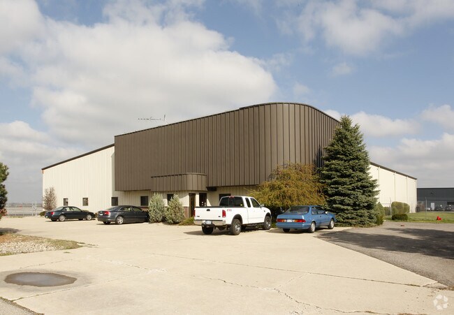
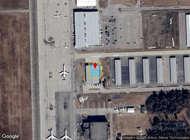
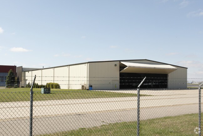
2006 F St
Detroit-Warren-Dearborn, MI
Accordancewith And Subject
83-189-99-0019-000
08WR2006 (ACT 189) USER OR LESSEE INTEREST IN PART OF REAL PROPERTY OF WILLOW RUN AIRPORT( AIRCRAFT HANGERS ) LYING IN SEC 8 T3S R8E. ASSESSED IN ACCORDANCE WITH AND SUBJECT TO THE PROVISIONS OF ACT 189, P.A. 1953.5.25 ACRES
Industrialgeneral
Wayne
X
Michigan
26161C0435E
0019
2024
5.25 AC
2025
Airport District
587000
Detroit
124,562 SF
DEMOGRAPHICS near 2006 F St
1 Mile
3 Mile
5 Mile
2024 Total Population
139
30,252
111,411
2029 Population
130
29,432
108,788
Pop Growth 2024-2029
(6.47%)
(2.71%)
(2.35%)
Average Age
43
40
39
2024 Total Households
68
13,406
45,059
HH Growth 2024-2029
(5.88%)
(2.81%)
(2.39%)
Median Household Inc
$59,999
$65,961
$72,457
Avg Household Size
2.00
2.20
2.40
2024 Avg HH Vehicles
1.00
2.00
2.00
Median Home Value
$163,513
$232,124
$223,283
Median Year Built
1990
1985
1984
Nearby Places
Map Layers
Map Styles
 Street
 Aerial
- Restaurants
- Banks
- Shops
- Fitness
- Groceries
PUBLIC TRANSPORTATION
AIRPORT
Detroit Metro Wayne County
DRIVE
WALK
Distance
Detroit Metro Wayne County
22 min
12.5 mi
Windsor International
DRIVE
WALK
Distance
Windsor International
62 min
39.9 mi
Freight Ports
Port of Toledo
DRIVE
WALK
Distance
Port of Toledo
71 min
54.2 mi
Nearby Properties
Address
Land Use
TOTAL SIZE
Lot Size
Zoning
Address
Land Use
TOTAL SIZE
Lot Size
Zoning
277.73 AC
Address
Land Use
TOTAL SIZE
Lot Size
Zoning
347,606 SF
71.56 AC
M2 GEN
Address
Land Use
TOTAL SIZE
Lot Size
Zoning
461,566 SF
50.13 AC
RM MULT
Address
Land Use
TOTAL SIZE
Lot Size
Zoning
387,834 SF
71.56 AC
M2 GEN
Address
Land Use
TOTAL SIZE
Lot Size
Zoning
357,286 SF
36.79 AC
RM MULT
Address
Land Use
TOTAL SIZE
Lot Size
Zoning
432.42 AC
M2 GEN
Address
Land Use
TOTAL SIZE
Lot Size
Zoning
182,952 SF
82.77 AC
Address
Land Use
TOTAL SIZE
Lot Size
Zoning
524,171 SF
42.18 AC
M2 GEN
Address
Land Use
TOTAL SIZE
Lot Size
Zoning
136,775 SF
15.54 AC
C-3
Address
Land Use
TOTAL SIZE
Lot Size
Zoning
450,840 SF
32.59 AC
Address
Land Use
TOTAL SIZE
Lot Size
Zoning
206,958 SF
8.33 AC
AP
Address
Land Use
TOTAL SIZE
Lot Size
Zoning
198,549 SF
13.43 AC
RM MULT
Address
Land Use
TOTAL SIZE
Lot Size
Zoning
630,828 SF
62.51 AC
R1B
Address
Land Use
TOTAL SIZE
Lot Size
Zoning
630,828 SF
62.51 AC
R1B
Address
Land Use
TOTAL SIZE
Lot Size
Zoning
196,044 SF
18.67 AC
RM MULT
Address
Land Use
TOTAL SIZE
Lot Size
Zoning
59,692 SF
M1 LIG
Address
Land Use
TOTAL SIZE
Lot Size
Zoning
949,540 SF
75.26 AC
M2 GEN
Address
Land Use
TOTAL SIZE
Lot Size
Zoning
132,528 SF
5.91 AC
C2 EXT
Address
Land Use
TOTAL SIZE
Lot Size
Zoning
199,776 SF
39.34 AC
C2 EXT
Address
Land Use
TOTAL SIZE
Lot Size
Zoning
137,893 SF
16.21 AC
C2 EXT
Address
Land Use
TOTAL SIZE
Lot Size
Zoning
191,446 SF
22.76 AC
C2 EXT
Address
Land Use
TOTAL SIZE
Lot Size
Zoning
231,105 SF
23.86 AC
LI-2
Address
Land Use
TOTAL SIZE
Lot Size
Zoning
198,304 SF
23.96 AC
C2 EXT
Address
Land Use
TOTAL SIZE
Lot Size
Zoning
889,111 SF
78.78 AC
Address
Land Use
TOTAL SIZE
Lot Size
Zoning
159,983 SF
4.85 AC
G-1
Address
Land Use
TOTAL SIZE
Lot Size
Zoning
160,283 SF
10.12 AC
LI-2
Address
Land Use
TOTAL SIZE
Lot Size
Zoning
62,633 SF
6.39 AC
C LOC
Address
Land Use
TOTAL SIZE
Lot Size
Zoning
89,242 SF
3.65 AC
LI-2
Address
Land Use
TOTAL SIZE
Lot Size
Zoning
69,415 SF
11.32 AC
C2 EXT
Address
Land Use
TOTAL SIZE
Lot Size
Zoning
165,635 SF
28.01 AC
M2 GEN
The World's #1 Commercial Real Estate Marketplace
Connect with us
© 2025 CoStar Group
The information above has been obtained from sources believed reliable. While we do not doubt its accuracy we have not verified it and make no guarantee, warranty or representation about it. It is your responsibility to independently confirm its accuracy and completeness. Any projections, opinions, assumptions, or estimates used are for example only and do not represent the current or future performance of the property. The value of this transaction to you depends on tax and other factors which should be evaluated by your tax, financial, and legal advisors. You and your advisors should conduct a careful, independent investigation of the property to determine to your satisfaction the suitability of the property for your needs.