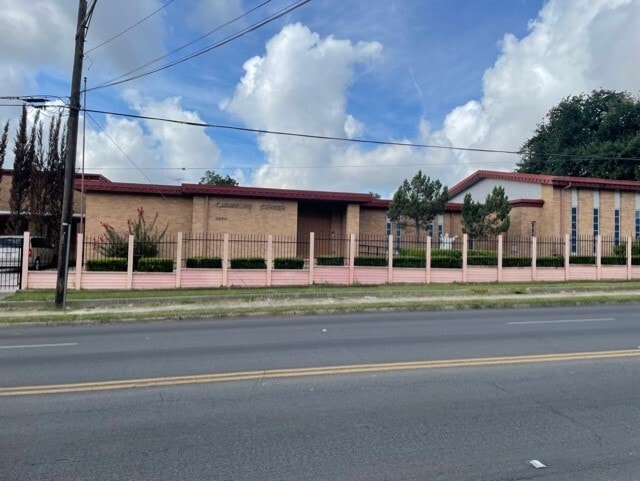
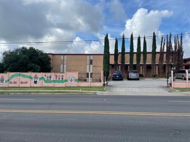
Property Record
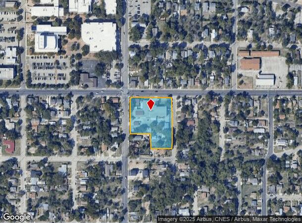
2006 Martin Luther King Dr, San Antonio, TX 78203
NEARBY LISTINGS FOR SALE OR LEASE
Property Detail
2006 Martin Luther King Dr
San Antonio-New Braunfels, TX
Conv A/S Code
01528-001-0010
NCB 1528 BLK 1 LOT A, EXC NW TRI 15.07 FT- B- 4- 5 & 17 THRU 20
Publicschool
Bexar
X
Texas
48029C0415G
1
0
1.98 AC
2025
Northeast
130401
San Antonio
28,289 SF
DEMOGRAPHICS near 2006 Martin Luther King Dr
1 Mile
3 Mile
5 Mile
2024 Total Population
16,368
112,701
294,702
2029 Population
17,676
121,649
315,988
Pop Growth 2024-2029
+ 7.99%
+ 7.94%
+ 7.22%
Average Age
36
37
38
2024 Total Households
5,424
43,580
108,318
HH Growth 2024-2029
+ 8.17%
+ 8.38%
+ 7.59%
Median Household Inc
$34,076
$41,449
$42,431
Avg Household Size
2.90
2.40
2.50
2024 Avg HH Vehicles
2.00
2.00
2.00
Median Home Value
$119,597
$152,751
$156,062
Median Year Built
1953
1961
1961
Nearby Places
Map Layers
Map Styles
 Street
 Aerial
- Restaurants
- Banks
- Shops
- Fitness
- Groceries
PUBLIC TRANSPORTATION
COMMUTER RAIL
San Antonio Amtrak Station (Sunset Limited - Amtrak, Texas Eagle - Amtrak)
DRIVE
WALK
Distance
San Antonio Amtrak Station (Sunset Limited - Amtrak, Texas Eagle - Amtrak)
4 min
2.2 mi
AIRPORT
San Antonio International
DRIVE
WALK
Distance
San Antonio International
14 min
10.1 mi
Freight Ports
Calhoun Port
DRIVE
WALK
Distance
Calhoun Port
176 min
144.0 mi
SALE & LEASE HISTORY
LISTING DATE
SALE/LEASE

Jan 23, 2023
For Sale
Nearby Properties
Address
Land Use
TOTAL SIZE
Lot Size
Zoning
Address
Land Use
TOTAL SIZE
Lot Size
Zoning
2,544.56 AC
Address
Land Use
TOTAL SIZE
Lot Size
Zoning
26.51 AC
Address
Land Use
TOTAL SIZE
Lot Size
Zoning
443,000 SF
4.16 AC
Address
Land Use
TOTAL SIZE
Lot Size
Zoning
738,650 SF
2.93 AC
Address
Land Use
TOTAL SIZE
Lot Size
Zoning
1,049,861 SF
1.50 AC
Address
Land Use
TOTAL SIZE
Lot Size
Zoning
339,590 SF
3.12 AC
Address
Land Use
TOTAL SIZE
Lot Size
Zoning
922,468 SF
10.78 AC
Address
Land Use
TOTAL SIZE
Lot Size
Zoning
443,560 SF
2.77 AC
Address
Land Use
TOTAL SIZE
Lot Size
Zoning
400,228 SF
0.78 AC
Address
Land Use
TOTAL SIZE
Lot Size
Zoning
290,794 SF
0.62 AC
Address
Land Use
TOTAL SIZE
Lot Size
Zoning
8.10 AC
Address
Land Use
TOTAL SIZE
Lot Size
Zoning
5,106 SF
2.30 AC
Address
Land Use
TOTAL SIZE
Lot Size
Zoning
387,443 SF
0.89 AC
Address
Land Use
TOTAL SIZE
Lot Size
Zoning
178,534 SF
1.32 AC
Address
Land Use
TOTAL SIZE
Lot Size
Zoning
254,108 SF
2.40 AC
Address
Land Use
TOTAL SIZE
Lot Size
Zoning
103,425 SF
4.76 AC
Address
Land Use
TOTAL SIZE
Lot Size
Zoning
521,935 SF
2.17 AC
Address
Land Use
TOTAL SIZE
Lot Size
Zoning
495,840 SF
1.20 AC
Address
Land Use
TOTAL SIZE
Lot Size
Zoning
308,878 SF
1.23 AC
Address
Land Use
TOTAL SIZE
Lot Size
Zoning
11,915 SF
4.06 AC
Address
Land Use
TOTAL SIZE
Lot Size
Zoning
254,908 SF
1.92 AC
Address
Land Use
TOTAL SIZE
Lot Size
Zoning
15,468 SF
4.18 AC
Address
Land Use
TOTAL SIZE
Lot Size
Zoning
221,865 SF
3.12 AC
Address
Land Use
TOTAL SIZE
Lot Size
Zoning
262,082 SF
1.60 AC
Address
Land Use
TOTAL SIZE
Lot Size
Zoning
7,018 SF
3.24 AC
Address
Land Use
TOTAL SIZE
Lot Size
Zoning
163,858 SF
0.62 AC
Address
Land Use
TOTAL SIZE
Lot Size
Zoning
481,589 SF
5.29 AC
Address
Land Use
TOTAL SIZE
Lot Size
Zoning
31,334 SF
14.11 AC
Address
Land Use
TOTAL SIZE
Lot Size
Zoning
399,007 SF
22.03 AC
Address
Land Use
TOTAL SIZE
Lot Size
Zoning
360,853 SF
1.18 AC
The World's #1 Commercial Real Estate Marketplace
Connect with us
© 2025 CoStar Group
The information above has been obtained from sources believed reliable. While we do not doubt its accuracy we have not verified it and make no guarantee, warranty or representation about it. It is your responsibility to independently confirm its accuracy and completeness. Any projections, opinions, assumptions, or estimates used are for example only and do not represent the current or future performance of the property. The value of this transaction to you depends on tax and other factors which should be evaluated by your tax, financial, and legal advisors. You and your advisors should conduct a careful, independent investigation of the property to determine to your satisfaction the suitability of the property for your needs.