Property Record
2007 N Point St, Chicago, IL 60647


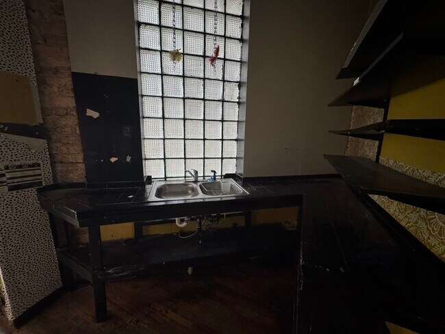
Property Detail
2007 N Point St
13-36-229-032-0000
S (STAVES) SUB OF 53ACS OF LYING SW OF MILWAUKEE AVE PLANK RD NE SEC 36-40-13
Miscresidentialimprovement
Cook
B3-1
Illinois
B and X Area of moderate flood hazard, usually the area between the limits of the 100-year and 500-year floods.
27
2023
0.20 AC
2025
Northwest City
221400
Chicago
7,092 SF
Chicago-Naperville-Elgin, IL-IN
NEARBY LISTINGS FOR SALE OR LEASE
DEMOGRAPHICS near 2007 N Point St
1 mile
3 mile
5 mile
2025 Total Population
61,652
480,096
1,241,373
2030 Population
60,752
471,689
1,228,104
Pop Growth 2025-2030
(1.46%)
(1.75%)
(1.07%)
Average Age
35
36
37
2025 Total Households
27,958
211,221
566,870
HH Growth 2025-2030
(1.71%)
(1.68%)
(0.71%)
Median Household Inc
$116,715
$105,738
$94,846
Avg Household Size
2.20
2.20
2.10
2025 Avg HH Vehicles
1.00
1.00
1.00
Median Home Value
$618,383
$586,569
$441,941
Median Year Built
1947
1948
1954
Nearby Places
Map Layers
Map Styles
 Street
 Aerial
Layers
 Traffic
 Biking
Places
Listings with unknown addresses are not visible on the map
- Restaurants
- Banks
- Shops
- Fitness
- Groceries
PUBLIC TRANSPORTATION
TRANSIT/SUBWAY
California Station (Blue Line - O'hare Branch) (Blue Line - Chicago Transit Authority "L" Trains (The "L"))
Drive
Walk
Distance
California Station (Blue Line - O'hare Branch) (Blue Line - Chicago Transit Authority "L" Trains (The "L"))
1 min
7 min
0.4 mi
Western Station (Blue Line - O'hare Branch) (Blue Line - Chicago Transit Authority "L" Trains (The "L"))
Drive
Walk
Distance
Western Station (Blue Line - O'hare Branch) (Blue Line - Chicago Transit Authority "L" Trains (The "L"))
0 min
7 min
0.4 mi
COMMUTER RAIL
Clybourn Station (Union Pacific North Line - Northeast Illinois Regional Commuter Railroad (Metra), Union Pacific Northwest Line - Northeast Illinois Regional Commuter Railroad (Metra))
Drive
Walk
Distance
Clybourn Station (Union Pacific North Line - Northeast Illinois Regional Commuter Railroad (Metra), Union Pacific Northwest Line - Northeast Illinois Regional Commuter Railroad (Metra))
3 min
1.4 mi
Healy Station (Milwaukee District North Line - Northeast Illinois Regional Commuter Railroad (Metra))
Drive
Walk
Distance
Healy Station (Milwaukee District North Line - Northeast Illinois Regional Commuter Railroad (Metra))
4 min
2.2 mi
AIRPORT
Chicago Midway International
Drive
Walk
Distance
Chicago Midway International
20 min
11.2 mi
Chicago O'Hare International
Drive
Walk
Distance
Chicago O'Hare International
21 min
13.6 mi
Freight Ports
Port Milwaukee
Drive
Walk
Distance
Port Milwaukee
99 min
81.8 mi
SALE & LEASE HISTORY
LISTING DATE
SALE/LEASE

Apr 23, 2025
For Lease
Nearby Properties
Address
Land Use
TOTAL SIZE
Lot Size
Zoning
Address
Land Use
TOTAL SIZE
Lot Size
Zoning
1,857,394 SF
3.13 AC
PD 447
Address
Land Use
TOTAL SIZE
Lot Size
Zoning
559,589 SF
1.72 AC
C3-5
Address
Land Use
TOTAL SIZE
Lot Size
Zoning
73,700 SF
0.48 AC
RM-6.5
Address
Land Use
TOTAL SIZE
Lot Size
Zoning
266,248 SF
Address
Land Use
TOTAL SIZE
Lot Size
Zoning
0.82 AC
PD 1470
Address
Land Use
TOTAL SIZE
Lot Size
Zoning
317,932 SF
0.97 AC
PD 1306
Address
Land Use
TOTAL SIZE
Lot Size
Zoning
222,240 SF
2.45 AC
PD 1439
Address
Land Use
TOTAL SIZE
Lot Size
Zoning
Address
Land Use
TOTAL SIZE
Lot Size
Zoning
230,000 SF
0.60 AC
PD 1456
Address
Land Use
TOTAL SIZE
Lot Size
Zoning
3.29 AC
PD 522
Address
Land Use
TOTAL SIZE
Lot Size
Zoning
2.67 AC
PD 522
Address
Land Use
TOTAL SIZE
Lot Size
Zoning
2.64 AC
PD 447
Address
Land Use
TOTAL SIZE
Lot Size
Zoning
0.96 AC
PD 958
Address
Land Use
TOTAL SIZE
Lot Size
Zoning
311,612 SF
2.40 AC
PD 1096
Address
Land Use
TOTAL SIZE
Lot Size
Zoning
16.93 AC
POS-1,PD 1
Address
Land Use
TOTAL SIZE
Lot Size
Zoning
19,500 SF
12.06 AC
PD 367
Address
Land Use
TOTAL SIZE
Lot Size
Zoning
0.66 AC
RS-3
Address
Land Use
TOTAL SIZE
Lot Size
Zoning
277,195 SF
1.78 AC
PD 1094
Address
Land Use
TOTAL SIZE
Lot Size
Zoning
434,320 SF
1.16 AC
C3-5
Address
Land Use
TOTAL SIZE
Lot Size
Zoning
268,778 SF
0.59 AC
RM-6.5
Address
Land Use
TOTAL SIZE
Lot Size
Zoning
0.94 AC
PD 536
Address
Land Use
TOTAL SIZE
Lot Size
Zoning
0.64 AC
PD 158
Address
Land Use
TOTAL SIZE
Lot Size
Zoning
0.81 AC
PD 158
Address
Land Use
TOTAL SIZE
Lot Size
Zoning
1.32 AC
PD 1398
Address
Land Use
TOTAL SIZE
Lot Size
Zoning
237,832 SF
14.04 AC
PD 418
Address
Land Use
TOTAL SIZE
Lot Size
Zoning
82,000 SF
9.68 AC
PD 437
Address
Land Use
TOTAL SIZE
Lot Size
Zoning
0.82 AC
PD 1526
Address
Land Use
TOTAL SIZE
Lot Size
Zoning
190,011 SF
5.90 AC
PD 353
Address
Land Use
TOTAL SIZE
Lot Size
Zoning
1,184,800 SF
3.74 AC
PMD 2,PD 1
Address
Land Use
TOTAL SIZE
Lot Size
Zoning
331,294 SF
13.03 AC
PD 439
The World's #1 Commercial Real Estate Marketplace
Connect with us
© 2026 CoStar Group
The information above has been obtained from sources believed reliable. While we do not doubt its accuracy we have not verified it and make no guarantee, warranty or representation about it. It is your responsibility to independently confirm its accuracy and completeness. Any projections, opinions, assumptions, or estimates used are for example only and do not represent the current or future performance of the property. The value of this transaction to you depends on tax and other factors which should be evaluated by your tax, financial, and legal advisors. You and your advisors should conduct a careful, independent investigation of the property to determine to your satisfaction the suitability of the property for your needs.