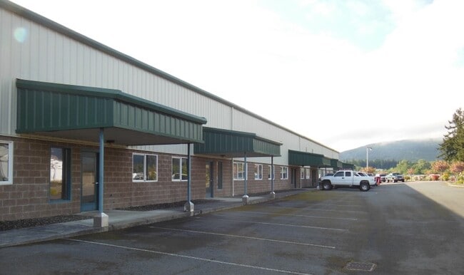
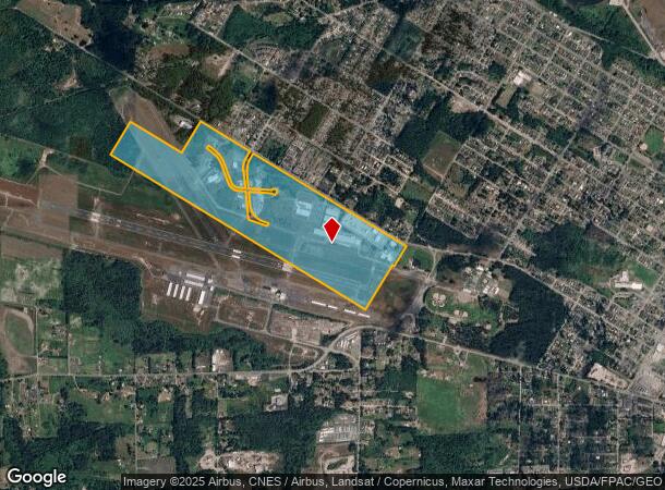
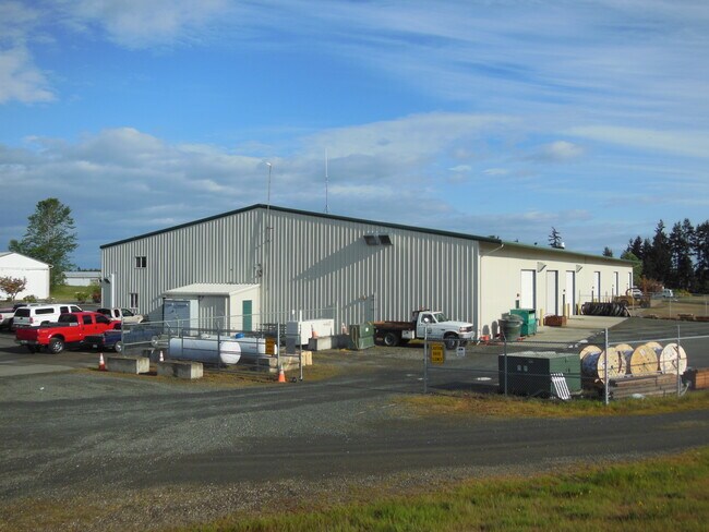
Property Record
2007 E O St, Port Angeles, WA 98362

Current Lease Availabilities
NEARBY LISTINGS FOR SALE OR LEASE
Property Detail
2007 E O St
Port Angeles, WA
Null
61107
LTS 119-126 & 141-150 & VAC STS ABTG; EXC R/W ;SURVEYS V14 P11;V25 P99; V27 P17;V42 P70;V44 P49;V53 P54; SURVEY V69 P7;SUR V71 P78;SUR V72 P13;VAC ORD#3431;BSP V1 P20;
Taxexempt
Clallam
X
Washington
53009C1176F
119-1
2024
167.06 AC
2025
Bellingham/Northwest
001300
Other Market Areas
DEMOGRAPHICS near 2007 E O St
1 Mile
3 Mile
5 Mile
2024 Total Population
3,139
15,796
25,569
2029 Population
3,297
16,554
26,795
Pop Growth 2024-2029
+ 5.03%
+ 4.80%
+ 4.79%
Average Age
41
42
43
2024 Total Households
1,244
6,812
11,276
HH Growth 2024-2029
+ 5.14%
+ 4.80%
+ 4.80%
Median Household Inc
$64,878
$60,245
$59,130
Avg Household Size
2.30
2.20
2.20
2024 Avg HH Vehicles
2.00
2.00
2.00
Median Home Value
$282,887
$293,768
$310,479
Median Year Built
1993
1972
1972
Nearby Places
- Restaurants
- Banks
- Shops
- Fitness
- Groceries
Nearby Properties
Address
Land Use
TOTAL SIZE
Lot Size
Zoning
Address
Land Use
TOTAL SIZE
Lot Size
Zoning
18.47 AC
RLC
Address
Land Use
TOTAL SIZE
Lot Size
Zoning
15,388 SF
5.90 AC
CBD
Address
Land Use
TOTAL SIZE
Lot Size
Zoning
67,080 SF
3 AC
PIH
Address
Land Use
TOTAL SIZE
Lot Size
Zoning
65.60 AC
Address
Land Use
TOTAL SIZE
Lot Size
Zoning
33,120 SF
2.50 AC
PCSD
Address
Land Use
TOTAL SIZE
Lot Size
Zoning
47,287 SF
4.73 AC
PCSD
Address
Land Use
TOTAL SIZE
Lot Size
Zoning
55,164 SF
4.29 AC
PCSD
Address
Land Use
TOTAL SIZE
Lot Size
Zoning
18,410 SF
0.64 AC
CSD
Address
Land Use
TOTAL SIZE
Lot Size
Zoning
36,253 SF
44.94 AC
M
Address
Land Use
TOTAL SIZE
Lot Size
Zoning
3,680 SF
1 AC
M
Address
Land Use
TOTAL SIZE
Lot Size
Zoning
1,196 SF
4.15 AC
RHD
Address
Land Use
TOTAL SIZE
Lot Size
Zoning
18,913 SF
0.96 AC
PCN
Address
Land Use
TOTAL SIZE
Lot Size
Zoning
27,814 SF
0.32 AC
PCBD
Address
Land Use
TOTAL SIZE
Lot Size
Zoning
21,208 SF
0.32 AC
PCBD
Address
Land Use
TOTAL SIZE
Lot Size
Zoning
26,000 SF
4.10 AC
SM2
Address
Land Use
TOTAL SIZE
Lot Size
Zoning
16,967 SF
0.72 AC
Address
Land Use
TOTAL SIZE
Lot Size
Zoning
Address
Land Use
TOTAL SIZE
Lot Size
Zoning
40,200 SF
1.13 AC
PCA
Address
Land Use
TOTAL SIZE
Lot Size
Zoning
31,168 SF
1.32 AC
Address
Land Use
TOTAL SIZE
Lot Size
Zoning
6,864 SF
3.21 AC
Address
Land Use
TOTAL SIZE
Lot Size
Zoning
7,854 SF
0.16 AC
PCN
Address
Land Use
TOTAL SIZE
Lot Size
Zoning
18,010 SF
0.64 AC
PCBD
Address
Land Use
TOTAL SIZE
Lot Size
Zoning
20,198 SF
2.73 AC
P_CSD
Address
Land Use
TOTAL SIZE
Lot Size
Zoning
9,288 SF
2.62 AC
PRHD
Address
Land Use
TOTAL SIZE
Lot Size
Zoning
16,418 SF
0.16 AC
Address
Land Use
TOTAL SIZE
Lot Size
Zoning
16,664 SF
1.86 AC
Address
Land Use
TOTAL SIZE
Lot Size
Zoning
7,800 SF
0.80 AC
OC
Address
Land Use
TOTAL SIZE
Lot Size
Zoning
20,340 SF
18.09 AC
Address
Land Use
TOTAL SIZE
Lot Size
Zoning
6,210 SF
0.32 AC
PCSD
Address
Land Use
TOTAL SIZE
Lot Size
Zoning
2,700 SF
6.34 AC
VLDLD
The World's #1 Commercial Real Estate Marketplace
Connect with us
© 2025 CoStar Group
The information above has been obtained from sources believed reliable. While we do not doubt its accuracy we have not verified it and make no guarantee, warranty or representation about it. It is your responsibility to independently confirm its accuracy and completeness. Any projections, opinions, assumptions, or estimates used are for example only and do not represent the current or future performance of the property. The value of this transaction to you depends on tax and other factors which should be evaluated by your tax, financial, and legal advisors. You and your advisors should conduct a careful, independent investigation of the property to determine to your satisfaction the suitability of the property for your needs.