Property Record
20071121, Camarillo, CA 93012
Property Detail
20071121
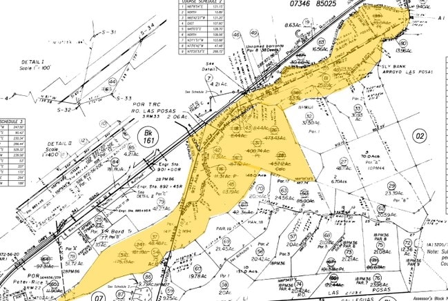
163-0-010-480
PR APN 1630010380
Orchard
VENTURA
OS40AC
California
AE The base floodplain where base flood elevations are provided. AE Zones are now used on new format FIRMs instead of A1-A30 Zones.
23.35 AC
2024
Camarillo/Point Mugu
2025
Los Angeles
005100
Oxnard-Thousand Oaks-Ventura, CA
NEARBY LISTINGS FOR SALE OR LEASE
-
-
View all Camarillo listings for sale on LoopNet.com
DEMOGRAPHICS near 20071121
1 mile
3 mile
5 mile
2025 Total Population
1,088
33,631
76,345
2030 Population
1,061
33,276
75,776
Pop Growth 2025-2030
(2.48%)
(1.06%)
(0.75%)
Average Age
43
45
43
2025 Total Households
332
12,536
28,061
HH Growth 2025-2030
(2.41%)
(1.12%)
(0.89%)
Median Household Inc
$159,286
$123,444
$118,096
Avg Household Size
3.00
2.60
2.60
2025 Avg HH Vehicles
3.00
2.00
2.00
Median Home Value
$1,105,076
$815,472
$832,439
Median Year Built
1980
1979
1978
Nearby Places
Map Layers
Map Styles
 Street
 Aerial
Layers
 Traffic
 Biking
Places
Listings with unknown addresses are not visible on the map
- Restaurants
- Banks
- Shops
- Fitness
- Groceries
PUBLIC TRANSPORTATION
COMMUTER RAIL
Camarillo (Ventura County Line - Southern California Regional Rail Authority (Metrolink))
Drive
Walk
Distance
Camarillo (Ventura County Line - Southern California Regional Rail Authority (Metrolink))
14 min
4.8 mi
Moorpark (Ventura County Line - Southern California Regional Rail Authority (Metrolink))
Drive
Walk
Distance
Moorpark (Ventura County Line - Southern California Regional Rail Authority (Metrolink))
21 min
9.3 mi
Freight Ports
The Port of Hueneme
Drive
Walk
Distance
The Port of Hueneme
33 min
16.6 mi
Nearby Properties
Address
Land Use
TOTAL SIZE
Lot Size
Zoning
Address
Land Use
TOTAL SIZE
Lot Size
Zoning
9.66 AC
PO
Address
Land Use
TOTAL SIZE
Lot Size
Zoning
9.76 AC
Address
Land Use
TOTAL SIZE
Lot Size
Zoning
3.72 AC
CPD
Address
Land Use
TOTAL SIZE
Lot Size
Zoning
66,716 SF
1.79 AC
Address
Land Use
TOTAL SIZE
Lot Size
Zoning
76,037 SF
6 AC
M2
Address
Land Use
TOTAL SIZE
Lot Size
Zoning
4.79 AC
Address
Land Use
TOTAL SIZE
Lot Size
Zoning
6.70 AC
Address
Land Use
TOTAL SIZE
Lot Size
Zoning
45,480 SF
3.15 AC
CPD
Address
Land Use
TOTAL SIZE
Lot Size
Zoning
83,104 SF
4.85 AC
M1
Address
Land Use
TOTAL SIZE
Lot Size
Zoning
12.04 AC
Address
Land Use
TOTAL SIZE
Lot Size
Zoning
9,478 SF
3.03 AC
CPD
Address
Land Use
TOTAL SIZE
Lot Size
Zoning
25,338 SF
2.65 AC
Address
Land Use
TOTAL SIZE
Lot Size
Zoning
74,503 SF
2.50 AC
M1
Address
Land Use
TOTAL SIZE
Lot Size
Zoning
58,532 SF
4.29 AC
Address
Land Use
TOTAL SIZE
Lot Size
Zoning
27,376 SF
0.95 AC
Address
Land Use
TOTAL SIZE
Lot Size
Zoning
586.22 AC
AEO-S-
Address
Land Use
TOTAL SIZE
Lot Size
Zoning
40,627 SF
2.16 AC
CPD
Address
Land Use
TOTAL SIZE
Lot Size
Zoning
16,150 SF
1.53 AC
CPD
Address
Land Use
TOTAL SIZE
Lot Size
Zoning
134.97 AC
A-E
Address
Land Use
TOTAL SIZE
Lot Size
Zoning
23,648 SF
1.51 AC
Address
Land Use
TOTAL SIZE
Lot Size
Zoning
84,211 SF
3.25 AC
M1
Address
Land Use
TOTAL SIZE
Lot Size
Zoning
19,600 SF
1.71 AC
Address
Land Use
TOTAL SIZE
Lot Size
Zoning
23,648 SF
0.59 AC
Address
Land Use
TOTAL SIZE
Lot Size
Zoning
19,600 SF
0.67 AC
Address
Land Use
TOTAL SIZE
Lot Size
Zoning
728 SF
32.05 AC
AE
Address
Land Use
TOTAL SIZE
Lot Size
Zoning
25,500 SF
2.20 AC
CPD
Address
Land Use
TOTAL SIZE
Lot Size
Zoning
920 SF
2.12 AC
M1
Address
Land Use
TOTAL SIZE
Lot Size
Zoning
183.96 AC
AE
Address
Land Use
TOTAL SIZE
Lot Size
Zoning
66.90 AC
Address
Land Use
TOTAL SIZE
Lot Size
Zoning
19,600 SF
0.85 AC
The World's #1 Commercial Real Estate Marketplace
Connect with us
© 2026 CoStar Group
The information above has been obtained from sources believed reliable. While we do not doubt its accuracy we have not verified it and make no guarantee, warranty or representation about it. It is your responsibility to independently confirm its accuracy and completeness. Any projections, opinions, assumptions, or estimates used are for example only and do not represent the current or future performance of the property. The value of this transaction to you depends on tax and other factors which should be evaluated by your tax, financial, and legal advisors. You and your advisors should conduct a careful, independent investigation of the property to determine to your satisfaction the suitability of the property for your needs.