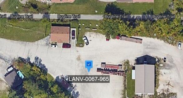
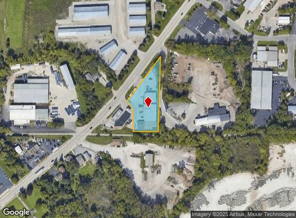
Property Record
20079 W Main St, Lannon, WI 53046
NEARBY LISTINGS FOR SALE OR LEASE
Property Detail
20079 W Main St
Milwaukee-Waukesha-West Allis, WI
PT NW1/4 SW1/4 SEC 17 T8N R20E COM SW COR N 1325.89 FT N8832E 1300.93 FT N0004W 30.01 FT THE BGN S8832W 115.65 FT N0128W 65.00 FT N3905W 115.44 FT NELY ALG CURVE 76.05 FT N3505E 251.58 FT S0004E 418.87 FT TO BGN ALSO PT SW1/4 SEC 17 T8N R20E COM SW C
LANV-0067-990-002
Waukesha
Commercialnec
Wisconsin
X
8
55133C0093H
1.80 AC
2024
NE/Menomonee Falls
2024
Milwaukee/Madison
200300
DEMOGRAPHICS near 20079 W Main St
1 Mile
3 Mile
5 Mile
2024 Total Population
2,075
22,129
70,791
2029 Population
2,088
22,284
71,475
Pop Growth 2024-2029
+ 0.63%
+ 0.70%
+ 0.97%
Average Age
42
45
43
2024 Total Households
831
9,313
28,311
HH Growth 2024-2029
+ 0.60%
+ 0.69%
+ 0.81%
Median Household Inc
$81,469
$87,188
$102,147
Avg Household Size
2.50
2.30
2.50
2024 Avg HH Vehicles
2.00
2.00
2.00
Median Home Value
$296,044
$300,870
$334,932
Median Year Built
1992
1979
1983
Nearby Places
Map Layers
Map Styles
 Street
 Aerial
- Restaurants
- Banks
- Shops
- Fitness
- Groceries
PUBLIC TRANSPORTATION
AIRPORT
General Mitchell International
DRIVE
WALK
Distance
General Mitchell International
44 min
26.6 mi
Freight Ports
Port Milwaukee
DRIVE
WALK
Distance
Port Milwaukee
38 min
22.8 mi
Nearby Properties
Address
Land Use
TOTAL SIZE
Lot Size
Zoning
Address
Land Use
TOTAL SIZE
Lot Size
Zoning
244,996 SF
16.82 AC
Address
Land Use
TOTAL SIZE
Lot Size
Zoning
145,836 SF
11 AC
Address
Land Use
TOTAL SIZE
Lot Size
Zoning
294,486 SF
12.78 AC
Address
Land Use
TOTAL SIZE
Lot Size
Zoning
864,365 SF
50.22 AC
Address
Land Use
TOTAL SIZE
Lot Size
Zoning
74.81 AC
Address
Land Use
TOTAL SIZE
Lot Size
Zoning
9.61 AC
Address
Land Use
TOTAL SIZE
Lot Size
Zoning
145,844 SF
27.98 AC
Address
Land Use
TOTAL SIZE
Lot Size
Zoning
358,699 SF
24.97 AC
Address
Land Use
TOTAL SIZE
Lot Size
Zoning
24.03 AC
Address
Land Use
TOTAL SIZE
Lot Size
Zoning
Address
Land Use
TOTAL SIZE
Lot Size
Zoning
204,175 SF
2.48 AC
Address
Land Use
TOTAL SIZE
Lot Size
Zoning
104,642 SF
7.06 AC
Address
Land Use
TOTAL SIZE
Lot Size
Zoning
302,895 SF
7.90 AC
Address
Land Use
TOTAL SIZE
Lot Size
Zoning
245,615 SF
15.88 AC
Address
Land Use
TOTAL SIZE
Lot Size
Zoning
12.64 AC
Address
Land Use
TOTAL SIZE
Lot Size
Zoning
152,006 SF
12.92 AC
Address
Land Use
TOTAL SIZE
Lot Size
Zoning
14.12 AC
Address
Land Use
TOTAL SIZE
Lot Size
Zoning
34.36 AC
Address
Land Use
TOTAL SIZE
Lot Size
Zoning
90,077 SF
0.95 AC
Address
Land Use
TOTAL SIZE
Lot Size
Zoning
Address
Land Use
TOTAL SIZE
Lot Size
Zoning
112,642 SF
10.73 AC
Address
Land Use
TOTAL SIZE
Lot Size
Zoning
106,514 SF
8.12 AC
Address
Land Use
TOTAL SIZE
Lot Size
Zoning
117,834 SF
10.80 AC
Address
Land Use
TOTAL SIZE
Lot Size
Zoning
85,193 SF
3.71 AC
Address
Land Use
TOTAL SIZE
Lot Size
Zoning
18.03 AC
Address
Land Use
TOTAL SIZE
Lot Size
Zoning
95,367 SF
5.42 AC
Address
Land Use
TOTAL SIZE
Lot Size
Zoning
31,144 SF
26.95 AC
Address
Land Use
TOTAL SIZE
Lot Size
Zoning
94,963 SF
13.30 AC
Address
Land Use
TOTAL SIZE
Lot Size
Zoning
63,850 SF
7.25 AC
Address
Land Use
TOTAL SIZE
Lot Size
Zoning
10.17 AC
The World's #1 Commercial Real Estate Marketplace
Connect with us
© 2025 CoStar Group
The information above has been obtained from sources believed reliable. While we do not doubt its accuracy we have not verified it and make no guarantee, warranty or representation about it. It is your responsibility to independently confirm its accuracy and completeness. Any projections, opinions, assumptions, or estimates used are for example only and do not represent the current or future performance of the property. The value of this transaction to you depends on tax and other factors which should be evaluated by your tax, financial, and legal advisors. You and your advisors should conduct a careful, independent investigation of the property to determine to your satisfaction the suitability of the property for your needs.