Property Record
2010 W 63Rd St, Chicago, IL 60636

NEARBY LISTINGS FOR SALE OR LEASE
Property Detail
2010 W 63Rd St
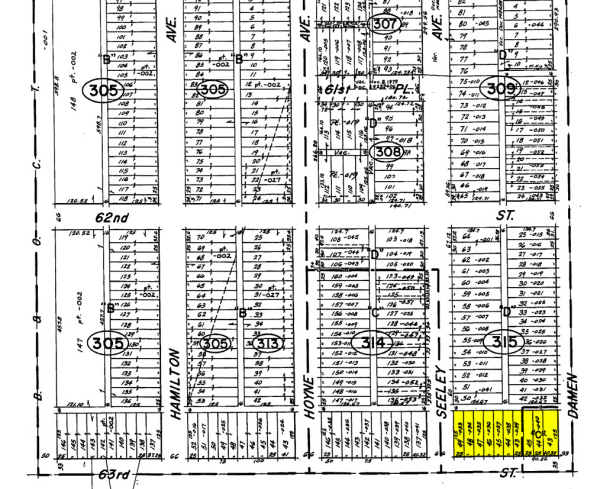
20-18-315-039-0000
63Rd & Robey Sub/Hinkamp & Com
Commercialbuilding
Cook
X
Illinois
17031C0520J
43
2023
0.72 AC
2025
South Chicago
670500
Chicago
4,500 SF
Chicago-Naperville-Elgin, IL-IN
DEMOGRAPHICS near 2010 W 63Rd St
1 Mile
3 Mile
5 Mile
2024 Total Population
32,266
288,574
728,958
2029 Population
30,452
271,510
692,377
Pop Growth 2024-2029
(5.62%)
(5.91%)
(5.02%)
Average Age
36
37
38
2024 Total Households
10,305
92,942
264,283
HH Growth 2024-2029
(6.07%)
(6.09%)
(5.09%)
Median Household Inc
$28,906
$37,648
$45,324
Avg Household Size
2.90
3.00
2.60
2024 Avg HH Vehicles
1.00
1.00
1.00
Median Home Value
$117,761
$179,972
$218,691
Median Year Built
1947
1948
1950
Nearby Places
Map Layers
Map Styles
 Street
 Aerial
- Restaurants
- Banks
- Shops
- Fitness
- Groceries
PUBLIC TRANSPORTATION
TRANSIT/SUBWAY
Ashland & 63rd Street Station (Green Line - Chicago Transit Authority "L" Trains (The "L"))
DRIVE
WALK
Distance
Ashland & 63rd Street Station (Green Line - Chicago Transit Authority "L" Trains (The "L"))
2 min
13 min
0.7 mi
COMMUTER RAIL
Wrightwood Station (SouthWest Service - Northeast Illinois Regional Commuter Railroad (Metra))
DRIVE
WALK
Distance
Wrightwood Station (SouthWest Service - Northeast Illinois Regional Commuter Railroad (Metra))
11 min
3.2 mi
Ashburn Station (SouthWest Service - Northeast Illinois Regional Commuter Railroad (Metra))
DRIVE
WALK
Distance
Ashburn Station (SouthWest Service - Northeast Illinois Regional Commuter Railroad (Metra))
12 min
4.0 mi
AIRPORT
Chicago Midway International
DRIVE
WALK
Distance
Chicago Midway International
17 min
5.1 mi
Chicago O'Hare International
DRIVE
WALK
Distance
Chicago O'Hare International
40 min
27.0 mi
Freight Ports
Port of Baltimore
DRIVE
WALK
Distance
Port of Baltimore
1 min
606.8 mi
SALE & LEASE HISTORY
LISTING DATE
SALE/LEASE

Mar 15, 2019
For Lease
Nearby Properties
Address
Land Use
TOTAL SIZE
Lot Size
Zoning
Address
Land Use
TOTAL SIZE
Lot Size
Zoning
4.71 AC
PD 1196
Address
Land Use
TOTAL SIZE
Lot Size
Zoning
2.98 AC
PD 1196
Address
Land Use
TOTAL SIZE
Lot Size
Zoning
134,800 SF
2.53 AC
PD 1273
Address
Land Use
TOTAL SIZE
Lot Size
Zoning
0.91 AC
PD 1177
Address
Land Use
TOTAL SIZE
Lot Size
Zoning
87,830 SF
0.76 AC
B1-1
Address
Land Use
TOTAL SIZE
Lot Size
Zoning
0.84 AC
B1-3
Address
Land Use
TOTAL SIZE
Lot Size
Zoning
633,057 SF
34.96 AC
PMD 8
Address
Land Use
TOTAL SIZE
Lot Size
Zoning
260,481 SF
12.93 AC
PD 463
Address
Land Use
TOTAL SIZE
Lot Size
Zoning
1,615,006 SF
41.91 AC
PMD13
Address
Land Use
TOTAL SIZE
Lot Size
Zoning
7,200 SF
0.22 AC
B3-3
Address
Land Use
TOTAL SIZE
Lot Size
Zoning
151,303 SF
0.88 AC
PD 568
Address
Land Use
TOTAL SIZE
Lot Size
Zoning
1.65 AC
B2-3
Address
Land Use
TOTAL SIZE
Lot Size
Zoning
7.47 AC
RT-4
Address
Land Use
TOTAL SIZE
Lot Size
Zoning
435,677 SF
12.37 AC
M1-2
Address
Land Use
TOTAL SIZE
Lot Size
Zoning
166,292 SF
5.95 AC
PMD13
Address
Land Use
TOTAL SIZE
Lot Size
Zoning
85,990 SF
6.46 AC
PD 411
Address
Land Use
TOTAL SIZE
Lot Size
Zoning
352,529 SF
12.77 AC
PMD 8
Address
Land Use
TOTAL SIZE
Lot Size
Zoning
283,228 SF
14.47 AC
PMD 8
Address
Land Use
TOTAL SIZE
Lot Size
Zoning
55,492 SF
3.35 AC
B3-3
Address
Land Use
TOTAL SIZE
Lot Size
Zoning
13,700 SF
0.33 AC
B3-2
Address
Land Use
TOTAL SIZE
Lot Size
Zoning
168,120 SF
8.06 AC
PMD 8
Address
Land Use
TOTAL SIZE
Lot Size
Zoning
258,000 SF
13.22 AC
PMD 8
Address
Land Use
TOTAL SIZE
Lot Size
Zoning
107,500 SF
2.88 AC
PD 363
Address
Land Use
TOTAL SIZE
Lot Size
Zoning
2.51 AC
RT-4,PD 12
Address
Land Use
TOTAL SIZE
Lot Size
Zoning
15,600 SF
0.18 AC
C2-1
Address
Land Use
TOTAL SIZE
Lot Size
Zoning
105,818 SF
9.17 AC
PD 910
Address
Land Use
TOTAL SIZE
Lot Size
Zoning
0.54 AC
RS-3
Address
Land Use
TOTAL SIZE
Lot Size
Zoning
276,348 SF
2.75 AC
M2-3
Address
Land Use
TOTAL SIZE
Lot Size
Zoning
10,500 SF
0.75 AC
C2-3
Address
Land Use
TOTAL SIZE
Lot Size
Zoning
0.39 AC
C2-3
The World's #1 Commercial Real Estate Marketplace
Connect with us
© 2026 CoStar Group
The information above has been obtained from sources believed reliable. While we do not doubt its accuracy we have not verified it and make no guarantee, warranty or representation about it. It is your responsibility to independently confirm its accuracy and completeness. Any projections, opinions, assumptions, or estimates used are for example only and do not represent the current or future performance of the property. The value of this transaction to you depends on tax and other factors which should be evaluated by your tax, financial, and legal advisors. You and your advisors should conduct a careful, independent investigation of the property to determine to your satisfaction the suitability of the property for your needs.