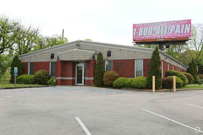
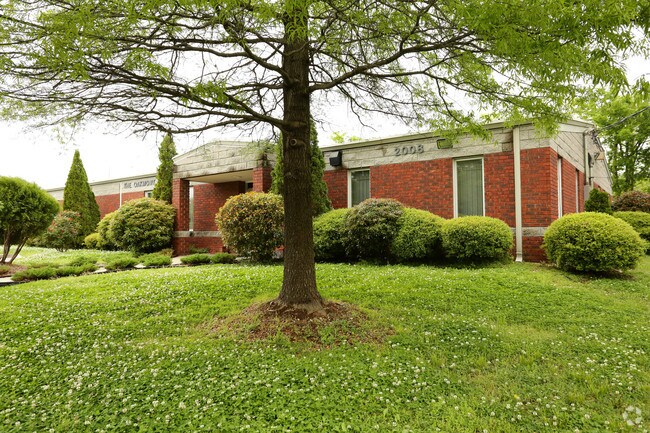
Property Record
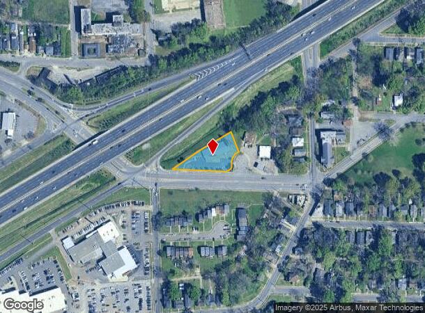
2008 21St St N, Birmingham, AL 35234
NEARBY LISTINGS FOR SALE OR LEASE
Property Detail
2008 21St St N
Birmingham, AL
Ensley Re Bk 1 22-32-3
22-00-32-3-040-002.000
LOT 1-A BLK 1 ENSLEY NO 1 ALA R-22 RESUR OF LOTS 1 THRU 4 PB 93 PG 9
Autorepair
Jefferson
AE
Alabama
01073C0369H
1-a
2023
0.59 AC
2024
Bessemer
001500
Birmingham
5,215 SF
DEMOGRAPHICS near 2008 21St St N
1 Mile
3 Mile
5 Mile
2024 Total Population
9,456
67,068
142,507
2029 Population
9,559
67,777
143,098
Pop Growth 2024-2029
+ 1.09%
+ 1.06%
+ 0.41%
Average Age
42
41
40
2024 Total Households
4,302
28,093
61,512
HH Growth 2024-2029
+ 1.07%
+ 1.10%
+ 0.57%
Median Household Inc
$29,999
$33,836
$38,087
Avg Household Size
2.10
2.20
2.10
2024 Avg HH Vehicles
1.00
1.00
2.00
Median Home Value
$76,741
$73,571
$93,429
Median Year Built
1954
1958
1964
Nearby Places
Map Layers
Map Styles
 Street
 Aerial
- Restaurants
- Banks
- Shops
- Fitness
- Groceries
PUBLIC TRANSPORTATION
AIRPORT
Birmingham-Shuttlesworth International
DRIVE
WALK
Distance
Birmingham-Shuttlesworth International
14 min
9.9 mi
SALE & LEASE HISTORY
LISTING DATE
SALE/LEASE

Sep 24, 2016
For Sale
Nearby Properties
Address
Land Use
TOTAL SIZE
Lot Size
Zoning
Address
Land Use
TOTAL SIZE
Lot Size
Zoning
203,878 SF
12.58 AC
B6
Address
Land Use
TOTAL SIZE
Lot Size
Zoning
344,150 SF
42 AC
R5
Address
Land Use
TOTAL SIZE
Lot Size
Zoning
416,477 SF
80 AC
R5
Address
Land Use
TOTAL SIZE
Lot Size
Zoning
127,240 SF
3.50 AC
R4
Address
Land Use
TOTAL SIZE
Lot Size
Zoning
200,650 SF
19.48 AC
R4
Address
Land Use
TOTAL SIZE
Lot Size
Zoning
116,442 SF
2.67 AC
B6
Address
Land Use
TOTAL SIZE
Lot Size
Zoning
32,922 SF
15 AC
I3
Address
Land Use
TOTAL SIZE
Lot Size
Zoning
106,366 SF
8.70 AC
R3
Address
Land Use
TOTAL SIZE
Lot Size
Zoning
68,046 SF
6 AC
B6
Address
Land Use
TOTAL SIZE
Lot Size
Zoning
250,918 SF
10 AC
B-2
Address
Land Use
TOTAL SIZE
Lot Size
Zoning
65,299 SF
2 AC
B2
Address
Land Use
TOTAL SIZE
Lot Size
Zoning
46,155 SF
0.77 AC
R4
Address
Land Use
TOTAL SIZE
Lot Size
Zoning
93,081 SF
1.06 AC
B2
Address
Land Use
TOTAL SIZE
Lot Size
Zoning
1.83 AC
B6
Address
Land Use
TOTAL SIZE
Lot Size
Zoning
225,942 SF
7.30 AC
M1
Address
Land Use
TOTAL SIZE
Lot Size
Zoning
41,695 SF
5.40 AC
R4
Address
Land Use
TOTAL SIZE
Lot Size
Zoning
74,509 SF
9 AC
B6
Address
Land Use
TOTAL SIZE
Lot Size
Zoning
211,517 SF
9.50 AC
M1
Address
Land Use
TOTAL SIZE
Lot Size
Zoning
140,764 SF
7.21 AC
R6
Address
Land Use
TOTAL SIZE
Lot Size
Zoning
37,619 SF
9.36 AC
R3
Address
Land Use
TOTAL SIZE
Lot Size
Zoning
8,324 SF
158 AC
R3
Address
Land Use
TOTAL SIZE
Lot Size
Zoning
10,297 SF
9.76 AC
QM
Address
Land Use
TOTAL SIZE
Lot Size
Zoning
65,260 SF
5.29 AC
B2
Address
Land Use
TOTAL SIZE
Lot Size
Zoning
128,484 SF
8.70 AC
QB1
Address
Land Use
TOTAL SIZE
Lot Size
Zoning
147,113 SF
18.31 AC
M2
Address
Land Use
TOTAL SIZE
Lot Size
Zoning
92,678 SF
2.07 AC
R4
Address
Land Use
TOTAL SIZE
Lot Size
Zoning
39,347 SF
6.03 AC
B2
Address
Land Use
TOTAL SIZE
Lot Size
Zoning
65,371 SF
1.27 AC
B2
Address
Land Use
TOTAL SIZE
Lot Size
Zoning
111,846 SF
6.80 AC
M1
Address
Land Use
TOTAL SIZE
Lot Size
Zoning
45,666 SF
3.46 AC
R5
The World's #1 Commercial Real Estate Marketplace
Connect with us
© 2026 CoStar Group
The information above has been obtained from sources believed reliable. While we do not doubt its accuracy we have not verified it and make no guarantee, warranty or representation about it. It is your responsibility to independently confirm its accuracy and completeness. Any projections, opinions, assumptions, or estimates used are for example only and do not represent the current or future performance of the property. The value of this transaction to you depends on tax and other factors which should be evaluated by your tax, financial, and legal advisors. You and your advisors should conduct a careful, independent investigation of the property to determine to your satisfaction the suitability of the property for your needs.