Property Record
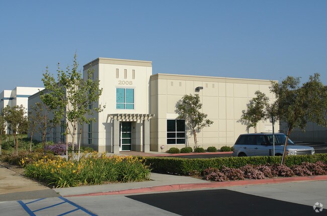
2008 2Nd St, Norco, CA 92860


NEARBY LISTINGS FOR SALE OR LEASE
Property Detail
2008 2Nd St
Riverside-San Bernardino-Ontario, CA
Tract 31359
126-210-020
.47 ACRES NET IN PAR 10 PM 207/096 TR 31359
Lightindustrial
Riverside
X
California
06065C0687H
10
2024
0.47 AC
2025
Corona/Eastvale
046602
Inland Empire (California)
DEMOGRAPHICS near 2008 2Nd St
1 Mile
3 Mile
5 Mile
2024 Total Population
11,202
93,113
282,320
2029 Population
11,645
97,656
296,052
Pop Growth 2024-2029
+ 3.95%
+ 4.88%
+ 4.86%
Average Age
39
36
36
2024 Total Households
2,320
26,025
78,812
HH Growth 2024-2029
+ 3.41%
+ 4.41%
+ 4.41%
Median Household Inc
$100,846
$89,189
$101,366
Avg Household Size
3.10
3.30
3.40
2024 Avg HH Vehicles
3.00
2.00
3.00
Median Home Value
$657,651
$633,254
$646,835
Median Year Built
1977
1985
1990
Nearby Places
Map Layers
Map Styles
 Street
 Aerial
- Restaurants
- Banks
- Shops
- Fitness
- Groceries
PUBLIC TRANSPORTATION
COMMUTER RAIL
North Main Corona (91 Line - Southern California Regional Rail Authority (Metrolink), Inland Empire-Orange County Line - Southern California Regional Rail Authority (Metrolink))
DRIVE
WALK
Distance
North Main Corona (91 Line - Southern California Regional Rail Authority (Metrolink), Inland Empire-Orange County Line - Southern California Regional Rail Authority (Metrolink))
5 min
2.5 mi
West Corona (91 Line - Southern California Regional Rail Authority (Metrolink), Inland Empire-Orange County Line - Southern California Regional Rail Authority (Metrolink))
DRIVE
WALK
Distance
West Corona (91 Line - Southern California Regional Rail Authority (Metrolink), Inland Empire-Orange County Line - Southern California Regional Rail Authority (Metrolink))
10 min
4.7 mi
AIRPORT
Ontario International
DRIVE
WALK
Distance
Ontario International
19 min
12.6 mi
John Wayne/Orange County
DRIVE
WALK
Distance
John Wayne/Orange County
39 min
29.7 mi
Long Beach (Daugherty Field)
DRIVE
WALK
Distance
Long Beach (Daugherty Field)
55 min
44.2 mi
Freight Ports
Port of Long Beach
DRIVE
WALK
Distance
Port of Long Beach
61 min
43.7 mi
Nearby Properties
Address
Land Use
TOTAL SIZE
Lot Size
Zoning
Address
Land Use
TOTAL SIZE
Lot Size
Zoning
32,924 SF
24.04 AC
Address
Land Use
TOTAL SIZE
Lot Size
Zoning
12.69 AC
Address
Land Use
TOTAL SIZE
Lot Size
Zoning
29,695 SF
18.71 AC
R3
Address
Land Use
TOTAL SIZE
Lot Size
Zoning
335,820 SF
15.18 AC
Address
Land Use
TOTAL SIZE
Lot Size
Zoning
364,193 SF
23.77 AC
Address
Land Use
TOTAL SIZE
Lot Size
Zoning
71,440 SF
14.37 AC
Address
Land Use
TOTAL SIZE
Lot Size
Zoning
24,144 SF
13.34 AC
R3
Address
Land Use
TOTAL SIZE
Lot Size
Zoning
182,066 SF
9.31 AC
Address
Land Use
TOTAL SIZE
Lot Size
Zoning
152,369 SF
5.38 AC
Address
Land Use
TOTAL SIZE
Lot Size
Zoning
421,898 SF
3 AC
Address
Land Use
TOTAL SIZE
Lot Size
Zoning
217,299 SF
7.41 AC
Address
Land Use
TOTAL SIZE
Lot Size
Zoning
171,707 SF
8.55 AC
Address
Land Use
TOTAL SIZE
Lot Size
Zoning
149,389 SF
6.72 AC
Address
Land Use
TOTAL SIZE
Lot Size
Zoning
359,304 SF
8.86 AC
R3
Address
Land Use
TOTAL SIZE
Lot Size
Zoning
154,581 SF
8.30 AC
Address
Land Use
TOTAL SIZE
Lot Size
Zoning
152,756 SF
7.07 AC
Address
Land Use
TOTAL SIZE
Lot Size
Zoning
159,517 SF
7.81 AC
Address
Land Use
TOTAL SIZE
Lot Size
Zoning
52,928 SF
9.69 AC
Address
Land Use
TOTAL SIZE
Lot Size
Zoning
160,264 SF
9.21 AC
M1
Address
Land Use
TOTAL SIZE
Lot Size
Zoning
140,216 SF
6.43 AC
Address
Land Use
TOTAL SIZE
Lot Size
Zoning
145,424 SF
7.23 AC
Address
Land Use
TOTAL SIZE
Lot Size
Zoning
311,297 SF
13.39 AC
Address
Land Use
TOTAL SIZE
Lot Size
Zoning
482,479 SF
26.14 AC
M2
Address
Land Use
TOTAL SIZE
Lot Size
Zoning
203,476 SF
10.40 AC
C3
Address
Land Use
TOTAL SIZE
Lot Size
Zoning
105,813 SF
3.54 AC
Address
Land Use
TOTAL SIZE
Lot Size
Zoning
105,813 SF
3.50 AC
A144
Address
Land Use
TOTAL SIZE
Lot Size
Zoning
128,674 SF
6.71 AC
M1
Address
Land Use
TOTAL SIZE
Lot Size
Zoning
116,654 SF
6.03 AC
The World's #1 Commercial Real Estate Marketplace
Connect with us
© 2026 CoStar Group
The information above has been obtained from sources believed reliable. While we do not doubt its accuracy we have not verified it and make no guarantee, warranty or representation about it. It is your responsibility to independently confirm its accuracy and completeness. Any projections, opinions, assumptions, or estimates used are for example only and do not represent the current or future performance of the property. The value of this transaction to you depends on tax and other factors which should be evaluated by your tax, financial, and legal advisors. You and your advisors should conduct a careful, independent investigation of the property to determine to your satisfaction the suitability of the property for your needs.