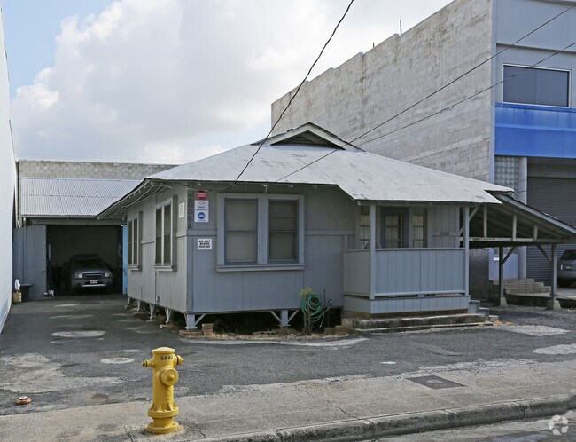
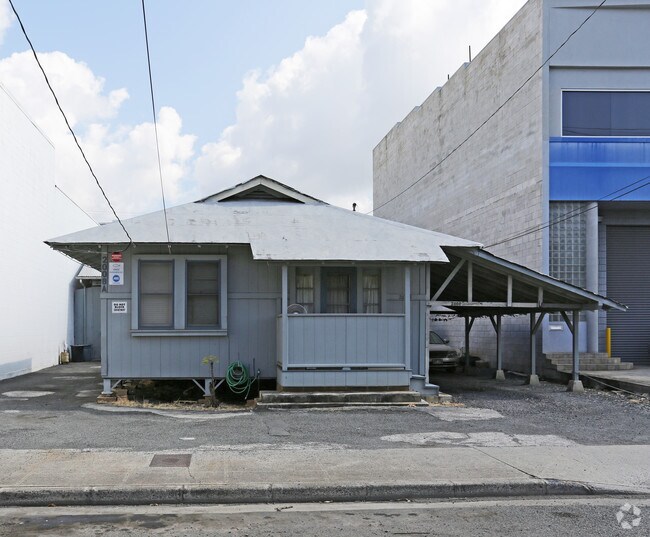
Property Record
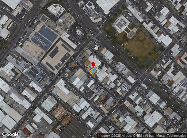
2008 Homerule St, Honolulu, HI 96819
NEARBY LISTINGS FOR SALE OR LEASE
Property Detail
2008 Homerule St
Urban Honolulu, HI
Kapiolani Tract
1-1-2-008-032-0000
LOT 12 BLOCK 37 KAPIOLANI TRACT 5,000 SF
Industrialgeneral
Honolulu
X
Hawaii
15003C0353G
12
2024
0.12 AC
2025
Honolulu
005900
Hawaii
1,200 SF
DEMOGRAPHICS near 2008 Homerule St
1 Mile
3 Mile
5 Mile
2024 Total Population
17,799
161,641
321,211
2029 Population
17,375
157,483
315,937
Pop Growth 2024-2029
(2.38%)
(2.57%)
(1.64%)
Average Age
39
42
42
2024 Total Households
4,460
56,769
123,419
HH Growth 2024-2029
(2.69%)
(2.60%)
(1.55%)
Median Household Inc
$68,480
$77,253
$74,630
Avg Household Size
3.60
2.60
2.40
2024 Avg HH Vehicles
2.00
1.00
1.00
Median Home Value
$532,197
$730,849
$727,422
Median Year Built
1967
1976
1974
Nearby Places
Map Layers
Map Styles
 Street
 Aerial
- Restaurants
- Banks
- Shops
- Fitness
- Groceries
PUBLIC TRANSPORTATION
AIRPORT
Daniel K Inouye International
DRIVE
WALK
Distance
Daniel K Inouye International
8 min
3.2 mi
Freight Ports
Honolulu Harbor, Oahu
DRIVE
WALK
Distance
Honolulu Harbor, Oahu
7 min
2.6 mi
SALE & LEASE HISTORY
LISTING DATE
SALE/LEASE

Jul 29, 2024
For Lease
Nearby Properties
Address
Land Use
TOTAL SIZE
Lot Size
Zoning
Address
Land Use
TOTAL SIZE
Lot Size
Zoning
1,675.63 AC
C/61/60
Address
Land Use
TOTAL SIZE
Lot Size
Zoning
355.21 AC
F-1
Address
Land Use
TOTAL SIZE
Lot Size
Zoning
55.93 AC
WI
Address
Land Use
TOTAL SIZE
Lot Size
Zoning
1,153,381 SF
425.42 AC
R-5
Address
Land Use
TOTAL SIZE
Lot Size
Zoning
2.32 AC
Kak
Address
Land Use
TOTAL SIZE
Lot Size
Zoning
254,832 SF
2.92 AC
BMX-4
Address
Land Use
TOTAL SIZE
Lot Size
Zoning
1,725,655 SF
11 AC
I-2
Address
Land Use
TOTAL SIZE
Lot Size
Zoning
1,725,655 SF
11 AC
I-2
Address
Land Use
TOTAL SIZE
Lot Size
Zoning
12,430 SF
86.69 AC
P-1
Address
Land Use
TOTAL SIZE
Lot Size
Zoning
9,272 SF
141.38 AC
P-2
Address
Land Use
TOTAL SIZE
Lot Size
Zoning
163,285 SF
15.08 AC
R-7.5
Address
Land Use
TOTAL SIZE
Lot Size
Zoning
26,537 SF
2,470.86 AC
I-2
Address
Land Use
TOTAL SIZE
Lot Size
Zoning
1,447,909 SF
12.54 AC
IMX-1
Address
Land Use
TOTAL SIZE
Lot Size
Zoning
446,464 SF
9.90 AC
Kak
Address
Land Use
TOTAL SIZE
Lot Size
Zoning
919,972 SF
14.45 AC
I-2
Address
Land Use
TOTAL SIZE
Lot Size
Zoning
14.38 AC
Kak
Address
Land Use
TOTAL SIZE
Lot Size
Zoning
936,400 SF
6.88 AC
Kak
Address
Land Use
TOTAL SIZE
Lot Size
Zoning
386,846 SF
8.76 AC
A-1
Address
Land Use
TOTAL SIZE
Lot Size
Zoning
6.20 AC
I-2
Address
Land Use
TOTAL SIZE
Lot Size
Zoning
960 SF
71.97 AC
P-2
Address
Land Use
TOTAL SIZE
Lot Size
Zoning
158,215 SF
1.83 AC
BMX-4
Address
Land Use
TOTAL SIZE
Lot Size
Zoning
204,596 SF
0.12 AC
BMX-4
Address
Land Use
TOTAL SIZE
Lot Size
Zoning
253,254 SF
10.73 AC
Kak
Address
Land Use
TOTAL SIZE
Lot Size
Zoning
16.46 AC
I-2
Address
Land Use
TOTAL SIZE
Lot Size
Zoning
49,330 SF
50 AC
I-3
Address
Land Use
TOTAL SIZE
Lot Size
Zoning
10.84 AC
B-2
Address
Land Use
TOTAL SIZE
Lot Size
Zoning
13.77 AC
U/34/30
Address
Land Use
TOTAL SIZE
Lot Size
Zoning
40.76 AC
P-1
Address
Land Use
TOTAL SIZE
Lot Size
Zoning
4.70 AC
BMX-3
The World's #1 Commercial Real Estate Marketplace
Connect with us
© 2025 CoStar Group
The information above has been obtained from sources believed reliable. While we do not doubt its accuracy we have not verified it and make no guarantee, warranty or representation about it. It is your responsibility to independently confirm its accuracy and completeness. Any projections, opinions, assumptions, or estimates used are for example only and do not represent the current or future performance of the property. The value of this transaction to you depends on tax and other factors which should be evaluated by your tax, financial, and legal advisors. You and your advisors should conduct a careful, independent investigation of the property to determine to your satisfaction the suitability of the property for your needs.