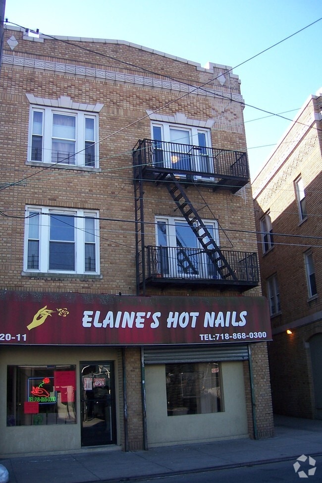
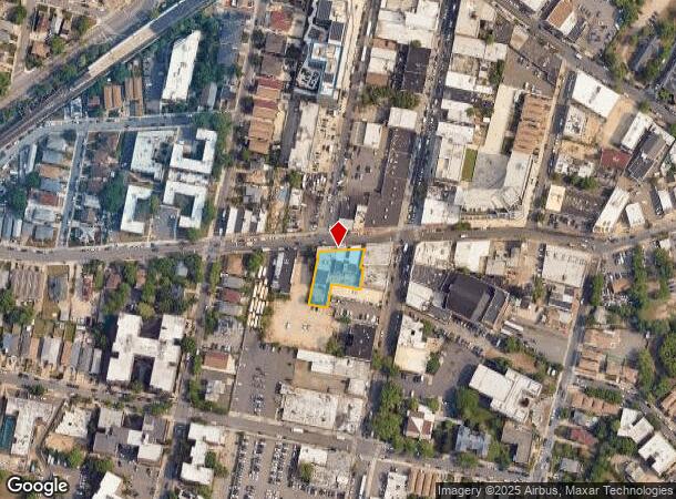
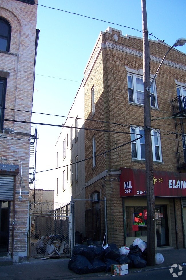
Property Record
2009 Cornaga Ave, Far Rockaway, NY 11691

NEARBY LISTINGS FOR SALE OR LEASE
Property Detail
2009 Cornaga Ave
15750-0029
Queens
Apartment
New York
X
29
36059C0282G
0.34 AC
2024
Far Rockaway
2025
Long Island (New York)
099801
New York-Jersey City-White Plains, NY-NJ
31,544 SF
DEMOGRAPHICS near 2009 Cornaga Ave
1 Mile
3 Mile
5 Mile
2024 Total Population
58,863
121,654
271,929
2029 Population
55,396
115,641
258,094
Pop Growth 2024-2029
(5.89%)
(4.94%)
(5.09%)
Average Age
38
38
40
2024 Total Households
19,277
39,839
89,890
HH Growth 2024-2029
(5.89%)
(5.07%)
(5.17%)
Median Household Inc
$51,679
$61,299
$84,881
Avg Household Size
2.80
2.80
2.80
2024 Avg HH Vehicles
1.00
1.00
1.00
Median Home Value
$687,178
$732,451
$685,171
Median Year Built
1963
1963
1958
Nearby Places
Map Layers
Map Styles
 Street
 Aerial
- Restaurants
- Banks
- Shops
- Fitness
- Groceries
PUBLIC TRANSPORTATION
TRANSIT/SUBWAY
Far Rockaway-Mott Avenue (A - New York MTA Subway (The Subway))
DRIVE
WALK
Distance
Far Rockaway-Mott Avenue (A - New York MTA Subway (The Subway))
1 min
4 min
0.2 mi
Beach 25 Street (A - New York MTA Subway (The Subway))
DRIVE
WALK
Distance
Beach 25 Street (A - New York MTA Subway (The Subway))
1 min
9 min
0.5 mi
Beach 36 Street (A - New York MTA Subway (The Subway))
DRIVE
WALK
Distance
Beach 36 Street (A - New York MTA Subway (The Subway))
2 min
18 min
0.9 mi
COMMUTER RAIL
Far Rockaway Station (Far Rockaway Branch - Long Island Rail Road)
DRIVE
WALK
Distance
Far Rockaway Station (Far Rockaway Branch - Long Island Rail Road)
2 min
11 min
0.6 mi
Inwood Station (Far Rockaway Branch - Long Island Rail Road)
DRIVE
WALK
Distance
Inwood Station (Far Rockaway Branch - Long Island Rail Road)
2 min
20 min
1.0 mi
AIRPORT
John F Kennedy International
DRIVE
WALK
Distance
John F Kennedy International
19 min
10.1 mi
LaGuardia
DRIVE
WALK
Distance
LaGuardia
28 min
15.8 mi
Newark Liberty International
DRIVE
WALK
Distance
Newark Liberty International
55 min
35.5 mi
Freight Ports
NY - Red Hook Container Terminal
DRIVE
WALK
Distance
NY - Red Hook Container Terminal
39 min
20.0 mi
Nearby Properties
Address
Land Use
TOTAL SIZE
Lot Size
Zoning
Address
Land Use
TOTAL SIZE
Lot Size
Zoning
229.51 AC
PARKUS
Address
Land Use
TOTAL SIZE
Lot Size
Zoning
111.98 AC
PARK
Address
Land Use
TOTAL SIZE
Lot Size
Zoning
182.50 AC
M1-1
Address
Land Use
TOTAL SIZE
Lot Size
Zoning
72,663 SF
264.48 AC
PARK
Address
Land Use
TOTAL SIZE
Lot Size
Zoning
124.60 AC
M1-1
Address
Land Use
TOTAL SIZE
Lot Size
Zoning
169.01 AC
PARK
Address
Land Use
TOTAL SIZE
Lot Size
Zoning
1,085,148 SF
13.53 AC
R6
Address
Land Use
TOTAL SIZE
Lot Size
Zoning
52.80 AC
PARK
Address
Land Use
TOTAL SIZE
Lot Size
Zoning
32.47 AC
PARK
Address
Land Use
TOTAL SIZE
Lot Size
Zoning
188,656 SF
5.78 AC
R5
Address
Land Use
TOTAL SIZE
Lot Size
Zoning
820,910 SF
21.03 AC
R4
Address
Land Use
TOTAL SIZE
Lot Size
Zoning
188.92 AC
PARK
Address
Land Use
TOTAL SIZE
Lot Size
Zoning
661,319 SF
50.43 AC
R5
Address
Land Use
TOTAL SIZE
Lot Size
Zoning
587,170 SF
13.55 AC
R4
Address
Land Use
TOTAL SIZE
Lot Size
Zoning
14.91 AC
C4-4
Address
Land Use
TOTAL SIZE
Lot Size
Zoning
154,051 SF
4.05 AC
R5
Address
Land Use
TOTAL SIZE
Lot Size
Zoning
119,788 SF
3.90 AC
R5
Address
Land Use
TOTAL SIZE
Lot Size
Zoning
449,000 SF
5.15 AC
R6
Address
Land Use
TOTAL SIZE
Lot Size
Zoning
128,000 SF
2.52 AC
R5
Address
Land Use
TOTAL SIZE
Lot Size
Zoning
155,875 SF
0.90 AC
R6
Address
Land Use
TOTAL SIZE
Lot Size
Zoning
145,883 SF
1.29 AC
R6
Address
Land Use
TOTAL SIZE
Lot Size
Zoning
120,994 SF
1.71 AC
R6
Address
Land Use
TOTAL SIZE
Lot Size
Zoning
6,077 SF
19.66 AC
PARK
Address
Land Use
TOTAL SIZE
Lot Size
Zoning
358,140 SF
8.13 AC
R5
Address
Land Use
TOTAL SIZE
Lot Size
Zoning
16.49 AC
PARK
Address
Land Use
TOTAL SIZE
Lot Size
Zoning
334,586 SF
12.25 AC
R5
Address
Land Use
TOTAL SIZE
Lot Size
Zoning
77,576 SF
1.38 AC
R5
Address
Land Use
TOTAL SIZE
Lot Size
Zoning
253,000 SF
7.97 AC
R5
Address
Land Use
TOTAL SIZE
Lot Size
Zoning
1,000 SF
27.14 AC
PARK
Address
Land Use
TOTAL SIZE
Lot Size
Zoning
102,204 SF
2.32 AC
R6
The World's #1 Commercial Real Estate Marketplace
Connect with us
© 2025 CoStar Group
The information above has been obtained from sources believed reliable. While we do not doubt its accuracy we have not verified it and make no guarantee, warranty or representation about it. It is your responsibility to independently confirm its accuracy and completeness. Any projections, opinions, assumptions, or estimates used are for example only and do not represent the current or future performance of the property. The value of this transaction to you depends on tax and other factors which should be evaluated by your tax, financial, and legal advisors. You and your advisors should conduct a careful, independent investigation of the property to determine to your satisfaction the suitability of the property for your needs.