Property Record
2009 E Ozark Ave, Gastonia, NC 28054


NEARBY LISTINGS FOR SALE OR LEASE
Property Detail
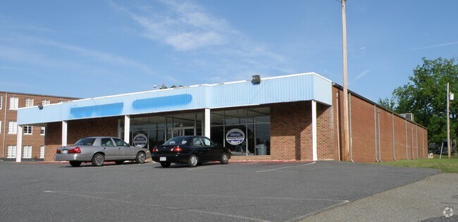
2009 E Ozark Ave
118364
Flint Manufacturing Company Subdivision
Religious
FLINT MANUFACTURING CO BLK B L 11 01 125C 020 00 000
X
Gaston
3710355600J
North Carolina
0
0.56 AC
2025
Gaston County
0314012019
Charlotte
9,760 SF
Charlotte-Concord-Gastonia, NC-SC
DEMOGRAPHICS near 2009 E Ozark Ave
1 Mile
3 Mile
5 Mile
2024 Total Population
6,039
47,990
104,032
2029 Population
6,401
51,012
110,911
Pop Growth 2024-2029
+ 5.99%
+ 6.30%
+ 6.61%
Average Age
40
39
39
2024 Total Households
2,389
19,273
41,635
HH Growth 2024-2029
+ 6.15%
+ 6.45%
+ 6.78%
Median Household Inc
$43,523
$46,300
$48,772
Avg Household Size
2.30
2.30
2.40
2024 Avg HH Vehicles
2.00
2.00
2.00
Median Home Value
$149,649
$175,952
$194,386
Median Year Built
1971
1971
1976
Nearby Places
Map Layers
Map Styles
 Street
 Aerial
- Restaurants
- Banks
- Shops
- Fitness
- Groceries
PUBLIC TRANSPORTATION
COMMUTER RAIL
DRIVE
WALK
Distance
4 min
1.3 mi
AIRPORT
Charlotte/Douglas International
DRIVE
WALK
Distance
Charlotte/Douglas International
30 min
15.8 mi
Concord-Padgett Regional
DRIVE
WALK
Distance
Concord-Padgett Regional
43 min
32.2 mi
Nearby Properties
Address
Land Use
TOTAL SIZE
Lot Size
Zoning
Address
Land Use
TOTAL SIZE
Lot Size
Zoning
104.72 AC
Address
Land Use
TOTAL SIZE
Lot Size
Zoning
56,000 SF
23.22 AC
GOV01
Address
Land Use
TOTAL SIZE
Lot Size
Zoning
54.70 AC
Address
Land Use
TOTAL SIZE
Lot Size
Zoning
47,625 SF
39.10 AC
SHOP2
Address
Land Use
TOTAL SIZE
Lot Size
Zoning
3,026 SF
32.14 AC
HCAR3
Address
Land Use
TOTAL SIZE
Lot Size
Zoning
159,263 SF
9.83 AC
GOV01
Address
Land Use
TOTAL SIZE
Lot Size
Zoning
Address
Land Use
TOTAL SIZE
Lot Size
Zoning
28.04 AC
Address
Land Use
TOTAL SIZE
Lot Size
Zoning
30,000 SF
18.87 AC
SHOP2
Address
Land Use
TOTAL SIZE
Lot Size
Zoning
8,040 SF
18.44 AC
APT01
Address
Land Use
TOTAL SIZE
Lot Size
Zoning
3,120 SF
15.05 AC
OFF01
Address
Land Use
TOTAL SIZE
Lot Size
Zoning
1,974 SF
15.50 AC
APT01
Address
Land Use
TOTAL SIZE
Lot Size
Zoning
9,792 SF
14.31 AC
APT01
Address
Land Use
TOTAL SIZE
Lot Size
Zoning
8,960 SF
12.67 AC
Address
Land Use
TOTAL SIZE
Lot Size
Zoning
103,890 SF
8.81 AC
OFF04
Address
Land Use
TOTAL SIZE
Lot Size
Zoning
2,688 SF
22.48 AC
OFF01
Address
Land Use
TOTAL SIZE
Lot Size
Zoning
20.41 AC
Address
Land Use
TOTAL SIZE
Lot Size
Zoning
4,568 SF
24.69 AC
PUB01
Address
Land Use
TOTAL SIZE
Lot Size
Zoning
1,680 SF
19.08 AC
OFF01
Address
Land Use
TOTAL SIZE
Lot Size
Zoning
Address
Land Use
TOTAL SIZE
Lot Size
Zoning
1,868 SF
15.93 AC
OFF01
Address
Land Use
TOTAL SIZE
Lot Size
Zoning
18,803 SF
9.57 AC
SHOP3
Address
Land Use
TOTAL SIZE
Lot Size
Zoning
33,258 SF
5.51 AC
Address
Land Use
TOTAL SIZE
Lot Size
Zoning
198,897 SF
10.89 AC
RET05
Address
Land Use
TOTAL SIZE
Lot Size
Zoning
22.85 AC
Address
Land Use
TOTAL SIZE
Lot Size
Zoning
123,948 SF
6.94 AC
GOV05
Address
Land Use
TOTAL SIZE
Lot Size
Zoning
0.79 AC
RET01
Address
Land Use
TOTAL SIZE
Lot Size
Zoning
135,840 SF
11.21 AC
Address
Land Use
TOTAL SIZE
Lot Size
Zoning
140,740 SF
17.45 AC
RET05
Address
Land Use
TOTAL SIZE
Lot Size
Zoning
53,260 SF
2.18 AC
HOTL1
The World's #1 Commercial Real Estate Marketplace
Connect with us
© 2026 CoStar Group
The information above has been obtained from sources believed reliable. While we do not doubt its accuracy we have not verified it and make no guarantee, warranty or representation about it. It is your responsibility to independently confirm its accuracy and completeness. Any projections, opinions, assumptions, or estimates used are for example only and do not represent the current or future performance of the property. The value of this transaction to you depends on tax and other factors which should be evaluated by your tax, financial, and legal advisors. You and your advisors should conduct a careful, independent investigation of the property to determine to your satisfaction the suitability of the property for your needs.