Property Record
200A Back River Neck Rd, Essex, MD 21221


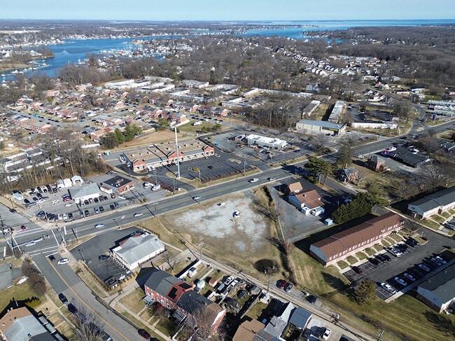
This Property Is For Sale
Property Detail
200A Back River Neck Rd
15-2500004423
UNIT 1 WS BACK RIVER PLAZA CONDO
Commercialacreage
BALTIMORE
ML
Maryland
B and X Area of moderate flood hazard, usually the area between the limits of the 100-year and 500-year floods.
0.04 AC
2024
Baltimore County East
2025
Baltimore
450504
Baltimore-Columbia-Towson, MD
NEARBY LISTINGS FOR SALE OR LEASE
DEMOGRAPHICS near 200A Back River Neck Rd
1 mile
3 mile
5 mile
2025 Total Population
19,090
70,128
178,077
2030 Population
19,212
70,460
178,642
Pop Growth 2025-2030
+ 0.64%
+ 0.47%
+ 0.32%
Average Age
38
40
40
2025 Total Households
8,121
27,373
68,309
HH Growth 2025-2030
+ 0.78%
+ 0.58%
+ 0.35%
Median Household Inc
$56,274
$67,051
$72,130
Avg Household Size
2.30
2.50
2.50
2025 Avg HH Vehicles
1.00
2.00
2.00
Median Home Value
$264,243
$273,478
$260,157
Median Year Built
1967
1966
1965
Nearby Places
Map Layers
Map Styles
 Street
 Aerial
Layers
 Traffic
 Biking
Places
Listings with unknown addresses are not visible on the map
- Restaurants
- Banks
- Shops
- Fitness
- Groceries
PUBLIC TRANSPORTATION
COMMUTER RAIL
Drive
Walk
Distance
8 min
3.1 mi
AIRPORT
Baltimore/Washington International Thurgood Marshall
Drive
Walk
Distance
Baltimore/Washington International Thurgood Marshall
37 min
22.8 mi
Freight Ports
Port of Baltimore
Drive
Walk
Distance
Port of Baltimore
24 min
11.4 mi
Nearby Properties
Address
Land Use
TOTAL SIZE
Lot Size
Zoning
Address
Land Use
TOTAL SIZE
Lot Size
Zoning
159,728 SF
0.02 AC
MH
Address
Land Use
TOTAL SIZE
Lot Size
Zoning
1,062,672 SF
70.27 AC
MHIM
Address
Land Use
TOTAL SIZE
Lot Size
Zoning
15.40 AC
DR16
Address
Land Use
TOTAL SIZE
Lot Size
Zoning
507,600 SF
21.36 AC
MHIM
Address
Land Use
TOTAL SIZE
Lot Size
Zoning
14.28 AC
DR16
Address
Land Use
TOTAL SIZE
Lot Size
Zoning
117,170 SF
7.84 AC
BM
Address
Land Use
TOTAL SIZE
Lot Size
Zoning
253,081 SF
42.21 AC
DR5.5
Address
Land Use
TOTAL SIZE
Lot Size
Zoning
135,931 SF
21.65 AC
DR5.5
Address
Land Use
TOTAL SIZE
Lot Size
Zoning
23.40 AC
DR16
Address
Land Use
TOTAL SIZE
Lot Size
Zoning
97,878 SF
12.45 AC
DR5.5
Address
Land Use
TOTAL SIZE
Lot Size
Zoning
20.13 AC
DR16
Address
Land Use
TOTAL SIZE
Lot Size
Zoning
19 AC
DR16
Address
Land Use
TOTAL SIZE
Lot Size
Zoning
24.95 AC
DR16
Address
Land Use
TOTAL SIZE
Lot Size
Zoning
12.47 AC
DR16
Address
Land Use
TOTAL SIZE
Lot Size
Zoning
126,096 SF
14.68 AC
DR105
Address
Land Use
TOTAL SIZE
Lot Size
Zoning
10.48 AC
DR16
Address
Land Use
TOTAL SIZE
Lot Size
Zoning
130,797 SF
18.11 AC
DR105
Address
Land Use
TOTAL SIZE
Lot Size
Zoning
237,925 SF
28.28 AC
Address
Land Use
TOTAL SIZE
Lot Size
Zoning
294,750 SF
16.51 AC
ML-IM
Address
Land Use
TOTAL SIZE
Lot Size
Zoning
12.25 AC
DR16
Address
Land Use
TOTAL SIZE
Lot Size
Zoning
1,914,359 SF
24.44 AC
MHIM
Address
Land Use
TOTAL SIZE
Lot Size
Zoning
300,000 SF
85.04 AC
MH
Address
Land Use
TOTAL SIZE
Lot Size
Zoning
14.14 AC
DR16
Address
Land Use
TOTAL SIZE
Lot Size
Zoning
3,844 SF
35.84 AC
Address
Land Use
TOTAL SIZE
Lot Size
Zoning
288,830 SF
14.80 AC
Address
Land Use
TOTAL SIZE
Lot Size
Zoning
21.53 AC
DR16
Address
Land Use
TOTAL SIZE
Lot Size
Zoning
119,871 SF
29.63 AC
DR5.5
Address
Land Use
TOTAL SIZE
Lot Size
Zoning
136,978 SF
12.06 AC
MH-IM
Address
Land Use
TOTAL SIZE
Lot Size
Zoning
14.13 AC
DR16
Address
Land Use
TOTAL SIZE
Lot Size
Zoning
124,751 SF
9.24 AC
BM
The World's #1 Commercial Real Estate Marketplace
Connect with us
© 2026 CoStar Group
The information above has been obtained from sources believed reliable. While we do not doubt its accuracy we have not verified it and make no guarantee, warranty or representation about it. It is your responsibility to independently confirm its accuracy and completeness. Any projections, opinions, assumptions, or estimates used are for example only and do not represent the current or future performance of the property. The value of this transaction to you depends on tax and other factors which should be evaluated by your tax, financial, and legal advisors. You and your advisors should conduct a careful, independent investigation of the property to determine to your satisfaction the suitability of the property for your needs.