Property Record
201 17Th St S, Saint Petersburg, FL 33712

Current Lease Availabilities
NEARBY LISTINGS FOR SALE OR LEASE
Property Detail
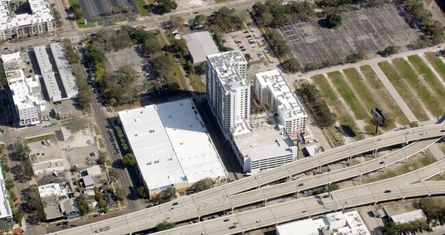
201 17Th St S
Tampa/St Petersburg
Fuller Sub Block 23 Replat
Tampa-St. Petersburg-Clearwater, FL
FULLER SUB BLOCK 23 REPLAT BLDG IMPROVEMENTS LYING WITHIN BLK 1, PART OF LOT 1 KNOWN AS EAST COMMERCIAL ELEMENT HAVING A LOWER VERTICAL LIMIT OF 46.86FT & AN UPPER VERTICAL LIMIT OF 67.56FT DESC AS COM NE COR OF SD LOT 1 TH W 23.32FT TH S 63.19FT FOR
24-31-16-29722-001-0012
Pinellas
Storebuilding
Florida
0
1
2025
0.18 AC
021600
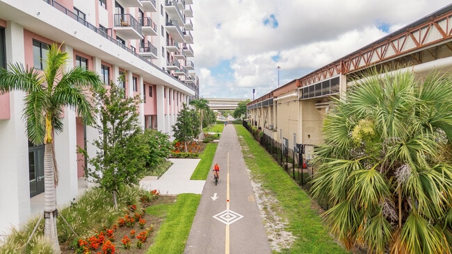
Edge District
7,816 SF
DEMOGRAPHICS near 201 17Th St S
1 Mile
3 Mile
5 Mile
2024 Total Population
16,292
112,873
246,643
2029 Population
16,532
113,399
247,556
Pop Growth 2024-2029
+ 1.47%
+ 0.47%
+ 0.37%
Average Age
40
42
44
2024 Total Households
8,180
51,902
112,585
HH Growth 2024-2029
+ 1.12%
+ 0.29%
+ 0.26%
Median Household Inc
$44,085
$61,256
$63,319
Avg Household Size
1.80
2.00
2.10
2024 Avg HH Vehicles
1.00
1.00
2.00
Median Home Value
$321,562
$298,555
$289,468
Median Year Built
1968
1958
1964
Nearby Places
- Restaurants
- Banks
- Shops
- Fitness
- Groceries
PUBLIC TRANSPORTATION
AIRPORT
St Pete-Clearwater International
DRIVE
WALK
Distance
St Pete-Clearwater International
19 min
12.7 mi
Tampa International
DRIVE
WALK
Distance
Tampa International
24 min
20.8 mi
Sarasota/Bradenton International
DRIVE
WALK
Distance
Sarasota/Bradenton International
48 min
35.4 mi
Freight Ports
Port Manatee
DRIVE
WALK
Distance
Port Manatee
1 min
11.1 mi
Nearby Properties
Address
Land Use
TOTAL SIZE
Lot Size
Zoning
Address
Land Use
TOTAL SIZE
Lot Size
Zoning
725,000 SF
6.05 AC
Address
Land Use
TOTAL SIZE
Lot Size
Zoning
221,003 SF
1.39 AC
Address
Land Use
TOTAL SIZE
Lot Size
Zoning
662,311 SF
2.89 AC
Address
Land Use
TOTAL SIZE
Lot Size
Zoning
655,966 SF
1.25 AC
Address
Land Use
TOTAL SIZE
Lot Size
Zoning
687,948 SF
2.86 AC
Address
Land Use
TOTAL SIZE
Lot Size
Zoning
690,001 SF
2.28 AC
Address
Land Use
TOTAL SIZE
Lot Size
Zoning
1,100,000 SF
57.70 AC
Address
Land Use
TOTAL SIZE
Lot Size
Zoning
12,611 SF
2,367.54 AC
Address
Land Use
TOTAL SIZE
Lot Size
Zoning
287,275 SF
6.29 AC
Address
Land Use
TOTAL SIZE
Lot Size
Zoning
807,604 SF
9.61 AC
Address
Land Use
TOTAL SIZE
Lot Size
Zoning
593,859 SF
2.04 AC
Address
Land Use
TOTAL SIZE
Lot Size
Zoning
593,733 SF
4.35 AC
Address
Land Use
TOTAL SIZE
Lot Size
Zoning
478,217 SF
9.84 AC
Address
Land Use
TOTAL SIZE
Lot Size
Zoning
399,617 SF
13.08 AC
Address
Land Use
TOTAL SIZE
Lot Size
Zoning
596,429 SF
8.07 AC
Address
Land Use
TOTAL SIZE
Lot Size
Zoning
474,605 SF
1.84 AC
Address
Land Use
TOTAL SIZE
Lot Size
Zoning
547,258 SF
3.24 AC
Address
Land Use
TOTAL SIZE
Lot Size
Zoning
443,983 SF
0.88 AC
Address
Land Use
TOTAL SIZE
Lot Size
Zoning
231,140 SF
5.10 AC
Address
Land Use
TOTAL SIZE
Lot Size
Zoning
386,795 SF
10.98 AC
Address
Land Use
TOTAL SIZE
Lot Size
Zoning
193,444 SF
2,339.19 AC
Address
Land Use
TOTAL SIZE
Lot Size
Zoning
402,572 SF
10.02 AC
Address
Land Use
TOTAL SIZE
Lot Size
Zoning
242,915 SF
2.20 AC
Address
Land Use
TOTAL SIZE
Lot Size
Zoning
348,400 SF
1.89 AC
Address
Land Use
TOTAL SIZE
Lot Size
Zoning
366,959 SF
2.02 AC
Address
Land Use
TOTAL SIZE
Lot Size
Zoning
512,449 SF
6.01 AC
Address
Land Use
TOTAL SIZE
Lot Size
Zoning
457,983 SF
3.86 AC
Address
Land Use
TOTAL SIZE
Lot Size
Zoning
393,952 SF
Address
Land Use
TOTAL SIZE
Lot Size
Zoning
341,472 SF
29.42 AC
Address
Land Use
TOTAL SIZE
Lot Size
Zoning
21,232 SF
332.98 AC
The World's #1 Commercial Real Estate Marketplace
Connect with us
© 2025 CoStar Group
The information above has been obtained from sources believed reliable. While we do not doubt its accuracy we have not verified it and make no guarantee, warranty or representation about it. It is your responsibility to independently confirm its accuracy and completeness. Any projections, opinions, assumptions, or estimates used are for example only and do not represent the current or future performance of the property. The value of this transaction to you depends on tax and other factors which should be evaluated by your tax, financial, and legal advisors. You and your advisors should conduct a careful, independent investigation of the property to determine to your satisfaction the suitability of the property for your needs.