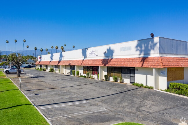
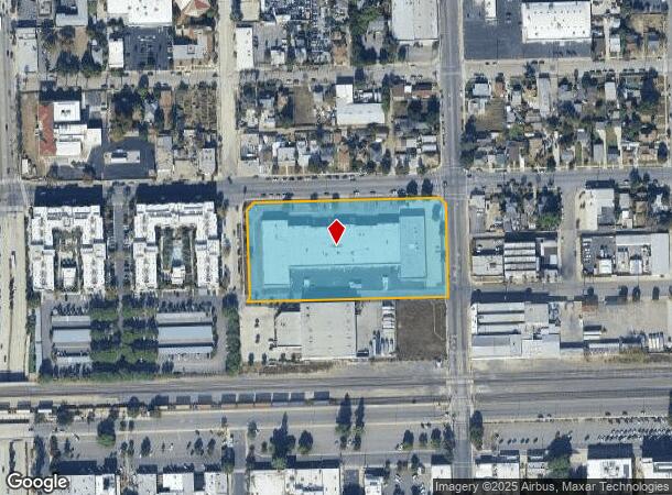
Property Record
201 N Palomares St, Pomona, CA 91767
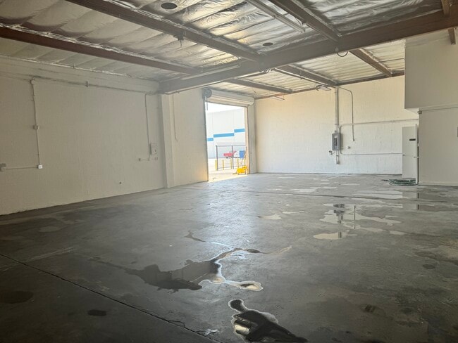

Current Lease Availabilities
NEARBY LISTINGS FOR SALE OR LEASE
-
-
-
-
-
-
-
-
-
-
-
-
-
No Photo
-
-
-
-
-
-
-
View all Pomona listings for lease on LoopNet.com
Property Detail
201 N Palomares St
Los Angeles-Long Beach-Glendale, CA
Parcel Map 17270
8336-028-034
P M 227-34-35 POR VAC ST ADJ ON W AND LO T 1
Lightindustrial
Los Angeles
X
California
06037C1750F
1
2025
3.91 AC
2025
East San Gabriel Valley
408800
Los Angeles
66,032 SF
DEMOGRAPHICS near 201 N Palomares St
1 Mile
3 Mile
5 Mile
2024 Total Population
28,462
178,952
390,593
2029 Population
27,526
174,250
385,104
Pop Growth 2024-2029
(3.29%)
(2.63%)
(1.41%)
Average Age
35
37
38
2024 Total Households
8,237
50,032
117,411
HH Growth 2024-2029
(3.48%)
(2.84%)
(1.53%)
Median Household Inc
$55,912
$72,466
$81,801
Avg Household Size
3.30
3.40
3.10
2024 Avg HH Vehicles
2.00
2.00
2.00
Median Home Value
$496,701
$548,949
$631,699
Median Year Built
1955
1966
1973
Nearby Places
Map Layers
Map Styles
 Street
 Aerial
- Restaurants
- Banks
- Shops
- Fitness
- Groceries
PUBLIC TRANSPORTATION
COMMUTER RAIL
Downtown Pomona (Riverside Line - Southern California Regional Rail Authority (Metrolink))
DRIVE
WALK
Distance
Downtown Pomona (Riverside Line - Southern California Regional Rail Authority (Metrolink))
1 min
8 min
0.4 mi
Pomona (North) (San Bernardino Line - Southern California Regional Rail Authority (Metrolink))
DRIVE
WALK
Distance
Pomona (North) (San Bernardino Line - Southern California Regional Rail Authority (Metrolink))
8 min
10 min
0.6 mi
AIRPORT
Ontario International
DRIVE
WALK
Distance
Ontario International
19 min
14.7 mi
John Wayne/Orange County
DRIVE
WALK
Distance
John Wayne/Orange County
37 min
35.5 mi
Long Beach (Daugherty Field)
DRIVE
WALK
Distance
Long Beach (Daugherty Field)
46 min
43.6 mi
Freight Ports
Port of Long Beach
DRIVE
WALK
Distance
Port of Long Beach
1 min
32.3 mi
Nearby Properties
Address
Land Use
TOTAL SIZE
Lot Size
Zoning
Address
Land Use
TOTAL SIZE
Lot Size
Zoning
491,876 SF
22.46 AC
Address
Land Use
TOTAL SIZE
Lot Size
Zoning
524,084 SF
23.41 AC
POM1*
Address
Land Use
TOTAL SIZE
Lot Size
Zoning
749,184 SF
32.26 AC
POM1
Address
Land Use
TOTAL SIZE
Lot Size
Zoning
126,533 SF
19.51 AC
Address
Land Use
TOTAL SIZE
Lot Size
Zoning
296,080 SF
14.57 AC
CLRM2000*
Address
Land Use
TOTAL SIZE
Lot Size
Zoning
224,998 SF
2.61 AC
CLI*
Address
Land Use
TOTAL SIZE
Lot Size
Zoning
142,438 SF
8.99 AC
CLRM
Address
Land Use
TOTAL SIZE
Lot Size
Zoning
206,631 SF
10.61 AC
Address
Land Use
TOTAL SIZE
Lot Size
Zoning
172,108 SF
7.77 AC
POR31500S*
Address
Land Use
TOTAL SIZE
Lot Size
Zoning
196,175 SF
9.14 AC
POM2*
Address
Land Use
TOTAL SIZE
Lot Size
Zoning
176,482 SF
2.31 AC
POMU
Address
Land Use
TOTAL SIZE
Lot Size
Zoning
70,400 SF
11.04 AC
POM1*
Address
Land Use
TOTAL SIZE
Lot Size
Zoning
9,594 SF
8.16 AC
POM2*
Address
Land Use
TOTAL SIZE
Lot Size
Zoning
157,736 SF
8.14 AC
POC1
Address
Land Use
TOTAL SIZE
Lot Size
Zoning
272,258 SF
1.41 AC
POMU
Address
Land Use
TOTAL SIZE
Lot Size
Zoning
168,875 SF
9.28 AC
POM1*
Address
Land Use
TOTAL SIZE
Lot Size
Zoning
107,525 SF
POR4*
Address
Land Use
TOTAL SIZE
Lot Size
Zoning
95,267 SF
3.12 AC
POR17200-R
Address
Land Use
TOTAL SIZE
Lot Size
Zoning
355,816 SF
16.59 AC
POC4*
Address
Land Use
TOTAL SIZE
Lot Size
Zoning
155,697 SF
1.82 AC
POC3*
Address
Land Use
TOTAL SIZE
Lot Size
Zoning
139,325 SF
6.95 AC
Address
Land Use
TOTAL SIZE
Lot Size
Zoning
100,332 SF
10.13 AC
Address
Land Use
TOTAL SIZE
Lot Size
Zoning
95,195 SF
5.33 AC
Address
Land Use
TOTAL SIZE
Lot Size
Zoning
201,940 SF
9.41 AC
POM2*
Address
Land Use
TOTAL SIZE
Lot Size
Zoning
41,460 SF
4.67 AC
POM2*
Address
Land Use
TOTAL SIZE
Lot Size
Zoning
238,268 SF
19.95 AC
POM1*
Address
Land Use
TOTAL SIZE
Lot Size
Zoning
237,858 SF
17.14 AC
POM1*
Address
Land Use
TOTAL SIZE
Lot Size
Zoning
72,707 SF
0.78 AC
POMUI*
Address
Land Use
TOTAL SIZE
Lot Size
Zoning
236,226 SF
9.88 AC
POM1*
The World's #1 Commercial Real Estate Marketplace
Connect with us
© 2025 CoStar Group
The information above has been obtained from sources believed reliable. While we do not doubt its accuracy we have not verified it and make no guarantee, warranty or representation about it. It is your responsibility to independently confirm its accuracy and completeness. Any projections, opinions, assumptions, or estimates used are for example only and do not represent the current or future performance of the property. The value of this transaction to you depends on tax and other factors which should be evaluated by your tax, financial, and legal advisors. You and your advisors should conduct a careful, independent investigation of the property to determine to your satisfaction the suitability of the property for your needs.