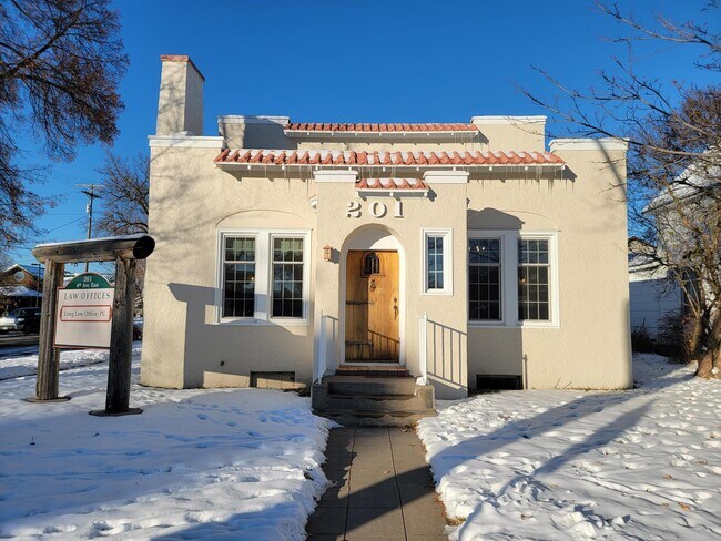
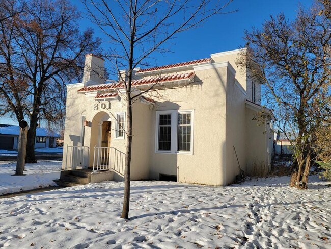
Property Record
201 4Th Ave E, Polson, MT 59860

Property Detail
201 4Th Ave E
15-3228-04-4-22-01-0000
POLSON ORIGINAL TOWNSITE, S04, T22 N, R20 W, BLOCK 016, LOT 007
Officebuilding
Lake
2
Montana
B and X Area of moderate flood hazard, usually the area between the limits of the 100-year and 500-year floods.
7
2025
0.16 AC
2025
Glacier Country
940304
Other Market Areas
2,817 SF
NEARBY LISTINGS FOR SALE OR LEASE
DEMOGRAPHICS near 201 4Th Ave E
1 mile
3 mile
5 mile
2025 Total Population
4,913
8,549
10,385
2030 Population
5,265
9,170
11,130
Pop Growth 2025-2030
+ 7.16%
+ 7.26%
+ 7.17%
Average Age
42
43
44
2025 Total Households
2,153
3,657
4,406
HH Growth 2025-2030
+ 7.01%
+ 7.00%
+ 6.95%
Median Household Inc
$51,781
$60,635
$62,581
Avg Household Size
2.20
2.30
2.30
2025 Avg HH Vehicles
2.00
2.00
2.00
Median Home Value
$352,972
$429,271
$450,223
Median Year Built
1979
1988
1989
Nearby Places
Map Layers
Map Styles
 Street
 Aerial
Transit
 Traffic
 Biking
Places
Listings with unknown addresses are not visible on the map
- Restaurants
- Banks
- Shops
- Fitness
- Groceries
SALE & LEASE HISTORY
LISTING DATE
SALE/LEASE

Jan 31, 2023
For Lease
Nearby Properties
Address
Land Use
TOTAL SIZE
Lot Size
Zoning
Address
Land Use
TOTAL SIZE
Lot Size
Zoning
6.63 AC
Address
Land Use
TOTAL SIZE
Lot Size
Zoning
57,868 SF
3.29 AC
Address
Land Use
TOTAL SIZE
Lot Size
Zoning
122,132 SF
17.66 AC
5
Address
Land Use
TOTAL SIZE
Lot Size
Zoning
60,718 SF
4.84 AC
Address
Land Use
TOTAL SIZE
Lot Size
Zoning
13,824 SF
3.04 AC
5
Address
Land Use
TOTAL SIZE
Lot Size
Zoning
21,955 SF
6 AC
Address
Land Use
TOTAL SIZE
Lot Size
Zoning
13,472 SF
3.55 AC
Address
Land Use
TOTAL SIZE
Lot Size
Zoning
58,127 SF
11.81 AC
Address
Land Use
TOTAL SIZE
Lot Size
Zoning
41,911 SF
5.77 AC
Address
Land Use
TOTAL SIZE
Lot Size
Zoning
19,195 SF
2.50 AC
Address
Land Use
TOTAL SIZE
Lot Size
Zoning
20,007 SF
0.91 AC
PTID
Address
Land Use
TOTAL SIZE
Lot Size
Zoning
30,070 SF
1.72 AC
2
Address
Land Use
TOTAL SIZE
Lot Size
Zoning
21,715 SF
0.32 AC
Address
Land Use
TOTAL SIZE
Lot Size
Zoning
49,036 SF
3.03 AC
5
Address
Land Use
TOTAL SIZE
Lot Size
Zoning
57,339 SF
18.14 AC
5
Address
Land Use
TOTAL SIZE
Lot Size
Zoning
22,008 SF
Address
Land Use
TOTAL SIZE
Lot Size
Zoning
13,650 SF
2.38 AC
5
Address
Land Use
TOTAL SIZE
Lot Size
Zoning
144 SF
11.37 AC
Address
Land Use
TOTAL SIZE
Lot Size
Zoning
2,816 SF
6 AC
Address
Land Use
TOTAL SIZE
Lot Size
Zoning
39,312 SF
5.52 AC
3
Address
Land Use
TOTAL SIZE
Lot Size
Zoning
8,000 SF
8.52 AC
Address
Land Use
TOTAL SIZE
Lot Size
Zoning
5,759 SF
1.72 AC
2
Address
Land Use
TOTAL SIZE
Lot Size
Zoning
7,220 SF
1 AC
Address
Land Use
TOTAL SIZE
Lot Size
Zoning
9,960 SF
1.62 AC
Address
Land Use
TOTAL SIZE
Lot Size
Zoning
21,434 SF
23.64 AC
Address
Land Use
TOTAL SIZE
Lot Size
Zoning
6,271 SF
1.59 AC
Address
Land Use
TOTAL SIZE
Lot Size
Zoning
0.16 AC
Address
Land Use
TOTAL SIZE
Lot Size
Zoning
15,237 SF
2.69 AC
Address
Land Use
TOTAL SIZE
Lot Size
Zoning
2,936 SF
0.94 AC
Address
Land Use
TOTAL SIZE
Lot Size
Zoning
30,175 SF
4.49 AC
2
The World's #1 Commercial Real Estate Marketplace
Connect with us
© 2026 CoStar Group
The information above has been obtained from sources believed reliable. While we do not doubt its accuracy we have not verified it and make no guarantee, warranty or representation about it. It is your responsibility to independently confirm its accuracy and completeness. Any projections, opinions, assumptions, or estimates used are for example only and do not represent the current or future performance of the property. The value of this transaction to you depends on tax and other factors which should be evaluated by your tax, financial, and legal advisors. You and your advisors should conduct a careful, independent investigation of the property to determine to your satisfaction the suitability of the property for your needs.