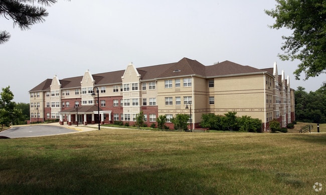
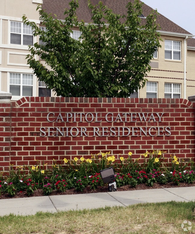
Property Record
201 58Th St Ne, Washington, DC 20019
NEARBY LISTINGS FOR SALE OR LEASE
Property Detail
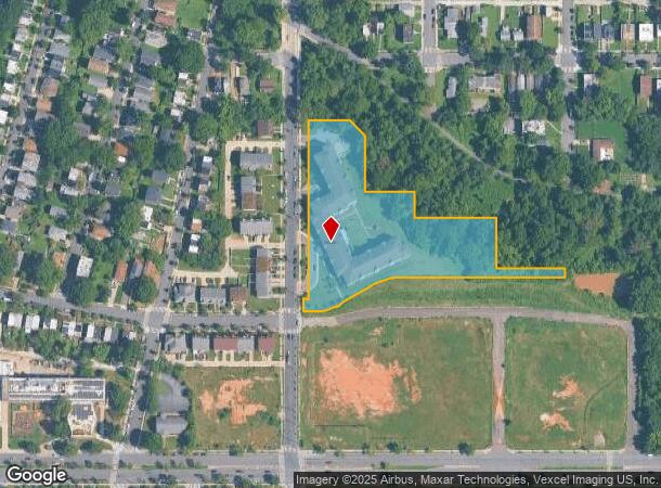
201 58Th St Ne
Washington-Arlington-Alexandria, DC-VA-MD-WV
Deanwood
5273-0066
SQUARE 5273 LOT 0066 NBHD: DEANWOOD
Apartment
District of Columbia
AE
District of Columbia
24033C0143E
66
2025
3.69 AC
2025
Grant Park
007808
Washington, DC
142,636 SF
DEMOGRAPHICS near 201 58Th St Ne
1 Mile
3 Mile
5 Mile
2024 Total Population
27,975
155,372
507,918
2029 Population
26,349
147,788
483,595
Pop Growth 2024-2029
(5.81%)
(4.88%)
(4.79%)
Average Age
38
39
38
2024 Total Households
10,409
61,251
205,853
HH Growth 2024-2029
(6.54%)
(5.44%)
(5.35%)
Median Household Inc
$57,499
$62,317
$73,957
Avg Household Size
2.60
2.50
2.40
2024 Avg HH Vehicles
1.00
1.00
1.00
Median Home Value
$323,215
$325,137
$382,889
Median Year Built
1961
1964
1966
Nearby Places
Map Layers
Map Styles
 Street
 Aerial
- Restaurants
- Banks
- Shops
- Fitness
- Groceries
PUBLIC TRANSPORTATION
COMMUTER RAIL
DRIVE
WALK
Distance
10 min
5.1 mi
Union Station (Red Line - Washington Metropolitan Area Transit Authority Metrorail (Metrorail))
DRIVE
WALK
Distance
Union Station (Red Line - Washington Metropolitan Area Transit Authority Metrorail (Metrorail))
12 min
5.4 mi
AIRPORT
Ronald Reagan Washington Ntl
DRIVE
WALK
Distance
Ronald Reagan Washington Ntl
21 min
11.3 mi
Baltimore/Washington International Thurgood Marshall
DRIVE
WALK
Distance
Baltimore/Washington International Thurgood Marshall
43 min
28.2 mi
Washington Dulles International
DRIVE
WALK
Distance
Washington Dulles International
55 min
33.9 mi
Freight Ports
Port of Baltimore
DRIVE
WALK
Distance
Port of Baltimore
52 min
34.5 mi
Nearby Properties
Address
Land Use
TOTAL SIZE
Lot Size
Zoning
Address
Land Use
TOTAL SIZE
Lot Size
Zoning
169.85 AC
R-2;RA-1;U
Address
Land Use
TOTAL SIZE
Lot Size
Zoning
236,535 SF
12.54 AC
R-2
Address
Land Use
TOTAL SIZE
Lot Size
Zoning
944,105 SF
23.09 AC
CGO
Address
Land Use
TOTAL SIZE
Lot Size
Zoning
241,725 SF
4.71 AC
MU-7B;PDR-
Address
Land Use
TOTAL SIZE
Lot Size
Zoning
62.03 AC
UNZONED
Address
Land Use
TOTAL SIZE
Lot Size
Zoning
229,238 SF
1.51 AC
MU-7B
Address
Land Use
TOTAL SIZE
Lot Size
Zoning
12.60 AC
LTOC
Address
Land Use
TOTAL SIZE
Lot Size
Zoning
821,240 SF
48.32 AC
IH
Address
Land Use
TOTAL SIZE
Lot Size
Zoning
192,440 SF
7.67 AC
R-2;RA-1
Address
Land Use
TOTAL SIZE
Lot Size
Zoning
107,130 SF
2.98 AC
R-2;RA-1
Address
Land Use
TOTAL SIZE
Lot Size
Zoning
419,689 SF
66.84 AC
PDR-1;PDR-
Address
Land Use
TOTAL SIZE
Lot Size
Zoning
132,000 SF
RA-1
Address
Land Use
TOTAL SIZE
Lot Size
Zoning
230,000 SF
4.25 AC
MU-5A;RA-4
Address
Land Use
TOTAL SIZE
Lot Size
Zoning
262,236 SF
15.26 AC
MU-8B
Address
Land Use
TOTAL SIZE
Lot Size
Zoning
379,168 SF
18.94 AC
RMF20
Address
Land Use
TOTAL SIZE
Lot Size
Zoning
181,530 SF
4.72 AC
R-2
Address
Land Use
TOTAL SIZE
Lot Size
Zoning
62,797 SF
0.55 AC
R2
Address
Land Use
TOTAL SIZE
Lot Size
Zoning
92,511 SF
1.48 AC
RA-1
Address
Land Use
TOTAL SIZE
Lot Size
Zoning
25.33 AC
UNZONED
Address
Land Use
TOTAL SIZE
Lot Size
Zoning
10.63 AC
RMF20
Address
Land Use
TOTAL SIZE
Lot Size
Zoning
123,950 SF
4.65 AC
R-2
Address
Land Use
TOTAL SIZE
Lot Size
Zoning
22.19 AC
UNZONED
Address
Land Use
TOTAL SIZE
Lot Size
Zoning
206,118 SF
0.82 AC
RA-1
Address
Land Use
TOTAL SIZE
Lot Size
Zoning
99,269 SF
4.73 AC
RA-1
Address
Land Use
TOTAL SIZE
Lot Size
Zoning
13.21 AC
RMF48
Address
Land Use
TOTAL SIZE
Lot Size
Zoning
115,788 SF
1.77 AC
MU-4;RA-1
Address
Land Use
TOTAL SIZE
Lot Size
Zoning
29.49 AC
RSFA
Address
Land Use
TOTAL SIZE
Lot Size
Zoning
360,645 SF
17.52 AC
RA-2
Address
Land Use
TOTAL SIZE
Lot Size
Zoning
162,221 SF
1.12 AC
R-2
The World's #1 Commercial Real Estate Marketplace
Connect with us
© 2026 CoStar Group
The information above has been obtained from sources believed reliable. While we do not doubt its accuracy we have not verified it and make no guarantee, warranty or representation about it. It is your responsibility to independently confirm its accuracy and completeness. Any projections, opinions, assumptions, or estimates used are for example only and do not represent the current or future performance of the property. The value of this transaction to you depends on tax and other factors which should be evaluated by your tax, financial, and legal advisors. You and your advisors should conduct a careful, independent investigation of the property to determine to your satisfaction the suitability of the property for your needs.