Property Record
201 9Th St, Magnolia, TX 77355
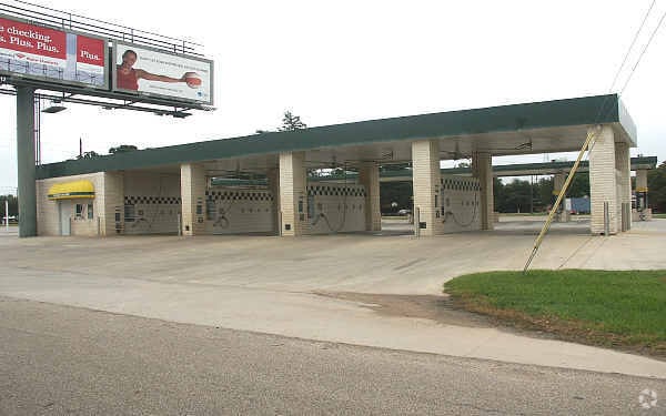


Property Detail
201 9Th St
3400-00-05900
S340000 - CHURCH ACRES, BLOCK 6, LOT 1 - 9
Commercialnec
Montgomery
2
Texas
B and X Area of moderate flood hazard, usually the area between the limits of the 100-year and 500-year floods.
1-9
2024
0.75 AC
2025
Northwest Outlier
690204
Houston
2,616 SF
Houston-Pasadena-The Woodlands, TX
NEARBY LISTINGS FOR SALE OR LEASE
-
-
View all Magnolia listings for sale on LoopNet.com
DEMOGRAPHICS near 201 9Th St
1 mile
3 mile
5 mile
2025 Total Population
2,270
17,932
37,956
2030 Population
2,696
21,333
44,931
Pop Growth 2025-2030
+ 18.77%
+ 18.97%
+ 18.38%
Average Age
37
38
39
2025 Total Households
789
6,007
12,807
HH Growth 2025-2030
+ 19.26%
+ 19.56%
+ 18.90%
Median Household Inc
$79,362
$94,294
$92,888
Avg Household Size
2.90
2.90
2.90
2025 Avg HH Vehicles
2.00
2.00
2.00
Median Home Value
$293,124
$390,701
$404,189
Median Year Built
2007
2010
2009
Nearby Places
Map Layers
Map Styles
 Street
 Aerial
Layers
 Traffic
 Biking
Places
Listings with unknown addresses are not visible on the map
- Restaurants
- Banks
- Shops
- Fitness
- Groceries
PUBLIC TRANSPORTATION
AIRPORT
George Bush Intcntl/Houston
Drive
Walk
Distance
George Bush Intcntl/Houston
49 min
38.8 mi
Freight Ports
Port of Houston
Drive
Walk
Distance
Port of Houston
69 min
49.5 mi
Nearby Properties
Address
Land Use
TOTAL SIZE
Lot Size
Zoning
Address
Land Use
TOTAL SIZE
Lot Size
Zoning
415,414 SF
78.38 AC
2
Address
Land Use
TOTAL SIZE
Lot Size
Zoning
182,399 SF
33.46 AC
2
Address
Land Use
TOTAL SIZE
Lot Size
Zoning
99,363 SF
13.76 AC
2
Address
Land Use
TOTAL SIZE
Lot Size
Zoning
65,975 SF
4.83 AC
Address
Land Use
TOTAL SIZE
Lot Size
Zoning
108,038 SF
7.58 AC
Address
Land Use
TOTAL SIZE
Lot Size
Zoning
14,920 SF
49.96 AC
2
Address
Land Use
TOTAL SIZE
Lot Size
Zoning
69,902 SF
14.82 AC
2
Address
Land Use
TOTAL SIZE
Lot Size
Zoning
28,308 SF
17.40 AC
Address
Land Use
TOTAL SIZE
Lot Size
Zoning
51,482 SF
17.16 AC
2
Address
Land Use
TOTAL SIZE
Lot Size
Zoning
28,102 SF
3.15 AC
Address
Land Use
TOTAL SIZE
Lot Size
Zoning
1,813 SF
42.94 AC
Address
Land Use
TOTAL SIZE
Lot Size
Zoning
14,820 SF
1.87 AC
2
Address
Land Use
TOTAL SIZE
Lot Size
Zoning
99,623 SF
25.35 AC
2
Address
Land Use
TOTAL SIZE
Lot Size
Zoning
97,804 SF
9.46 AC
2
Address
Land Use
TOTAL SIZE
Lot Size
Zoning
59,976 SF
3.68 AC
Address
Land Use
TOTAL SIZE
Lot Size
Zoning
29,692 SF
19.28 AC
Address
Land Use
TOTAL SIZE
Lot Size
Zoning
20,301 SF
13.34 AC
2
Address
Land Use
TOTAL SIZE
Lot Size
Zoning
21,186 SF
11.62 AC
2
Address
Land Use
TOTAL SIZE
Lot Size
Zoning
72,180 SF
8.83 AC
2
Address
Land Use
TOTAL SIZE
Lot Size
Zoning
4,038 SF
40.70 AC
Address
Land Use
TOTAL SIZE
Lot Size
Zoning
18,862 SF
20.45 AC
2
Address
Land Use
TOTAL SIZE
Lot Size
Zoning
18,900 SF
5 AC
2
Address
Land Use
TOTAL SIZE
Lot Size
Zoning
34,780 SF
11.35 AC
2
Address
Land Use
TOTAL SIZE
Lot Size
Zoning
45,676 SF
7.49 AC
Address
Land Use
TOTAL SIZE
Lot Size
Zoning
1,200 SF
22.36 AC
2
Address
Land Use
TOTAL SIZE
Lot Size
Zoning
103,710 SF
7.50 AC
2
Address
Land Use
TOTAL SIZE
Lot Size
Zoning
62,020 SF
5.28 AC
Address
Land Use
TOTAL SIZE
Lot Size
Zoning
48,444 SF
9.55 AC
Address
Land Use
TOTAL SIZE
Lot Size
Zoning
61,584 SF
33.90 AC
Address
Land Use
TOTAL SIZE
Lot Size
Zoning
8.23 AC
2
The World's #1 Commercial Real Estate Marketplace
Connect with us
© 2026 CoStar Group
The information above has been obtained from sources believed reliable. While we do not doubt its accuracy we have not verified it and make no guarantee, warranty or representation about it. It is your responsibility to independently confirm its accuracy and completeness. Any projections, opinions, assumptions, or estimates used are for example only and do not represent the current or future performance of the property. The value of this transaction to you depends on tax and other factors which should be evaluated by your tax, financial, and legal advisors. You and your advisors should conduct a careful, independent investigation of the property to determine to your satisfaction the suitability of the property for your needs.