Property Record
201 Broad St, Phillipsburg, NJ 08865


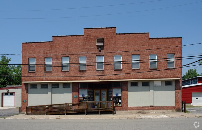
Property Detail
201 Broad St
Allentown-Bethlehem-Easton, PA-NJ
ADDITIONAL LOTS: 14,16 COMBINED 1997
19-00101-0000-00013
Warren
Commercialnec
New Jersey
I-1
13
C and X Area of minimal flood hazard, usually depicted on FIRMs as above the 500-year flood level.
0.32 AC
2024
Warren
2025
Northern New Jersey
030600
NEARBY LISTINGS FOR SALE OR LEASE
DEMOGRAPHICS near 201 Broad St
1 mile
3 mile
5 mile
2025 Total Population
16,857
85,123
123,904
2030 Population
17,248
86,782
126,242
Pop Growth 2025-2030
+ 2.32%
+ 1.95%
+ 1.89%
Average Age
38
40
42
2025 Total Households
6,161
31,928
46,969
HH Growth 2025-2030
+ 2.19%
+ 2.00%
+ 1.96%
Median Household Inc
$83,491
$79,499
$88,487
Avg Household Size
2.30
2.40
2.50
2025 Avg HH Vehicles
2.00
2.00
2.00
Median Home Value
$257,270
$272,620
$299,299
Median Year Built
1947
1955
1965
Nearby Places
Map Layers
Map Styles
 Street
 Aerial
Layers
 Traffic
 Biking
Places
Listings with unknown addresses are not visible on the map
- Restaurants
- Banks
- Shops
- Fitness
- Groceries
PUBLIC TRANSPORTATION
AIRPORT
Lehigh Valley International
Drive
Walk
Distance
Lehigh Valley International
26 min
15.4 mi
Trenton Mercer
Drive
Walk
Distance
Trenton Mercer
72 min
47.1 mi
Freight Ports
Port of Philadelphia
Drive
Walk
Distance
Port of Philadelphia
103 min
62.9 mi
Nearby Properties
Address
Land Use
TOTAL SIZE
Lot Size
Zoning
Address
Land Use
TOTAL SIZE
Lot Size
Zoning
330,000 SF
121.88 AC
R150
Address
Land Use
TOTAL SIZE
Lot Size
Zoning
511,200 SF
66.74 AC
HBRM
Address
Land Use
TOTAL SIZE
Lot Size
Zoning
54.61 AC
Address
Land Use
TOTAL SIZE
Lot Size
Zoning
48.27 AC
I2RA
Address
Land Use
TOTAL SIZE
Lot Size
Zoning
9.80 AC
B-1
Address
Land Use
TOTAL SIZE
Lot Size
Zoning
27.73 AC
RA-7
Address
Land Use
TOTAL SIZE
Lot Size
Zoning
20.65 AC
HBRM
Address
Land Use
TOTAL SIZE
Lot Size
Zoning
15,080 SF
34.28 AC
R120
Address
Land Use
TOTAL SIZE
Lot Size
Zoning
16.54 AC
Address
Land Use
TOTAL SIZE
Lot Size
Zoning
87,508 SF
40.79 AC
CCE
Address
Land Use
TOTAL SIZE
Lot Size
Zoning
14.60 AC
RA-7
Address
Land Use
TOTAL SIZE
Lot Size
Zoning
13,916 SF
9.47 AC
RLD
Address
Land Use
TOTAL SIZE
Lot Size
Zoning
17.06 AC
R-75
Address
Land Use
TOTAL SIZE
Lot Size
Zoning
17.65 AC
I-1
Address
Land Use
TOTAL SIZE
Lot Size
Zoning
127,731 SF
56.29 AC
R12
Address
Land Use
TOTAL SIZE
Lot Size
Zoning
7.43 AC
R-50
Address
Land Use
TOTAL SIZE
Lot Size
Zoning
43.49 AC
B-3
Address
Land Use
TOTAL SIZE
Lot Size
Zoning
15.02 AC
ROM
Address
Land Use
TOTAL SIZE
Lot Size
Zoning
6,966 SF
8.86 AC
RMD
Address
Land Use
TOTAL SIZE
Lot Size
Zoning
20.75 AC
B-1
Address
Land Use
TOTAL SIZE
Lot Size
Zoning
84,805 SF
12.20 AC
CHDD
Address
Land Use
TOTAL SIZE
Lot Size
Zoning
12.16 AC
Address
Land Use
TOTAL SIZE
Lot Size
Zoning
1,852 SF
10.43 AC
PO
Address
Land Use
TOTAL SIZE
Lot Size
Zoning
32.92 AC
HBRM
Address
Land Use
TOTAL SIZE
Lot Size
Zoning
10 AC
PO
Address
Land Use
TOTAL SIZE
Lot Size
Zoning
2.67 AC
R-75
Address
Land Use
TOTAL SIZE
Lot Size
Zoning
5.77 AC
B-2
Address
Land Use
TOTAL SIZE
Lot Size
Zoning
15.20 AC
B2R5
Address
Land Use
TOTAL SIZE
Lot Size
Zoning
2.55 AC
R-50
Address
Land Use
TOTAL SIZE
Lot Size
Zoning
20.10 AC
R120
The World's #1 Commercial Real Estate Marketplace
Connect with us
© 2026 CoStar Group
The information above has been obtained from sources believed reliable. While we do not doubt its accuracy we have not verified it and make no guarantee, warranty or representation about it. It is your responsibility to independently confirm its accuracy and completeness. Any projections, opinions, assumptions, or estimates used are for example only and do not represent the current or future performance of the property. The value of this transaction to you depends on tax and other factors which should be evaluated by your tax, financial, and legal advisors. You and your advisors should conduct a careful, independent investigation of the property to determine to your satisfaction the suitability of the property for your needs.