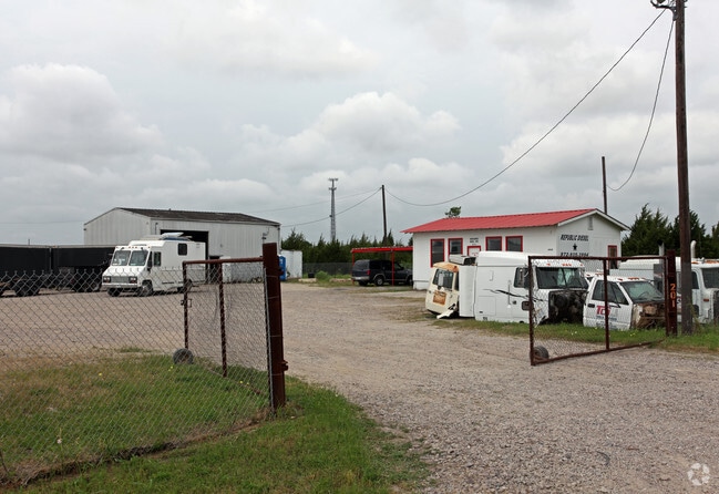
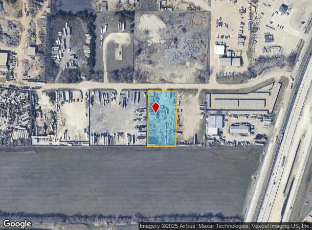
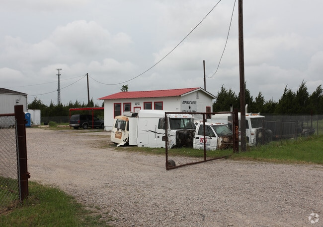
Property Record
201 Brown Industrial Rd, Waxahachie, TX 75167
NEARBY LISTINGS FOR SALE OR LEASE
Property Detail
201 Brown Industrial Rd
Dallas-Fort Worth-Arlington, TX
Brown Ind Sites
223035
LOT 2 B BROWN IND SITES #1-REV 1.532 AC
Commercialnec
Ellis
X
Texas
48139C0180G
2
2024
1.53 AC
2025
SW Dallas/US 67
060209
Dallas/Ft Worth
2,618 SF
DEMOGRAPHICS near 201 Brown Industrial Rd
1 Mile
3 Mile
5 Mile
2024 Total Population
176
17,868
73,851
2029 Population
219
22,559
93,358
Pop Growth 2024-2029
+ 24.43%
+ 26.25%
+ 26.41%
Average Age
39
37
37
2024 Total Households
59
6,064
25,309
HH Growth 2024-2029
+ 25.42%
+ 26.42%
+ 26.64%
Median Household Inc
$124,999
$106,256
$100,947
Avg Household Size
3.00
2.90
2.90
2024 Avg HH Vehicles
3.00
2.00
2.00
Median Home Value
$320,000
$290,960
$280,060
Median Year Built
2000
2006
2002
Nearby Places
Map Layers
Map Styles
 Street
 Aerial
- Restaurants
- Banks
- Shops
- Fitness
- Groceries
PUBLIC TRANSPORTATION
AIRPORT
Dallas Love Field
DRIVE
WALK
Distance
Dallas Love Field
41 min
29.8 mi
Freight Ports
Port of Shreveport
DRIVE
WALK
Distance
Port of Shreveport
227 min
210.9 mi
Nearby Properties
Address
Land Use
TOTAL SIZE
Lot Size
Zoning
Address
Land Use
TOTAL SIZE
Lot Size
Zoning
488,705 SF
43.76 AC
Address
Land Use
TOTAL SIZE
Lot Size
Zoning
146,074 SF
42.83 AC
Address
Land Use
TOTAL SIZE
Lot Size
Zoning
448,643 SF
8.93 AC
Address
Land Use
TOTAL SIZE
Lot Size
Zoning
281,216 SF
75.37 AC
Address
Land Use
TOTAL SIZE
Lot Size
Zoning
643,064 SF
42.15 AC
Address
Land Use
TOTAL SIZE
Lot Size
Zoning
675,375 SF
59.26 AC
Address
Land Use
TOTAL SIZE
Lot Size
Zoning
177,000 SF
20.25 AC
Address
Land Use
TOTAL SIZE
Lot Size
Zoning
708,800 SF
149.18 AC
Address
Land Use
TOTAL SIZE
Lot Size
Zoning
198,180 SF
11.48 AC
Address
Land Use
TOTAL SIZE
Lot Size
Zoning
1,123,347 SF
74.97 AC
Address
Land Use
TOTAL SIZE
Lot Size
Zoning
413,050 SF
54.30 AC
Address
Land Use
TOTAL SIZE
Lot Size
Zoning
85,823 SF
56.24 AC
Address
Land Use
TOTAL SIZE
Lot Size
Zoning
326,740 SF
23.01 AC
Address
Land Use
TOTAL SIZE
Lot Size
Zoning
352,350 SF
18.78 AC
Address
Land Use
TOTAL SIZE
Lot Size
Zoning
568,234 SF
65.79 AC
Address
Land Use
TOTAL SIZE
Lot Size
Zoning
92,475 SF
12.38 AC
Address
Land Use
TOTAL SIZE
Lot Size
Zoning
326,130 SF
18.48 AC
Address
Land Use
TOTAL SIZE
Lot Size
Zoning
92,860 SF
26.02 AC
Address
Land Use
TOTAL SIZE
Lot Size
Zoning
Address
Land Use
TOTAL SIZE
Lot Size
Zoning
109,423 SF
7.04 AC
Address
Land Use
TOTAL SIZE
Lot Size
Zoning
60,041 SF
6.76 AC
Address
Land Use
TOTAL SIZE
Lot Size
Zoning
79,244 SF
11.28 AC
Address
Land Use
TOTAL SIZE
Lot Size
Zoning
871,497 SF
134.08 AC
Address
Land Use
TOTAL SIZE
Lot Size
Zoning
57,600 SF
5.86 AC
Address
Land Use
TOTAL SIZE
Lot Size
Zoning
71,124 SF
10.72 AC
Address
Land Use
TOTAL SIZE
Lot Size
Zoning
61,685 SF
8.03 AC
Address
Land Use
TOTAL SIZE
Lot Size
Zoning
62,126 SF
16.85 AC
Address
Land Use
TOTAL SIZE
Lot Size
Zoning
131,480 SF
7.30 AC
Address
Land Use
TOTAL SIZE
Lot Size
Zoning
68,150 SF
51.99 AC
Address
Land Use
TOTAL SIZE
Lot Size
Zoning
77,212 SF
28.59 AC
The World's #1 Commercial Real Estate Marketplace
Connect with us
© 2025 CoStar Group
The information above has been obtained from sources believed reliable. While we do not doubt its accuracy we have not verified it and make no guarantee, warranty or representation about it. It is your responsibility to independently confirm its accuracy and completeness. Any projections, opinions, assumptions, or estimates used are for example only and do not represent the current or future performance of the property. The value of this transaction to you depends on tax and other factors which should be evaluated by your tax, financial, and legal advisors. You and your advisors should conduct a careful, independent investigation of the property to determine to your satisfaction the suitability of the property for your needs.