Property Record
201 Butterworth St, Mankato, MN 56001
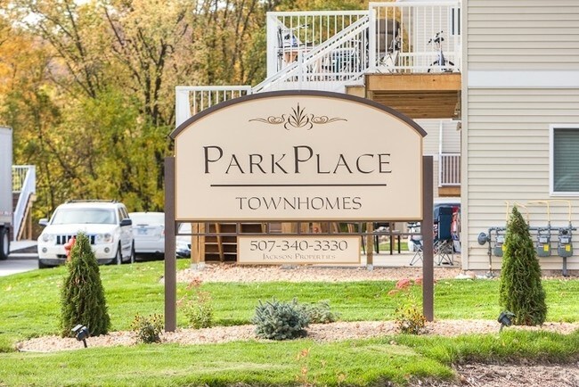

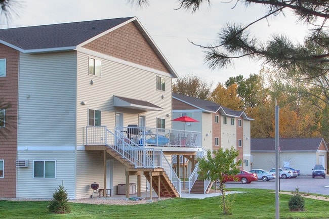
Property Detail
201 Butterworth St
Other Market Areas
JACKSON PLACE, LOT 2 BLOCK 1 02.63A
Mankato, MN
Blue Earth
R01-08-01-451-009
Minnesota
Apartment
2
2026
2.63 AC
2025
North Mankato
170300
NEARBY LISTINGS FOR SALE OR LEASE
DEMOGRAPHICS near 201 Butterworth St
1 mile
3 mile
5 mile
2025 Total Population
5,408
45,304
65,255
2030 Population
5,321
45,523
65,888
Pop Growth 2025-2030
(1.61%)
+ 0.48%
+ 0.97%
Average Age
40
36
36
2025 Total Households
2,212
18,271
25,763
HH Growth 2025-2030
(1.58%)
+ 0.48%
+ 1.01%
Median Household Inc
$75,081
$64,926
$67,475
Avg Household Size
2.40
2.20
2.30
2025 Avg HH Vehicles
2.00
2.00
2.00
Median Home Value
$236,271
$257,010
$276,813
Median Year Built
1958
1973
1982
Nearby Places
Map Layers
Map Styles
 Street
 Aerial
Transit
 Traffic
 Biking
Places
Listings with unknown addresses are not visible on the map
- Restaurants
- Banks
- Shops
- Fitness
- Groceries
Nearby Properties
Address
Land Use
TOTAL SIZE
Lot Size
Zoning
Address
Land Use
TOTAL SIZE
Lot Size
Zoning
666,816 SF
6.31 AC
Address
Land Use
TOTAL SIZE
Lot Size
Zoning
184,270 SF
79.30 AC
Address
Land Use
TOTAL SIZE
Lot Size
Zoning
616,099 SF
4.06 AC
Address
Land Use
TOTAL SIZE
Lot Size
Zoning
17.90 AC
Address
Land Use
TOTAL SIZE
Lot Size
Zoning
11.75 AC
Address
Land Use
TOTAL SIZE
Lot Size
Zoning
269,842 SF
48.03 AC
Address
Land Use
TOTAL SIZE
Lot Size
Zoning
130,218 SF
39.09 AC
Address
Land Use
TOTAL SIZE
Lot Size
Zoning
331,604 SF
35.88 AC
Address
Land Use
TOTAL SIZE
Lot Size
Zoning
219,165 SF
24.49 AC
Address
Land Use
TOTAL SIZE
Lot Size
Zoning
4.26 AC
Address
Land Use
TOTAL SIZE
Lot Size
Zoning
3.73 AC
Address
Land Use
TOTAL SIZE
Lot Size
Zoning
83,917 SF
10.08 AC
Address
Land Use
TOTAL SIZE
Lot Size
Zoning
12,400 SF
60.45 AC
Address
Land Use
TOTAL SIZE
Lot Size
Zoning
5.67 AC
Address
Land Use
TOTAL SIZE
Lot Size
Zoning
168,908 SF
5.71 AC
Address
Land Use
TOTAL SIZE
Lot Size
Zoning
26,500 SF
3.31 AC
Address
Land Use
TOTAL SIZE
Lot Size
Zoning
97,508 SF
44.54 AC
Address
Land Use
TOTAL SIZE
Lot Size
Zoning
6.91 AC
Address
Land Use
TOTAL SIZE
Lot Size
Zoning
6.44 AC
Address
Land Use
TOTAL SIZE
Lot Size
Zoning
58,604 SF
1.19 AC
Address
Land Use
TOTAL SIZE
Lot Size
Zoning
94,135 SF
23.74 AC
Address
Land Use
TOTAL SIZE
Lot Size
Zoning
67,200 SF
13.04 AC
Address
Land Use
TOTAL SIZE
Lot Size
Zoning
24,568 SF
3.48 AC
Address
Land Use
TOTAL SIZE
Lot Size
Zoning
22,522 SF
2.49 AC
Address
Land Use
TOTAL SIZE
Lot Size
Zoning
0.75 AC
Address
Land Use
TOTAL SIZE
Lot Size
Zoning
4.28 AC
Address
Land Use
TOTAL SIZE
Lot Size
Zoning
13,886 SF
19.50 AC
Address
Land Use
TOTAL SIZE
Lot Size
Zoning
2.57 AC
The World's #1 Commercial Real Estate Marketplace
Connect with us
© 2026 CoStar Group
The information above has been obtained from sources believed reliable. While we do not doubt its accuracy we have not verified it and make no guarantee, warranty or representation about it. It is your responsibility to independently confirm its accuracy and completeness. Any projections, opinions, assumptions, or estimates used are for example only and do not represent the current or future performance of the property. The value of this transaction to you depends on tax and other factors which should be evaluated by your tax, financial, and legal advisors. You and your advisors should conduct a careful, independent investigation of the property to determine to your satisfaction the suitability of the property for your needs.