Property Record
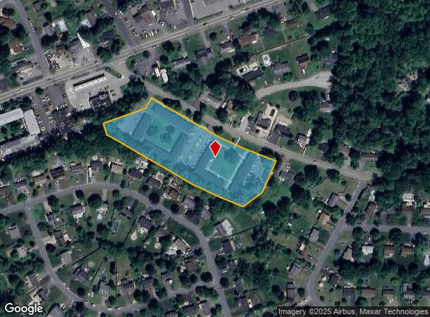
201 Caesars Ln, New Windsor, NY 12553


NEARBY LISTINGS FOR SALE OR LEASE
Property Detail
201 Caesars Ln
334800-037-000-0001-054.000-0000
Orange
Apartment
New York
X
54.00
36071C0333E
3.30 AC
2024
Outlying Orange County
2024
Northern New Jersey
012800
Kiryas Joel-Poughkeepsie-Newburgh, NY
DEMOGRAPHICS near 201 Caesars Ln
1 mile
3 mile
5 mile
2024 Total Population
7,365
48,644
91,298
2029 Population
7,555
49,483
92,849
Pop Growth 2024-2029
+ 2.58%
+ 1.72%
+ 1.70%
Average Age
42
39
39
2024 Total Households
2,926
18,093
34,331
HH Growth 2024-2029
+ 2.70%
+ 1.95%
+ 1.79%
Median Household Inc
$82,592
$79,701
$84,102
Avg Household Size
2.40
2.60
2.50
2024 Avg HH Vehicles
2.00
2.00
2.00
Median Home Value
$272,926
$291,193
$314,109
Median Year Built
1973
1961
1961
Nearby Places
Map Layers
Map Styles
 Street
 Aerial
Transit
 Traffic
 Biking
Places
Listings with unknown addresses are not visible on the map
- Restaurants
- Banks
- Shops
- Fitness
- Groceries
PUBLIC TRANSPORTATION
COMMUTER RAIL
Beacon Station (Hudson Line - Metro-North Commuter Railroad Company (Metro-North))
Drive
Walk
Distance
Beacon Station (Hudson Line - Metro-North Commuter Railroad Company (Metro-North))
14 min
7.9 mi
AIRPORT
New York Stewart International
Drive
Walk
Distance
New York Stewart International
13 min
6.7 mi
Freight Ports
NY - Red Hook Container Terminal
Drive
Walk
Distance
NY - Red Hook Container Terminal
99 min
66.0 mi
Nearby Properties
Address
Land Use
TOTAL SIZE
Lot Size
Zoning
Address
Land Use
TOTAL SIZE
Lot Size
Zoning
211,240 SF
5.30 AC
WG
Address
Land Use
TOTAL SIZE
Lot Size
Zoning
325,026 SF
6.30 AC
RM
Address
Land Use
TOTAL SIZE
Lot Size
Zoning
88,103 SF
32.60 AC
RH
Address
Land Use
TOTAL SIZE
Lot Size
Zoning
183,335 SF
12.40 AC
Address
Land Use
TOTAL SIZE
Lot Size
Zoning
115,270 SF
49.30 AC
Address
Land Use
TOTAL SIZE
Lot Size
Zoning
10,746 SF
11 AC
PWD
Address
Land Use
TOTAL SIZE
Lot Size
Zoning
182,318 SF
9.20 AC
RL
Address
Land Use
TOTAL SIZE
Lot Size
Zoning
364,010 SF
83 AC
R2
Address
Land Use
TOTAL SIZE
Lot Size
Zoning
50 AC
Address
Land Use
TOTAL SIZE
Lot Size
Zoning
176,680 SF
1.28 AC
RM
Address
Land Use
TOTAL SIZE
Lot Size
Zoning
Address
Land Use
TOTAL SIZE
Lot Size
Zoning
59,220 SF
6.40 AC
CD
Address
Land Use
TOTAL SIZE
Lot Size
Zoning
249,379 SF
29.34 AC
Address
Land Use
TOTAL SIZE
Lot Size
Zoning
173,706 SF
11.10 AC
Address
Land Use
TOTAL SIZE
Lot Size
Zoning
101,510 SF
12.80 AC
Address
Land Use
TOTAL SIZE
Lot Size
Zoning
94,608 SF
3.90 AC
RH
Address
Land Use
TOTAL SIZE
Lot Size
Zoning
107,016 SF
0.79 AC
WG
Address
Land Use
TOTAL SIZE
Lot Size
Zoning
139,016 SF
3 AC
Address
Land Use
TOTAL SIZE
Lot Size
Zoning
35,012 SF
Address
Land Use
TOTAL SIZE
Lot Size
Zoning
110,686 SF
6.50 AC
RH
Address
Land Use
TOTAL SIZE
Lot Size
Zoning
Address
Land Use
TOTAL SIZE
Lot Size
Zoning
90,584 SF
2.60 AC
RH
Address
Land Use
TOTAL SIZE
Lot Size
Zoning
200,000 SF
13.80 AC
CD
Address
Land Use
TOTAL SIZE
Lot Size
Zoning
25,800 SF
7.90 AC
R4
Address
Land Use
TOTAL SIZE
Lot Size
Zoning
50,096 SF
4.80 AC
Address
Land Use
TOTAL SIZE
Lot Size
Zoning
51,264 SF
1.35 AC
BC
Address
Land Use
TOTAL SIZE
Lot Size
Zoning
43,604 SF
0.66 AC
Address
Land Use
TOTAL SIZE
Lot Size
Zoning
51,641 SF
2.70 AC
RH
Address
Land Use
TOTAL SIZE
Lot Size
Zoning
8,053 SF
8.40 AC
Address
Land Use
TOTAL SIZE
Lot Size
Zoning
108.47 AC
R4A
The World's #1 Commercial Real Estate Marketplace
Connect with us
© 2026 CoStar Group
The information above has been obtained from sources believed reliable. While we do not doubt its accuracy we have not verified it and make no guarantee, warranty or representation about it. It is your responsibility to independently confirm its accuracy and completeness. Any projections, opinions, assumptions, or estimates used are for example only and do not represent the current or future performance of the property. The value of this transaction to you depends on tax and other factors which should be evaluated by your tax, financial, and legal advisors. You and your advisors should conduct a careful, independent investigation of the property to determine to your satisfaction the suitability of the property for your needs.