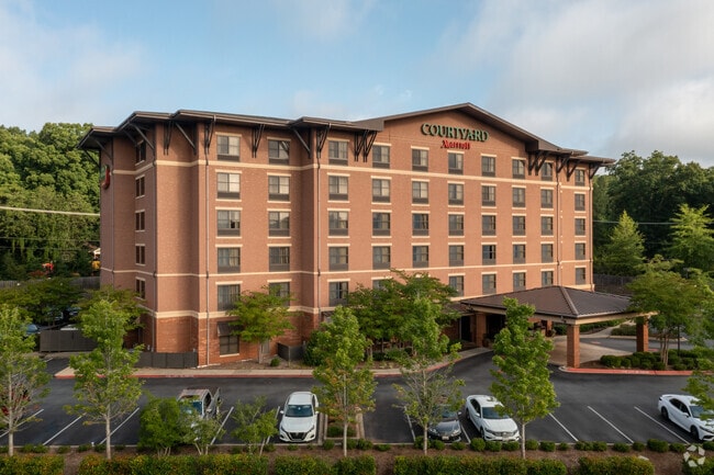
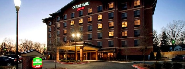
Property Record
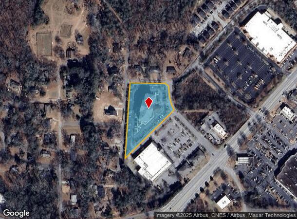
201 Canoy Ln, Clemson, SC 29631
NEARBY LISTINGS FOR SALE OR LEASE
-
-
View all Clemson listings for sale on LoopNet.com
Property Detail
201 Canoy Ln
Greenville-Anderson-Mauldin, SC
Tillman Village
4054-14-43-7874
TILLMAN VILLAGE, PARCEL 4, PLAT 590/6
Hotel
Pickens
X
South Carolina
45073C0355C
3
2025
2.21 AC
2024
Anderson/Clemson
011204
Greenville/Spartanburg
69,132 SF
DEMOGRAPHICS near 201 Canoy Ln
1 Mile
3 Mile
5 Mile
2024 Total Population
5,575
28,337
41,637
2029 Population
5,604
29,228
43,245
Pop Growth 2024-2029
+ 0.52%
+ 3.14%
+ 3.86%
Average Age
30
32
34
2024 Total Households
2,178
10,309
15,948
HH Growth 2024-2029
+ 0.37%
+ 3.61%
+ 4.31%
Median Household Inc
$37,161
$38,934
$41,632
Avg Household Size
2.40
2.30
2.30
2024 Avg HH Vehicles
2.00
2.00
2.00
Median Home Value
$262,672
$285,945
$244,153
Median Year Built
1989
1991
1990
Nearby Places
Map Layers
Map Styles
 Street
 Aerial
- Restaurants
- Banks
- Shops
- Fitness
- Groceries
PUBLIC TRANSPORTATION
COMMUTER RAIL
Clemson Amtrak Station (Crescent - Amtrak)
DRIVE
WALK
Distance
Clemson Amtrak Station (Crescent - Amtrak)
3 min
1.4 mi
Freight Ports
Georgia Ports - Savannah
DRIVE
WALK
Distance
Georgia Ports - Savannah
318 min
227.3 mi
Nearby Properties
Address
Land Use
TOTAL SIZE
Lot Size
Zoning
Address
Land Use
TOTAL SIZE
Lot Size
Zoning
3,224.70 AC
NOT ZONED
Address
Land Use
TOTAL SIZE
Lot Size
Zoning
21,573 SF
4.91 AC
CP 2 COMMU
Address
Land Use
TOTAL SIZE
Lot Size
Zoning
3,985 SF
56.58 AC
Address
Land Use
TOTAL SIZE
Lot Size
Zoning
119,175 SF
2.11 AC
RM 3 MULTI
Address
Land Use
TOTAL SIZE
Lot Size
Zoning
259,277 SF
3.39 AC
PD17
Address
Land Use
TOTAL SIZE
Lot Size
Zoning
24,882 SF
12.94 AC
PD
Address
Land Use
TOTAL SIZE
Lot Size
Zoning
54,420 SF
9.52 AC
PD16
Address
Land Use
TOTAL SIZE
Lot Size
Zoning
15,783 SF
1.43 AC
RM 4 MULTI
Address
Land Use
TOTAL SIZE
Lot Size
Zoning
325,684 SF
19.26 AC
PD
Address
Land Use
TOTAL SIZE
Lot Size
Zoning
26,864 SF
0.98 AC
GC
Address
Land Use
TOTAL SIZE
Lot Size
Zoning
4,688 SF
10.93 AC
RM 3 MULTI
Address
Land Use
TOTAL SIZE
Lot Size
Zoning
185,383 SF
2.52 AC
GENERAL CO
Address
Land Use
TOTAL SIZE
Lot Size
Zoning
4.97 AC
PD
Address
Land Use
TOTAL SIZE
Lot Size
Zoning
267,298 SF
1.68 AC
GC
Address
Land Use
TOTAL SIZE
Lot Size
Zoning
7,070 SF
2.59 AC
GENERAL CO
Address
Land Use
TOTAL SIZE
Lot Size
Zoning
17 AC
RIL RESEAR
Address
Land Use
TOTAL SIZE
Lot Size
Zoning
6,574 SF
0.50 AC
RLC
Address
Land Use
TOTAL SIZE
Lot Size
Zoning
11,881 SF
2.02 AC
GENERAL CO
Address
Land Use
TOTAL SIZE
Lot Size
Zoning
7,692 SF
0.40 AC
RIL
Address
Land Use
TOTAL SIZE
Lot Size
Zoning
20,686 SF
15.84 AC
RM16
Address
Land Use
TOTAL SIZE
Lot Size
Zoning
84,530 SF
5.10 AC
CP 2 COMMU
Address
Land Use
TOTAL SIZE
Lot Size
Zoning
10.09 AC
GC
Address
Land Use
TOTAL SIZE
Lot Size
Zoning
249,600 SF
12.61 AC
RM16
Address
Land Use
TOTAL SIZE
Lot Size
Zoning
20,927 SF
2.66 AC
GC
Address
Land Use
TOTAL SIZE
Lot Size
Zoning
36.40 AC
RM 1 TWO F
Address
Land Use
TOTAL SIZE
Lot Size
Zoning
22,722 SF
12.68 AC
PD
Address
Land Use
TOTAL SIZE
Lot Size
Zoning
17,592 SF
10.67 AC
RM16 RESID
Address
Land Use
TOTAL SIZE
Lot Size
Zoning
64,306 SF
0.96 AC
RIL
Address
Land Use
TOTAL SIZE
Lot Size
Zoning
11.42 AC
Address
Land Use
TOTAL SIZE
Lot Size
Zoning
198 SF
6.26 AC
PD
The World's #1 Commercial Real Estate Marketplace
Connect with us
© 2025 CoStar Group
The information above has been obtained from sources believed reliable. While we do not doubt its accuracy we have not verified it and make no guarantee, warranty or representation about it. It is your responsibility to independently confirm its accuracy and completeness. Any projections, opinions, assumptions, or estimates used are for example only and do not represent the current or future performance of the property. The value of this transaction to you depends on tax and other factors which should be evaluated by your tax, financial, and legal advisors. You and your advisors should conduct a careful, independent investigation of the property to determine to your satisfaction the suitability of the property for your needs.