Property Record
201 Cedar Hill St, Marlborough, MA 01752

NEARBY LISTINGS FOR SALE OR LEASE
Property Detail
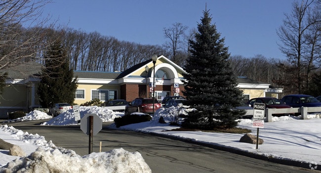
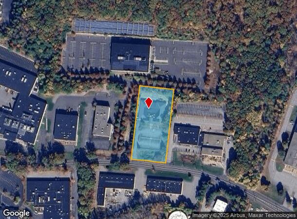
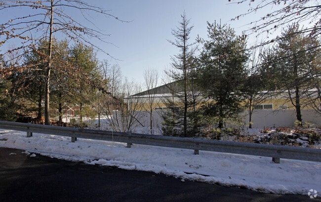
201 Cedar Hill St
Daycare
Middlesex
X
Massachusetts
25027C0654F
2.01 AC
2025
Marlborough
2025
Boston
321400
Boston-Cambridge-Newton, MA-NH
16,592 SF
MARL-000115-000003C
DEMOGRAPHICS near 201 Cedar Hill St
1 Mile
3 Mile
5 Mile
2024 Total Population
1,632
33,857
90,376
2029 Population
1,671
33,440
89,827
Pop Growth 2024-2029
+ 2.39%
(1.23%)
(0.61%)
Average Age
38
40
41
2024 Total Households
781
13,030
35,012
HH Growth 2024-2029
+ 2.30%
(1.22%)
(0.63%)
Median Household Inc
$113,333
$102,969
$107,457
Avg Household Size
2.10
2.50
2.50
2024 Avg HH Vehicles
2.00
2.00
2.00
Median Home Value
$468,749
$486,082
$487,659
Median Year Built
2009
1972
1975
Nearby Places
Map Layers
Map Styles
 Street
 Aerial
- Restaurants
- Banks
- Shops
- Fitness
- Groceries
PUBLIC TRANSPORTATION
COMMUTER RAIL
Southborough (Framingham/Worcester Line - Massachusetts Bay Transportation Authority Commuter Rail (Purple Line))
DRIVE
WALK
Distance
Southborough (Framingham/Worcester Line - Massachusetts Bay Transportation Authority Commuter Rail (Purple Line))
15 min
7.5 mi
Westborough (Framingham/Worcester Line - Massachusetts Bay Transportation Authority Commuter Rail (Purple Line))
DRIVE
WALK
Distance
Westborough (Framingham/Worcester Line - Massachusetts Bay Transportation Authority Commuter Rail (Purple Line))
17 min
8.9 mi
AIRPORT
Worcester Regional
DRIVE
WALK
Distance
Worcester Regional
35 min
20.8 mi
General Edward Lawrence Logan International
DRIVE
WALK
Distance
General Edward Lawrence Logan International
51 min
37.1 mi
Nearby Properties
Address
Land Use
TOTAL SIZE
Lot Size
Zoning
Address
Land Use
TOTAL SIZE
Lot Size
Zoning
339,553 SF
42.94 AC
RC
Address
Land Use
TOTAL SIZE
Lot Size
Zoning
18.73 AC
I
Address
Land Use
TOTAL SIZE
Lot Size
Zoning
263,979 SF
0.12 AC
EROD
Address
Land Use
TOTAL SIZE
Lot Size
Zoning
24.39 AC
Address
Land Use
TOTAL SIZE
Lot Size
Zoning
7,383 SF
80.70 AC
RA
Address
Land Use
TOTAL SIZE
Lot Size
Zoning
237,337 SF
16.65 AC
IB
Address
Land Use
TOTAL SIZE
Lot Size
Zoning
8,160 SF
11 AC
RA
Address
Land Use
TOTAL SIZE
Lot Size
Zoning
657,045 SF
46.52 AC
LI
Address
Land Use
TOTAL SIZE
Lot Size
Zoning
19.07 AC
IP
Address
Land Use
TOTAL SIZE
Lot Size
Zoning
320,540 SF
20.02 AC
BA
Address
Land Use
TOTAL SIZE
Lot Size
Zoning
300,989 SF
66.90 AC
I
Address
Land Use
TOTAL SIZE
Lot Size
Zoning
24.95 AC
I
Address
Land Use
TOTAL SIZE
Lot Size
Zoning
314,677 SF
97.28 AC
Address
Land Use
TOTAL SIZE
Lot Size
Zoning
347,607 SF
51.50 AC
IP
Address
Land Use
TOTAL SIZE
Lot Size
Zoning
113.78 AC
I
Address
Land Use
TOTAL SIZE
Lot Size
Zoning
188,882 SF
19.37 AC
A3
Address
Land Use
TOTAL SIZE
Lot Size
Zoning
15.20 AC
BA
Address
Land Use
TOTAL SIZE
Lot Size
Zoning
677,238 SF
92.81 AC
IB
Address
Land Use
TOTAL SIZE
Lot Size
Zoning
56.73 AC
LI
Address
Land Use
TOTAL SIZE
Lot Size
Zoning
260,605 SF
29 AC
I
Address
Land Use
TOTAL SIZE
Lot Size
Zoning
220,336 SF
24.65 AC
I
Address
Land Use
TOTAL SIZE
Lot Size
Zoning
299,149 SF
28.81 AC
I
Address
Land Use
TOTAL SIZE
Lot Size
Zoning
204,205 SF
14.59 AC
IP
Address
Land Use
TOTAL SIZE
Lot Size
Zoning
1,976 SF
81.69 AC
RA
Address
Land Use
TOTAL SIZE
Lot Size
Zoning
38.24 AC
LI
Address
Land Use
TOTAL SIZE
Lot Size
Zoning
37.84 AC
LI
Address
Land Use
TOTAL SIZE
Lot Size
Zoning
386,463 SF
23.80 AC
I
Address
Land Use
TOTAL SIZE
Lot Size
Zoning
216,218 SF
97.33 AC
Address
Land Use
TOTAL SIZE
Lot Size
Zoning
32.51 AC
IB
Address
Land Use
TOTAL SIZE
Lot Size
Zoning
99,619 SF
1.56 AC
B
The World's #1 Commercial Real Estate Marketplace
Connect with us
© 2025 CoStar Group
The information above has been obtained from sources believed reliable. While we do not doubt its accuracy we have not verified it and make no guarantee, warranty or representation about it. It is your responsibility to independently confirm its accuracy and completeness. Any projections, opinions, assumptions, or estimates used are for example only and do not represent the current or future performance of the property. The value of this transaction to you depends on tax and other factors which should be evaluated by your tax, financial, and legal advisors. You and your advisors should conduct a careful, independent investigation of the property to determine to your satisfaction the suitability of the property for your needs.