Property Record
201 Center Point Rd, San Marcos, TX 78666

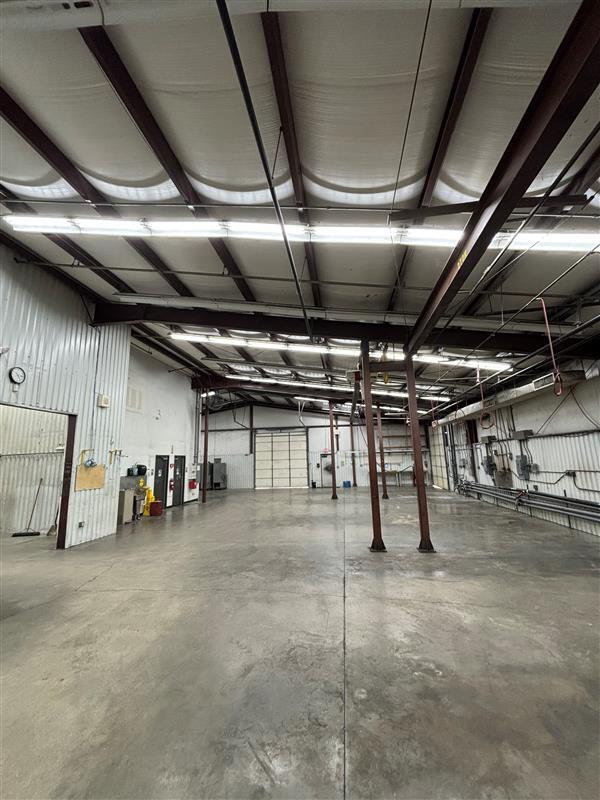
This Property Is For Sale
Property Detail
201 Center Point Rd
R88793
A0063 EDWARD BURLESON SURVEY, ACRES 1.121
Industrialgeneral
HAYS
B and X Area of moderate flood hazard, usually the area between the limits of the 100-year and 500-year floods.
Texas
2024
1.12 AC
2025
Hays County
010500
Austin
12,000 SF
Austin-Round Rock-San Marcos, TX
NEARBY LISTINGS FOR SALE OR LEASE
DEMOGRAPHICS near 201 Center Point Rd
1 mile
3 mile
5 mile
2025 Total Population
1,605
16,305
53,959
2030 Population
1,915
19,203
62,401
Pop Growth 2025-2030
+ 19.31%
+ 17.77%
+ 15.65%
Average Age
46
39
36
2025 Total Households
702
7,228
20,415
HH Growth 2025-2030
+ 20.23%
+ 18.83%
+ 17.23%
Median Household Inc
$82,315
$58,605
$63,730
Avg Household Size
2.30
2.20
2.40
2025 Avg HH Vehicles
2.00
2.00
2.00
Median Home Value
$464,814
$411,687
$341,758
Median Year Built
2007
2007
2001
Nearby Places
Map Layers
Map Styles
 Street
 Aerial
Layers
 Traffic
 Biking
Places
Listings with unknown addresses are not visible on the map
- Restaurants
- Banks
- Shops
- Fitness
- Groceries
PUBLIC TRANSPORTATION
COMMUTER RAIL
San Marcos Amtrak (Texas Eagle - Amtrak)
Drive
Walk
Distance
San Marcos Amtrak (Texas Eagle - Amtrak)
9 min
5.6 mi
Freight Ports
Calhoun Port
Drive
Walk
Distance
Calhoun Port
170 min
140.0 mi
Nearby Properties
Address
Land Use
TOTAL SIZE
Lot Size
Zoning
Address
Land Use
TOTAL SIZE
Lot Size
Zoning
70,432 SF
45.07 AC
Address
Land Use
TOTAL SIZE
Lot Size
Zoning
855,000 SF
95.65 AC
Address
Land Use
TOTAL SIZE
Lot Size
Zoning
289,554 SF
76.50 AC
Address
Land Use
TOTAL SIZE
Lot Size
Zoning
454,563 SF
16.44 AC
Address
Land Use
TOTAL SIZE
Lot Size
Zoning
250,811 SF
23.88 AC
Address
Land Use
TOTAL SIZE
Lot Size
Zoning
326,836 SF
16.38 AC
Address
Land Use
TOTAL SIZE
Lot Size
Zoning
239,345 SF
23.41 AC
Address
Land Use
TOTAL SIZE
Lot Size
Zoning
279,131 SF
22.46 AC
Address
Land Use
TOTAL SIZE
Lot Size
Zoning
352,285 SF
12.75 AC
Address
Land Use
TOTAL SIZE
Lot Size
Zoning
283,033 SF
19.46 AC
Address
Land Use
TOTAL SIZE
Lot Size
Zoning
223,401 SF
9.75 AC
Address
Land Use
TOTAL SIZE
Lot Size
Zoning
184,438 SF
12.57 AC
Address
Land Use
TOTAL SIZE
Lot Size
Zoning
343,560 SF
10.40 AC
Address
Land Use
TOTAL SIZE
Lot Size
Zoning
255,621 SF
8.83 AC
Address
Land Use
TOTAL SIZE
Lot Size
Zoning
277,659 SF
10.77 AC
Address
Land Use
TOTAL SIZE
Lot Size
Zoning
307,962 SF
14.23 AC
Address
Land Use
TOTAL SIZE
Lot Size
Zoning
115.78 AC
Address
Land Use
TOTAL SIZE
Lot Size
Zoning
341,111 SF
20.94 AC
Address
Land Use
TOTAL SIZE
Lot Size
Zoning
190,554 SF
5.59 AC
Address
Land Use
TOTAL SIZE
Lot Size
Zoning
195,018 SF
7.37 AC
Address
Land Use
TOTAL SIZE
Lot Size
Zoning
305,644 SF
27.93 AC
Address
Land Use
TOTAL SIZE
Lot Size
Zoning
222,984 SF
12.85 AC
Address
Land Use
TOTAL SIZE
Lot Size
Zoning
240,123 SF
8.75 AC
Address
Land Use
TOTAL SIZE
Lot Size
Zoning
127,306 SF
20.85 AC
Address
Land Use
TOTAL SIZE
Lot Size
Zoning
296,034 SF
7.78 AC
Address
Land Use
TOTAL SIZE
Lot Size
Zoning
247,668 SF
9.08 AC
Address
Land Use
TOTAL SIZE
Lot Size
Zoning
230,979 SF
7.54 AC
Address
Land Use
TOTAL SIZE
Lot Size
Zoning
152,046 SF
8 AC
Address
Land Use
TOTAL SIZE
Lot Size
Zoning
146,295 SF
5.08 AC
Address
Land Use
TOTAL SIZE
Lot Size
Zoning
165,000 SF
9.78 AC
The World's #1 Commercial Real Estate Marketplace
Connect with us
© 2026 CoStar Group
The information above has been obtained from sources believed reliable. While we do not doubt its accuracy we have not verified it and make no guarantee, warranty or representation about it. It is your responsibility to independently confirm its accuracy and completeness. Any projections, opinions, assumptions, or estimates used are for example only and do not represent the current or future performance of the property. The value of this transaction to you depends on tax and other factors which should be evaluated by your tax, financial, and legal advisors. You and your advisors should conduct a careful, independent investigation of the property to determine to your satisfaction the suitability of the property for your needs.