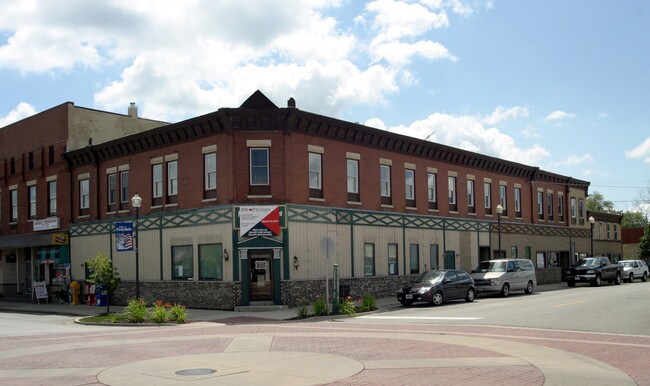
Property Record
201 Center St, Grayslake, IL 60030
NEARBY LISTINGS FOR SALE OR LEASE
Property Detail
201 Center St
Chicago-Naperville-Elgin, IL-IN-WI
Village Of Grays Lake
06-26-315-002
VILLAGE OF GRAYS LAKE; LOT 1 BLOCK 7
Taxexempt
Lake
X
Illinois
17097C0131M
1
2023
0.86 AC
2024
Far North
861105
Chicago
DEMOGRAPHICS near 201 Center St
1 Mile
3 Mile
5 Mile
2024 Total Population
9,341
54,018
138,470
2029 Population
9,154
53,217
136,354
Pop Growth 2024-2029
(2.00%)
(1.48%)
(1.53%)
Average Age
39
39
39
2024 Total Households
3,707
19,413
48,748
HH Growth 2024-2029
(2.05%)
(1.54%)
(1.62%)
Median Household Inc
$96,629
$90,529
$100,317
Avg Household Size
2.50
2.70
2.80
2024 Avg HH Vehicles
2.00
2.00
2.00
Median Home Value
$262,424
$228,561
$249,032
Median Year Built
1988
1991
1991
Nearby Places
Map Layers
Map Styles
 Street
 Aerial
- Restaurants
- Banks
- Shops
- Fitness
- Groceries
PUBLIC TRANSPORTATION
TRANSIT/SUBWAY
Grayslake Station (MD-N) (Milwaukee District North Line - Northeast Illinois Regional Commuter Railroad (Metra))
DRIVE
WALK
Distance
Grayslake Station (MD-N) (Milwaukee District North Line - Northeast Illinois Regional Commuter Railroad (Metra))
3 min
18 min
0.9 mi
COMMUTER RAIL
Grayslake Station (MD-N) (Milwaukee District North Line - Northeast Illinois Regional Commuter Railroad (Metra))
DRIVE
WALK
Distance
Grayslake Station (MD-N) (Milwaukee District North Line - Northeast Illinois Regional Commuter Railroad (Metra))
3 min
17 min
0.9 mi
Washington St (Grayslake) Station (NCS) (North Central Service - Northeast Illinois Regional Commuter Railroad (Metra))
DRIVE
WALK
Distance
Washington St (Grayslake) Station (NCS) (North Central Service - Northeast Illinois Regional Commuter Railroad (Metra))
5 min
1.6 mi
AIRPORT
Chicago O'Hare International
DRIVE
WALK
Distance
Chicago O'Hare International
69 min
38.5 mi
Freight Ports
Port Milwaukee
DRIVE
WALK
Distance
Port Milwaukee
67 min
53.9 mi
Nearby Properties
Address
Land Use
TOTAL SIZE
Lot Size
Zoning
Address
Land Use
TOTAL SIZE
Lot Size
Zoning
1,401,971 SF
85.78 AC
Address
Land Use
TOTAL SIZE
Lot Size
Zoning
2,993,760 SF
20.63 AC
Address
Land Use
TOTAL SIZE
Lot Size
Zoning
298,181 SF
20.41 AC
Address
Land Use
TOTAL SIZE
Lot Size
Zoning
194,075 SF
14.84 AC
Address
Land Use
TOTAL SIZE
Lot Size
Zoning
135,180 SF
22.05 AC
Address
Land Use
TOTAL SIZE
Lot Size
Zoning
1,656,984 SF
11.84 AC
Address
Land Use
TOTAL SIZE
Lot Size
Zoning
308,160 SF
7.43 AC
Address
Land Use
TOTAL SIZE
Lot Size
Zoning
282,999 SF
23.06 AC
Address
Land Use
TOTAL SIZE
Lot Size
Zoning
71,320 SF
26.33 AC
Address
Land Use
TOTAL SIZE
Lot Size
Zoning
100,123 SF
12.63 AC
Address
Land Use
TOTAL SIZE
Lot Size
Zoning
89,754 SF
8.64 AC
Address
Land Use
TOTAL SIZE
Lot Size
Zoning
132,256 SF
18.59 AC
Address
Land Use
TOTAL SIZE
Lot Size
Zoning
79,136 SF
30.10 AC
Address
Land Use
TOTAL SIZE
Lot Size
Zoning
71,064 SF
29.20 AC
Address
Land Use
TOTAL SIZE
Lot Size
Zoning
92,245 SF
5.89 AC
Address
Land Use
TOTAL SIZE
Lot Size
Zoning
70,256 SF
33.85 AC
Address
Land Use
TOTAL SIZE
Lot Size
Zoning
519,710 SF
16.32 AC
Address
Land Use
TOTAL SIZE
Lot Size
Zoning
17,079 SF
3.02 AC
Address
Land Use
TOTAL SIZE
Lot Size
Zoning
421,146 SF
4.79 AC
Address
Land Use
TOTAL SIZE
Lot Size
Zoning
115,805 SF
4.38 AC
Address
Land Use
TOTAL SIZE
Lot Size
Zoning
17,484 SF
3.52 AC
Address
Land Use
TOTAL SIZE
Lot Size
Zoning
58,922 SF
71.36 AC
Address
Land Use
TOTAL SIZE
Lot Size
Zoning
97,798 SF
6.98 AC
Address
Land Use
TOTAL SIZE
Lot Size
Zoning
86,920 SF
6.89 AC
Address
Land Use
TOTAL SIZE
Lot Size
Zoning
77,864 SF
5.28 AC
Address
Land Use
TOTAL SIZE
Lot Size
Zoning
62,821 SF
6.79 AC
Address
Land Use
TOTAL SIZE
Lot Size
Zoning
50,137 SF
15.97 AC
Address
Land Use
TOTAL SIZE
Lot Size
Zoning
45,772 SF
89.95 AC
Address
Land Use
TOTAL SIZE
Lot Size
Zoning
39,253 SF
2.26 AC
Address
Land Use
TOTAL SIZE
Lot Size
Zoning
6,000 SF
111.79 AC
The World's #1 Commercial Real Estate Marketplace
Connect with us
© 2025 CoStar Group
The information above has been obtained from sources believed reliable. While we do not doubt its accuracy we have not verified it and make no guarantee, warranty or representation about it. It is your responsibility to independently confirm its accuracy and completeness. Any projections, opinions, assumptions, or estimates used are for example only and do not represent the current or future performance of the property. The value of this transaction to you depends on tax and other factors which should be evaluated by your tax, financial, and legal advisors. You and your advisors should conduct a careful, independent investigation of the property to determine to your satisfaction the suitability of the property for your needs.