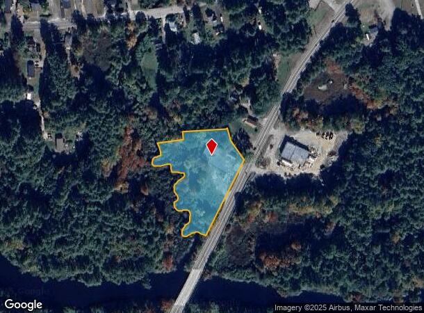
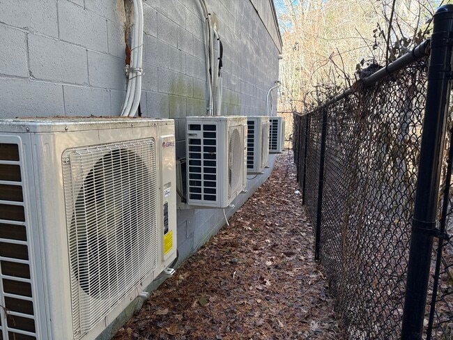
Property Record
201 Daniel Shays Hwy, Athol, MA 01331
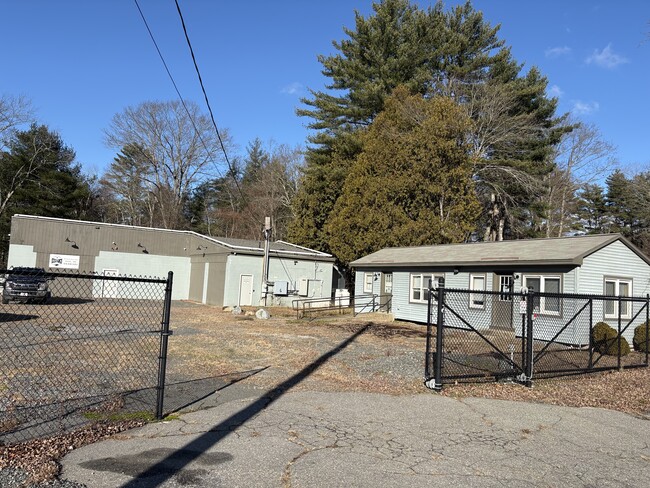
This Property Is For Sale
NEARBY LISTINGS FOR SALE OR LEASE
Property Detail
201 Daniel Shays Hwy
Industrialgeneral
Worcester
ARE
Massachusetts
25027C0159E
2.20 AC
2025
Outlying Worcester
2025
Boston
703200
Worcester, MA-CT
1,728 SF
ATHO-000018-000051
DEMOGRAPHICS near 201 Daniel Shays Hwy
1 Mile
3 Mile
5 Mile
2024 Total Population
1,941
16,932
21,425
2029 Population
1,956
17,071
21,605
Pop Growth 2024-2029
+ 0.77%
+ 0.82%
+ 0.84%
Average Age
46
43
43
2024 Total Households
855
7,086
8,900
HH Growth 2024-2029
+ 0.82%
+ 0.80%
+ 0.82%
Median Household Inc
$57,710
$58,105
$61,778
Avg Household Size
2.20
2.30
2.30
2024 Avg HH Vehicles
2.00
2.00
2.00
Median Home Value
$158,838
$200,081
$212,942
Median Year Built
1970
1957
1958
Nearby Places
- Restaurants
- Banks
- Shops
- Fitness
- Groceries
PUBLIC TRANSPORTATION
AIRPORT
Worcester Regional
DRIVE
WALK
Distance
Worcester Regional
66 min
37.5 mi
Nearby Properties
Address
Land Use
TOTAL SIZE
Lot Size
Zoning
Address
Land Use
TOTAL SIZE
Lot Size
Zoning
66,835 SF
12.39 AC
Address
Land Use
TOTAL SIZE
Lot Size
Zoning
102,280 SF
30 AC
D
Address
Land Use
TOTAL SIZE
Lot Size
Zoning
112,054 SF
10.48 AC
Address
Land Use
TOTAL SIZE
Lot Size
Zoning
22 AC
Address
Land Use
TOTAL SIZE
Lot Size
Zoning
66,766 SF
11 AC
Address
Land Use
TOTAL SIZE
Lot Size
Zoning
3.50 AC
Address
Land Use
TOTAL SIZE
Lot Size
Zoning
390.20 AC
B
Address
Land Use
TOTAL SIZE
Lot Size
Zoning
77,887 SF
40 AC
D
Address
Land Use
TOTAL SIZE
Lot Size
Zoning
8.78 AC
B
Address
Land Use
TOTAL SIZE
Lot Size
Zoning
193,872 SF
22.63 AC
A
Address
Land Use
TOTAL SIZE
Lot Size
Zoning
130,539 SF
Address
Land Use
TOTAL SIZE
Lot Size
Zoning
134,851 SF
7.36 AC
B
Address
Land Use
TOTAL SIZE
Lot Size
Zoning
5.10 AC
A
Address
Land Use
TOTAL SIZE
Lot Size
Zoning
9.30 AC
B
Address
Land Use
TOTAL SIZE
Lot Size
Zoning
6.85 AC
Address
Land Use
TOTAL SIZE
Lot Size
Zoning
49,820 SF
0.75 AC
Address
Land Use
TOTAL SIZE
Lot Size
Zoning
27,129 SF
3 AC
Address
Land Use
TOTAL SIZE
Lot Size
Zoning
43,043 SF
7.41 AC
A
Address
Land Use
TOTAL SIZE
Lot Size
Zoning
110,928 SF
10.21 AC
B
Address
Land Use
TOTAL SIZE
Lot Size
Zoning
10.61 AC
Address
Land Use
TOTAL SIZE
Lot Size
Zoning
37 AC
A
Address
Land Use
TOTAL SIZE
Lot Size
Zoning
25,156 SF
4.80 AC
Address
Land Use
TOTAL SIZE
Lot Size
Zoning
72.73 AC
B
Address
Land Use
TOTAL SIZE
Lot Size
Zoning
240,650 SF
36.98 AC
A
Address
Land Use
TOTAL SIZE
Lot Size
Zoning
30,327 SF
0.56 AC
Address
Land Use
TOTAL SIZE
Lot Size
Zoning
145,916 SF
1.67 AC
A
Address
Land Use
TOTAL SIZE
Lot Size
Zoning
7.05 AC
Address
Land Use
TOTAL SIZE
Lot Size
Zoning
20,065 SF
Address
Land Use
TOTAL SIZE
Lot Size
Zoning
164,998 SF
9.59 AC
B
Address
Land Use
TOTAL SIZE
Lot Size
Zoning
29,090 SF
0.57 AC
The World's #1 Commercial Real Estate Marketplace
Connect with us
© 2025 CoStar Group
The information above has been obtained from sources believed reliable. While we do not doubt its accuracy we have not verified it and make no guarantee, warranty or representation about it. It is your responsibility to independently confirm its accuracy and completeness. Any projections, opinions, assumptions, or estimates used are for example only and do not represent the current or future performance of the property. The value of this transaction to you depends on tax and other factors which should be evaluated by your tax, financial, and legal advisors. You and your advisors should conduct a careful, independent investigation of the property to determine to your satisfaction the suitability of the property for your needs.