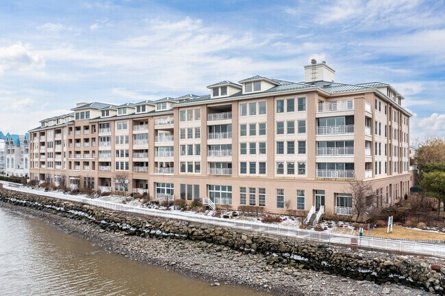
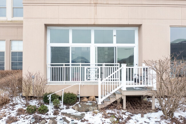
Property Record
201 Devries Ct, Piermont, NY 10968
NEARBY LISTINGS FOR SALE OR LEASE
-
-
View all Piermont listings for sale on LoopNet.com
Property Detail
201 Devries Ct
392405-075-055-0001-001-006-2010
Devries Point Condominium
Apartment
Rockland
VE
New York
36087C0191G
1.4
2023
0.04 AC
2024
Rockland County
013300
Northern New Jersey
1,753 SF
New York-Jersey City-White Plains, NY-NJ
DEMOGRAPHICS near 201 Devries Ct
1 Mile
3 Mile
5 Mile
2024 Total Population
2,876
33,886
136,303
2029 Population
2,888
33,637
134,897
Pop Growth 2024-2029
+ 0.42%
(0.73%)
(1.03%)
Average Age
46
43
42
2024 Total Households
1,343
12,333
49,852
HH Growth 2024-2029
+ 0.37%
(0.79%)
(1.20%)
Median Household Inc
$109,797
$134,955
$135,193
Avg Household Size
2.10
2.60
2.60
2024 Avg HH Vehicles
2.00
2.00
2.00
Median Home Value
$718,546
$695,493
$699,549
Median Year Built
1972
1960
1961
Nearby Places
- Restaurants
- Banks
- Shops
- Fitness
- Groceries
PUBLIC TRANSPORTATION
AIRPORT
Westchester County
DRIVE
WALK
Distance
Westchester County
33 min
21.2 mi
LaGuardia
DRIVE
WALK
Distance
LaGuardia
45 min
26.1 mi
Newark Liberty International
DRIVE
WALK
Distance
Newark Liberty International
43 min
30.3 mi
Freight Ports
NY - Red Hook Container Terminal
DRIVE
WALK
Distance
NY - Red Hook Container Terminal
57 min
32.5 mi
Nearby Properties
Address
Land Use
TOTAL SIZE
Lot Size
Zoning
Address
Land Use
TOTAL SIZE
Lot Size
Zoning
2,736 SF
25.26 AC
Address
Land Use
TOTAL SIZE
Lot Size
Zoning
61.28 AC
Address
Land Use
TOTAL SIZE
Lot Size
Zoning
97,600 SF
136.28 AC
R-40
Address
Land Use
TOTAL SIZE
Lot Size
Zoning
29.35 AC
Address
Land Use
TOTAL SIZE
Lot Size
Zoning
11.68 AC
Address
Land Use
TOTAL SIZE
Lot Size
Zoning
37.99 AC
Address
Land Use
TOTAL SIZE
Lot Size
Zoning
220,594 SF
22.30 AC
R-40
Address
Land Use
TOTAL SIZE
Lot Size
Zoning
26.50 AC
Address
Land Use
TOTAL SIZE
Lot Size
Zoning
9.67 AC
Address
Land Use
TOTAL SIZE
Lot Size
Zoning
237,408 SF
14.97 AC
R-40
Address
Land Use
TOTAL SIZE
Lot Size
Zoning
8.08 AC
C
Address
Land Use
TOTAL SIZE
Lot Size
Zoning
220,000 SF
2.01 AC
Address
Land Use
TOTAL SIZE
Lot Size
Zoning
14.31 AC
Address
Land Use
TOTAL SIZE
Lot Size
Zoning
9.75 AC
Address
Land Use
TOTAL SIZE
Lot Size
Zoning
16.91 AC
Address
Land Use
TOTAL SIZE
Lot Size
Zoning
35,631 SF
8.60 AC
LI
Address
Land Use
TOTAL SIZE
Lot Size
Zoning
6.72 AC
C
Address
Land Use
TOTAL SIZE
Lot Size
Zoning
125,000 SF
1.62 AC
Address
Land Use
TOTAL SIZE
Lot Size
Zoning
48.19 AC
P
Address
Land Use
TOTAL SIZE
Lot Size
Zoning
15.23 AC
C
Address
Land Use
TOTAL SIZE
Lot Size
Zoning
8 AC
AH1CC
Address
Land Use
TOTAL SIZE
Lot Size
Zoning
67.80 AC
Address
Land Use
TOTAL SIZE
Lot Size
Zoning
231,978 SF
48.30 AC
R-40
Address
Land Use
TOTAL SIZE
Lot Size
Zoning
191,148 SF
32.26 AC
R-40
Address
Land Use
TOTAL SIZE
Lot Size
Zoning
114,520 SF
6.71 AC
R4
Address
Land Use
TOTAL SIZE
Lot Size
Zoning
75,000 SF
3.58 AC
Address
Land Use
TOTAL SIZE
Lot Size
Zoning
17.67 AC
Address
Land Use
TOTAL SIZE
Lot Size
Zoning
47,432 SF
9.81 AC
RG
Address
Land Use
TOTAL SIZE
Lot Size
Zoning
11.09 AC
Address
Land Use
TOTAL SIZE
Lot Size
Zoning
42,626 SF
6.58 AC
The World's #1 Commercial Real Estate Marketplace
Connect with us
© 2025 CoStar Group
The information above has been obtained from sources believed reliable. While we do not doubt its accuracy we have not verified it and make no guarantee, warranty or representation about it. It is your responsibility to independently confirm its accuracy and completeness. Any projections, opinions, assumptions, or estimates used are for example only and do not represent the current or future performance of the property. The value of this transaction to you depends on tax and other factors which should be evaluated by your tax, financial, and legal advisors. You and your advisors should conduct a careful, independent investigation of the property to determine to your satisfaction the suitability of the property for your needs.