Property Record
201 E Oregon Rd, Lititz, PA 17543
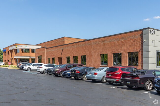

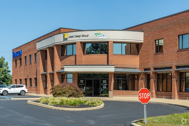

Property Detail
201 E Oregon Rd
390-23960-0-0000
201 E OREGON RD
Commercialnec
Lancaster
B-1
Pennsylvania
B and X Area of moderate flood hazard, usually the area between the limits of the 100-year and 500-year floods.
11
2024
8 AC
2025
Lancaster County
011904
Philadelphia
78,301 SF
Lancaster, PA
NEARBY LISTINGS FOR SALE OR LEASE
DEMOGRAPHICS near 201 E Oregon Rd
1 mile
3 mile
5 mile
2024 Total Population
9,769
51,277
138,286
2029 Population
10,158
52,607
140,821
Pop Growth 2024-2029
+ 3.98%
+ 2.59%
+ 1.83%
Average Age
48
45
42
2024 Total Households
3,343
19,303
54,023
HH Growth 2024-2029
+ 4.49%
+ 2.68%
+ 1.82%
Median Household Inc
$83,798
$95,877
$84,315
Avg Household Size
2.50
2.50
2.40
2024 Avg HH Vehicles
2.00
2.00
2.00
Median Home Value
$338,855
$370,231
$339,724
Median Year Built
1993
1984
1973
Nearby Places
Map Layers
Map Styles
 Street
 Aerial
Transit
 Traffic
 Biking
Places
Listings with unknown addresses are not visible on the map
- Restaurants
- Banks
- Shops
- Fitness
- Groceries
PUBLIC TRANSPORTATION
COMMUTER RAIL
Drive
Walk
Distance
10 min
4.1 mi
AIRPORT
Harrisburg International
Drive
Walk
Distance
Harrisburg International
42 min
31.3 mi
Freight Ports
Port Newark Container Terminal
Drive
Walk
Distance
Port Newark Container Terminal
88 min
51.9 mi
SALE & LEASE HISTORY
LISTING DATE
SALE/LEASE

Jan 30, 2023
For Lease
Nearby Properties
Address
Land Use
TOTAL SIZE
Lot Size
Zoning
Address
Land Use
TOTAL SIZE
Lot Size
Zoning
1,070,497 SF
149.62 AC
Address
Land Use
TOTAL SIZE
Lot Size
Zoning
822,447 SF
77.29 AC
Address
Land Use
TOTAL SIZE
Lot Size
Zoning
740,990 SF
106.29 AC
Address
Land Use
TOTAL SIZE
Lot Size
Zoning
678,995 SF
96.17 AC
Address
Land Use
TOTAL SIZE
Lot Size
Zoning
259,035 SF
744.42 AC
Address
Land Use
TOTAL SIZE
Lot Size
Zoning
553,591 SF
70.19 AC
Address
Land Use
TOTAL SIZE
Lot Size
Zoning
185,924 SF
43.71 AC
I2
Address
Land Use
TOTAL SIZE
Lot Size
Zoning
275,959 SF
68.50 AC
IN
Address
Land Use
TOTAL SIZE
Lot Size
Zoning
233,738 SF
34.10 AC
Address
Land Use
TOTAL SIZE
Lot Size
Zoning
354,921 SF
6.36 AC
Address
Land Use
TOTAL SIZE
Lot Size
Zoning
283,042 SF
17.50 AC
Address
Land Use
TOTAL SIZE
Lot Size
Zoning
203,415 SF
10.74 AC
Address
Land Use
TOTAL SIZE
Lot Size
Zoning
99,894 SF
21.88 AC
Address
Land Use
TOTAL SIZE
Lot Size
Zoning
223,327 SF
21.80 AC
B-4
Address
Land Use
TOTAL SIZE
Lot Size
Zoning
246,742 SF
12.49 AC
B-4
Address
Land Use
TOTAL SIZE
Lot Size
Zoning
210,312 SF
25.89 AC
R-2
Address
Land Use
TOTAL SIZE
Lot Size
Zoning
131,294 SF
11.14 AC
B-4
Address
Land Use
TOTAL SIZE
Lot Size
Zoning
89,662 SF
18.40 AC
R-1
Address
Land Use
TOTAL SIZE
Lot Size
Zoning
98,000 SF
18.30 AC
R-1
Address
Land Use
TOTAL SIZE
Lot Size
Zoning
10 SF
26.30 AC
I-2
Address
Land Use
TOTAL SIZE
Lot Size
Zoning
205,692 SF
19.79 AC
R-3
Address
Land Use
TOTAL SIZE
Lot Size
Zoning
80,125 SF
19.27 AC
Address
Land Use
TOTAL SIZE
Lot Size
Zoning
123,564 SF
11.68 AC
Address
Land Use
TOTAL SIZE
Lot Size
Zoning
128,516 SF
20.40 AC
R2
Address
Land Use
TOTAL SIZE
Lot Size
Zoning
54,494 SF
39.98 AC
Address
Land Use
TOTAL SIZE
Lot Size
Zoning
23,314 SF
106.31 AC
Address
Land Use
TOTAL SIZE
Lot Size
Zoning
103,118 SF
17.29 AC
Address
Land Use
TOTAL SIZE
Lot Size
Zoning
96,702 SF
10.67 AC
B-4
Address
Land Use
TOTAL SIZE
Lot Size
Zoning
66,767 SF
13.40 AC
IN
Address
Land Use
TOTAL SIZE
Lot Size
Zoning
133,273 SF
12.84 AC
The World's #1 Commercial Real Estate Marketplace
Connect with us
© 2026 CoStar Group
The information above has been obtained from sources believed reliable. While we do not doubt its accuracy we have not verified it and make no guarantee, warranty or representation about it. It is your responsibility to independently confirm its accuracy and completeness. Any projections, opinions, assumptions, or estimates used are for example only and do not represent the current or future performance of the property. The value of this transaction to you depends on tax and other factors which should be evaluated by your tax, financial, and legal advisors. You and your advisors should conduct a careful, independent investigation of the property to determine to your satisfaction the suitability of the property for your needs.