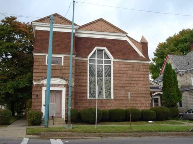
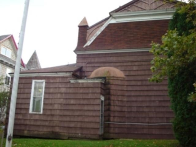
Property Record
201 E State St, Olean, NY 14760


Property Detail
201 E State St
041200-094-065-0007-048-000-0000
Cattaraugus
Religious
New York
CC
48.000
2025
0.09 AC
2025
Other Market Areas
961700
Olean, NY
2,676 SF
NEARBY LISTINGS FOR SALE OR LEASE
-
-
View all Olean listings for sale on LoopNet.com
DEMOGRAPHICS near 201 E State St
1 mile
3 mile
5 mile
2024 Total Population
9,534
16,495
22,707
2029 Population
9,361
16,179
22,314
Pop Growth 2024-2029
(1.81%)
(1.92%)
(1.73%)
Average Age
40
41
41
2024 Total Households
4,320
7,139
9,399
HH Growth 2024-2029
(1.92%)
(2.09%)
(1.97%)
Median Household Inc
$40,480
$46,128
$49,745
Avg Household Size
2.10
2.10
2.20
2024 Avg HH Vehicles
1.00
1.00
2.00
Median Home Value
$84,499
$90,910
$103,700
Median Year Built
1946
1947
1949
Nearby Places
Map Layers
Map Styles
 Street
 Aerial
Transit
 Traffic
 Biking
Places
Listings with unknown addresses are not visible on the map
- Restaurants
- Banks
- Shops
- Fitness
- Groceries
Nearby Properties
Address
Land Use
TOTAL SIZE
Lot Size
Zoning
Address
Land Use
TOTAL SIZE
Lot Size
Zoning
326.55 AC
CF
Address
Land Use
TOTAL SIZE
Lot Size
Zoning
116,203 SF
9.07 AC
R3
Address
Land Use
TOTAL SIZE
Lot Size
Zoning
159,609 SF
29.60 AC
R3
Address
Land Use
TOTAL SIZE
Lot Size
Zoning
32,878 SF
11.10 AC
CC
Address
Land Use
TOTAL SIZE
Lot Size
Zoning
26,777 SF
9.65 AC
WC
Address
Land Use
TOTAL SIZE
Lot Size
Zoning
26,250 SF
16.65 AC
I2
Address
Land Use
TOTAL SIZE
Lot Size
Zoning
222,845 SF
17 AC
C2
Address
Land Use
TOTAL SIZE
Lot Size
Zoning
8,944 SF
4.55 AC
R3
Address
Land Use
TOTAL SIZE
Lot Size
Zoning
23 AC
Address
Land Use
TOTAL SIZE
Lot Size
Zoning
Address
Land Use
TOTAL SIZE
Lot Size
Zoning
2,816 SF
Address
Land Use
TOTAL SIZE
Lot Size
Zoning
116,006 SF
16.80 AC
I2
Address
Land Use
TOTAL SIZE
Lot Size
Zoning
Address
Land Use
TOTAL SIZE
Lot Size
Zoning
6,889 SF
88.10 AC
I
Address
Land Use
TOTAL SIZE
Lot Size
Zoning
104,870 SF
8 AC
AR
Address
Land Use
TOTAL SIZE
Lot Size
Zoning
323,724 SF
25.25 AC
CON
Address
Land Use
TOTAL SIZE
Lot Size
Zoning
117,634 SF
2.30 AC
GC
Address
Land Use
TOTAL SIZE
Lot Size
Zoning
60,287 SF
10.62 AC
GC
Address
Land Use
TOTAL SIZE
Lot Size
Zoning
90,875 SF
12 AC
I2
Address
Land Use
TOTAL SIZE
Lot Size
Zoning
106.40 AC
R1
Address
Land Use
TOTAL SIZE
Lot Size
Zoning
10 AC
CF
Address
Land Use
TOTAL SIZE
Lot Size
Zoning
67,513 SF
3.93 AC
Address
Land Use
TOTAL SIZE
Lot Size
Zoning
117,946 SF
11.62 AC
GC
Address
Land Use
TOTAL SIZE
Lot Size
Zoning
4 AC
R2
Address
Land Use
TOTAL SIZE
Lot Size
Zoning
68,400 SF
7.35 AC
C2
Address
Land Use
TOTAL SIZE
Lot Size
Zoning
42,074 SF
2.70 AC
C2
Address
Land Use
TOTAL SIZE
Lot Size
Zoning
61,850 SF
2.39 AC
Address
Land Use
TOTAL SIZE
Lot Size
Zoning
64,924 SF
2.57 AC
Address
Land Use
TOTAL SIZE
Lot Size
Zoning
23,326 SF
1.14 AC
CC
Address
Land Use
TOTAL SIZE
Lot Size
Zoning
35,546 SF
1.80 AC
R3
The World's #1 Commercial Real Estate Marketplace
Connect with us
© 2026 CoStar Group
The information above has been obtained from sources believed reliable. While we do not doubt its accuracy we have not verified it and make no guarantee, warranty or representation about it. It is your responsibility to independently confirm its accuracy and completeness. Any projections, opinions, assumptions, or estimates used are for example only and do not represent the current or future performance of the property. The value of this transaction to you depends on tax and other factors which should be evaluated by your tax, financial, and legal advisors. You and your advisors should conduct a careful, independent investigation of the property to determine to your satisfaction the suitability of the property for your needs.