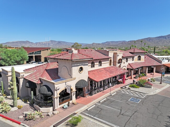
Property Record
201 Easy St, Carefree, AZ 85377
NEARBY LISTINGS FOR SALE OR LEASE
Property Detail
201 Easy St
Phoenix-Mesa-Chandler, AZ
Carefree Arizona
216-83-027A
CAREFREE ARIZONA MCR 80/27
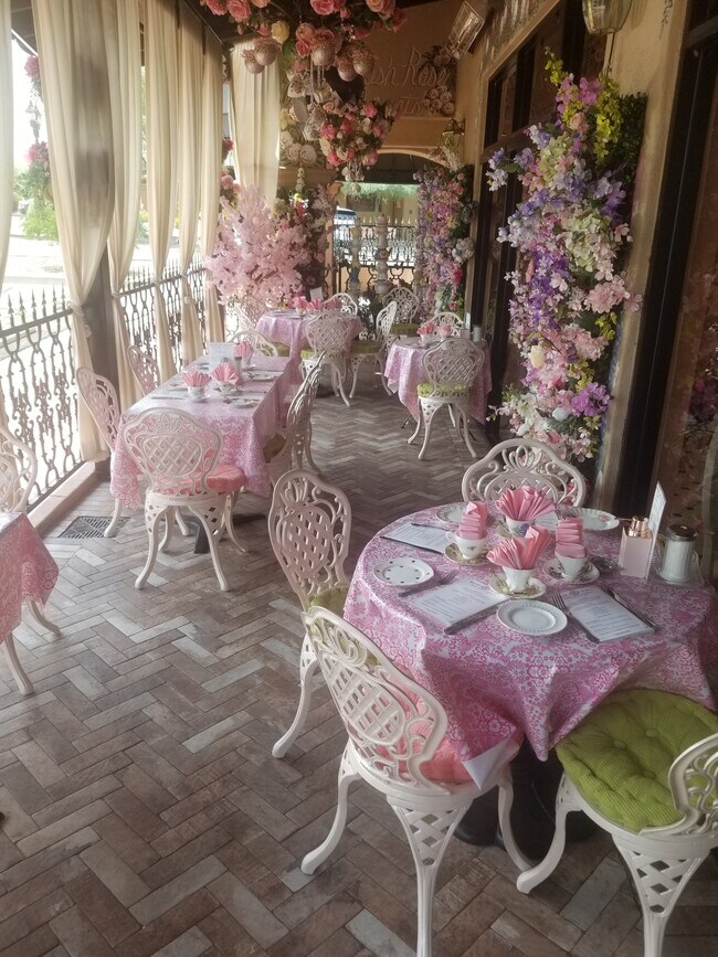
Storebuilding
Maricopa
X
Arizona
04013C0883L
29
2025
0.10 AC
2025
Carefree
030401
Phoenix
7,718 SF
DEMOGRAPHICS near 201 Easy St
1 mile
3 mile
5 mile
2024 Total Population
1,993
15,882
38,351
2029 Population
2,202
17,687
42,499
Pop Growth 2024-2029
+ 10.49%
+ 11.37%
+ 10.82%
Average Age
60
59
55
2024 Total Households
1,002
7,494
16,998
HH Growth 2024-2029
+ 10.48%
+ 11.48%
+ 11.08%
Median Household Inc
$119,834
$129,847
$142,170
Avg Household Size
2.00
2.10
2.20
2024 Avg HH Vehicles
2.00
2.00
2.00
Median Home Value
$863,636
$839,054
$829,883
Median Year Built
1988
1997
2000
Nearby Places
Map Layers
Map Styles
 Street
 Aerial
Transit
 Traffic
 Biking
Places
Listings with unknown addresses are not visible on the map
- Restaurants
- Banks
- Shops
- Fitness
- Groceries
PUBLIC TRANSPORTATION
AIRPORT
Phoenix Sky Harbor International
Drive
Walk
Distance
Phoenix Sky Harbor International
51 min
34.0 mi
Freight Ports
Port of San Diego
Drive
Walk
Distance
Port of San Diego
435 min
383.4 mi
SALE & LEASE HISTORY
LISTING DATE
SALE/LEASE

Sep 13, 2023
For Sale
Feb 27, 2020
For Lease
Nearby Properties
Address
Land Use
TOTAL SIZE
Lot Size
Zoning
Address
Land Use
TOTAL SIZE
Lot Size
Zoning
140,303 SF
29.18 AC
R-4R
Address
Land Use
TOTAL SIZE
Lot Size
Zoning
123,518 SF
14.92 AC
C-C
Address
Land Use
TOTAL SIZE
Lot Size
Zoning
126,785 SF
17.94 AC
C-G
Address
Land Use
TOTAL SIZE
Lot Size
Zoning
223,188 SF
13.68 AC
RT
Address
Land Use
TOTAL SIZE
Lot Size
Zoning
82,175 SF
8.65 AC
C-C
Address
Land Use
TOTAL SIZE
Lot Size
Zoning
3,816 SF
0.90 AC
R-18
Address
Land Use
TOTAL SIZE
Lot Size
Zoning
47,830 SF
5.22 AC
R-43
Address
Land Use
TOTAL SIZE
Lot Size
Zoning
3,033 SF
5.48 AC
R-89
Address
Land Use
TOTAL SIZE
Lot Size
Zoning
84,248 SF
6.68 AC
C-C
Address
Land Use
TOTAL SIZE
Lot Size
Zoning
24,471 SF
152.22 AC
Address
Land Use
TOTAL SIZE
Lot Size
Zoning
35,734 SF
10.13 AC
R-43
Address
Land Use
TOTAL SIZE
Lot Size
Zoning
32,944 SF
6.89 AC
R-70
Address
Land Use
TOTAL SIZE
Lot Size
Zoning
65,744 SF
2.05 AC
Address
Land Use
TOTAL SIZE
Lot Size
Zoning
21,828 SF
58.46 AC
R-43
Address
Land Use
TOTAL SIZE
Lot Size
Zoning
15,261 SF
13.02 AC
R135
Address
Land Use
TOTAL SIZE
Lot Size
Zoning
31,318 SF
5.37 AC
C-C
Address
Land Use
TOTAL SIZE
Lot Size
Zoning
27,058 SF
8.21 AC
O-S
Address
Land Use
TOTAL SIZE
Lot Size
Zoning
2.88 AC
R-43
Address
Land Use
TOTAL SIZE
Lot Size
Zoning
64,796 SF
2.86 AC
C-C
Address
Land Use
TOTAL SIZE
Lot Size
Zoning
12.46 AC
C-C
Address
Land Use
TOTAL SIZE
Lot Size
Zoning
90,526 SF
32.62 AC
R-190
Address
Land Use
TOTAL SIZE
Lot Size
Zoning
12,832 SF
5.44 AC
RURAL43
Address
Land Use
TOTAL SIZE
Lot Size
Zoning
35,680 SF
5.91 AC
RT
Address
Land Use
TOTAL SIZE
Lot Size
Zoning
2,068 SF
1.44 AC
R-35
Address
Land Use
TOTAL SIZE
Lot Size
Zoning
9.27 AC
RT
Address
Land Use
TOTAL SIZE
Lot Size
Zoning
29,792 SF
3.42 AC
C-T
Address
Land Use
TOTAL SIZE
Lot Size
Zoning
14,188 SF
2.80 AC
C-C
Address
Land Use
TOTAL SIZE
Lot Size
Zoning
1.10 AC
R35
Address
Land Use
TOTAL SIZE
Lot Size
Zoning
7.65 AC
RT
The World's #1 Commercial Real Estate Marketplace
Connect with us
© 2026 CoStar Group
The information above has been obtained from sources believed reliable. While we do not doubt its accuracy we have not verified it and make no guarantee, warranty or representation about it. It is your responsibility to independently confirm its accuracy and completeness. Any projections, opinions, assumptions, or estimates used are for example only and do not represent the current or future performance of the property. The value of this transaction to you depends on tax and other factors which should be evaluated by your tax, financial, and legal advisors. You and your advisors should conduct a careful, independent investigation of the property to determine to your satisfaction the suitability of the property for your needs.