Property Record
201 Forrest Ave, Brewton, AL 36426
NEARBY LISTINGS FOR SALE OR LEASE
Property Detail
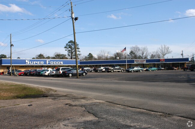
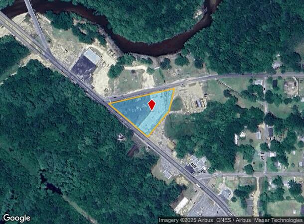
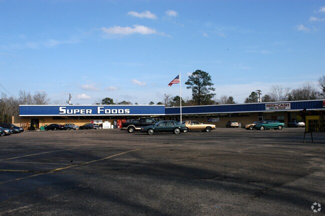
201 Forrest Ave
Stripcommercialcenter
BEG INT NE S FORREST AVE & S S SNOWDEN ST SEC. 33 T2N R10E TH NE LY ALG SNOWDE ST 445.9 S LY 150 SW LY 219.3 TO NE S FORREST AVE NW LY ALONG ST 350.8 EAST BREWTON
AE
Escambia
01053C0477E
Alabama
2025
1.62 AC
2024
Other Market Areas
969802
Atmore, AL
17,238 SF
15-08-33-2-005-003.000
DEMOGRAPHICS near 201 Forrest Ave
1 Mile
3 Mile
5 Mile
2024 Total Population
1,668
8,050
10,393
2029 Population
1,667
8,006
10,314
Pop Growth 2024-2029
(0.06%)
(0.55%)
(0.76%)
Average Age
40
42
42
2024 Total Households
686
3,336
4,300
HH Growth 2024-2029
0.00%
(0.48%)
(0.72%)
Median Household Inc
$41,438
$42,003
$42,590
Avg Household Size
2.30
2.30
2.30
2024 Avg HH Vehicles
2.00
2.00
2.00
Median Home Value
$98,316
$111,448
$118,960
Median Year Built
1989
1986
1986
Nearby Places
Map Layers
Map Styles
 Street
 Aerial
- Restaurants
- Banks
- Shops
- Fitness
- Groceries
Nearby Properties
Address
Land Use
TOTAL SIZE
Lot Size
Zoning
Address
Land Use
TOTAL SIZE
Lot Size
Zoning
Address
Land Use
TOTAL SIZE
Lot Size
Zoning
71,500 SF
66 AC
Address
Land Use
TOTAL SIZE
Lot Size
Zoning
51,186 SF
3 AC
Address
Land Use
TOTAL SIZE
Lot Size
Zoning
47,100 SF
4 AC
Address
Land Use
TOTAL SIZE
Lot Size
Zoning
63,789 SF
21 AC
Address
Land Use
TOTAL SIZE
Lot Size
Zoning
98,091 SF
17 AC
Address
Land Use
TOTAL SIZE
Lot Size
Zoning
28,298 SF
1.23 AC
Address
Land Use
TOTAL SIZE
Lot Size
Zoning
54,565 SF
3 AC
Address
Land Use
TOTAL SIZE
Lot Size
Zoning
125,000 SF
12 AC
Address
Land Use
TOTAL SIZE
Lot Size
Zoning
34,870 SF
2 AC
Address
Land Use
TOTAL SIZE
Lot Size
Zoning
54,850 SF
77 AC
Address
Land Use
TOTAL SIZE
Lot Size
Zoning
55,500 SF
14 AC
Address
Land Use
TOTAL SIZE
Lot Size
Zoning
20,314 SF
1 AC
Address
Land Use
TOTAL SIZE
Lot Size
Zoning
44,076 SF
4 AC
Address
Land Use
TOTAL SIZE
Lot Size
Zoning
15,216 SF
1.33 AC
Address
Land Use
TOTAL SIZE
Lot Size
Zoning
13,574 SF
2.15 AC
Address
Land Use
TOTAL SIZE
Lot Size
Zoning
15,019 SF
0.56 AC
Address
Land Use
TOTAL SIZE
Lot Size
Zoning
94,564 SF
6.60 AC
Address
Land Use
TOTAL SIZE
Lot Size
Zoning
7,600 SF
0.06 AC
Address
Land Use
TOTAL SIZE
Lot Size
Zoning
3,228 SF
2.10 AC
Address
Land Use
TOTAL SIZE
Lot Size
Zoning
15,074 SF
0.32 AC
Address
Land Use
TOTAL SIZE
Lot Size
Zoning
3,376 SF
83 AC
Address
Land Use
TOTAL SIZE
Lot Size
Zoning
8,160 SF
2 AC
Address
Land Use
TOTAL SIZE
Lot Size
Zoning
16,674 SF
0.50 AC
Address
Land Use
TOTAL SIZE
Lot Size
Zoning
8,540 SF
5 AC
Address
Land Use
TOTAL SIZE
Lot Size
Zoning
20,386 SF
2.36 AC
Address
Land Use
TOTAL SIZE
Lot Size
Zoning
27,748 SF
2.75 AC
Address
Land Use
TOTAL SIZE
Lot Size
Zoning
500 SF
4 AC
The World's #1 Commercial Real Estate Marketplace
Connect with us
© 2026 CoStar Group
The information above has been obtained from sources believed reliable. While we do not doubt its accuracy we have not verified it and make no guarantee, warranty or representation about it. It is your responsibility to independently confirm its accuracy and completeness. Any projections, opinions, assumptions, or estimates used are for example only and do not represent the current or future performance of the property. The value of this transaction to you depends on tax and other factors which should be evaluated by your tax, financial, and legal advisors. You and your advisors should conduct a careful, independent investigation of the property to determine to your satisfaction the suitability of the property for your needs.