Property Record
201 Keyes Ave, Hampshire, IL 60140


Save to a Folder
{{folder.Name}}
{{folder.ListingIds.length}} Properties
{{folder.ListingIds.length}} Property
Create a New Folder
Property Detail
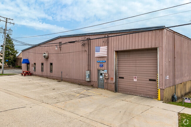
201 Keyes Ave
01-22-302-009
PT
Industrialgeneral
KANE
B3 DISTRIC
Illinois
B and X Area of moderate flood hazard, usually the area between the limits of the 100-year and 500-year floods.
1.92 AC
2025
North Kane/I-90
2025
Chicago
850705
Chicago-Naperville-Elgin, IL-IN
36,695 SF
NEARBY LISTINGS FOR SALE OR LEASE
-
-
View all Hampshire listings for sale on LoopNet.com
DEMOGRAPHICS near 201 Keyes Ave
1 mile
3 mile
5 mile
2025 Total Population
4,780
9,116
24,525
2030 Population
5,002
9,519
25,226
Pop Growth 2025-2030
+ 4.64%
+ 4.42%
+ 2.86%
Average Age
40
41
45
2025 Total Households
1,735
3,384
9,775
HH Growth 2025-2030
+ 4.61%
+ 4.40%
+ 2.76%
Median Household Inc
$103,208
$100,460
$100,121
Avg Household Size
2.70
2.70
2.50
2025 Avg HH Vehicles
2.00
2.00
2.00
Median Home Value
$316,716
$324,517
$335,583
Median Year Built
1999
2001
2004
Nearby Places
Map Layers
Map Styles
 Street
 Aerial
Layers
 Traffic
 Biking
Places
Listings with unknown addresses are not visible on the map
- Restaurants
- Banks
- Shops
- Fitness
- Groceries
PUBLIC TRANSPORTATION
AIRPORT
Chicago/Rockford International
Drive
Walk
Distance
Chicago/Rockford International
59 min
37.3 mi
Freight Ports
Port Milwaukee
Drive
Walk
Distance
Port Milwaukee
123 min
88.6 mi
Nearby Properties
Address
Land Use
TOTAL SIZE
Lot Size
Zoning
Address
Land Use
TOTAL SIZE
Lot Size
Zoning
Address
Land Use
TOTAL SIZE
Lot Size
Zoning
Address
Land Use
TOTAL SIZE
Lot Size
Zoning
152,275 SF
12.22 AC
I DISTRICT
Address
Land Use
TOTAL SIZE
Lot Size
Zoning
44,800 SF
35.39 AC
M2 MANUFAC
Address
Land Use
TOTAL SIZE
Lot Size
Zoning
Address
Land Use
TOTAL SIZE
Lot Size
Zoning
105,030 SF
10.53 AC
O-M OFFICE
Address
Land Use
TOTAL SIZE
Lot Size
Zoning
1.75 AC
Address
Land Use
TOTAL SIZE
Lot Size
Zoning
5.50 AC
O-M OFFICE
Address
Land Use
TOTAL SIZE
Lot Size
Zoning
4.64 AC
Address
Land Use
TOTAL SIZE
Lot Size
Zoning
Address
Land Use
TOTAL SIZE
Lot Size
Zoning
11.22 AC
Address
Land Use
TOTAL SIZE
Lot Size
Zoning
162,846 SF
4.71 AC
Address
Land Use
TOTAL SIZE
Lot Size
Zoning
28,900 SF
9 AC
I DISTRICT
Address
Land Use
TOTAL SIZE
Lot Size
Zoning
23,626 SF
1.98 AC
I DISTRICT
Address
Land Use
TOTAL SIZE
Lot Size
Zoning
4.83 AC
Address
Land Use
TOTAL SIZE
Lot Size
Zoning
46,596 SF
5.66 AC
M1 MANUFAC
Address
Land Use
TOTAL SIZE
Lot Size
Zoning
29,863 SF
3.27 AC
I DISTRICT
Address
Land Use
TOTAL SIZE
Lot Size
Zoning
30,607 SF
2.36 AC
B1 DISTRIC
Address
Land Use
TOTAL SIZE
Lot Size
Zoning
23,754 SF
1.87 AC
I DISTRICT
Address
Land Use
TOTAL SIZE
Lot Size
Zoning
1.16 AC
Address
Land Use
TOTAL SIZE
Lot Size
Zoning
18,317 SF
2.06 AC
B2 DISTRIC
Address
Land Use
TOTAL SIZE
Lot Size
Zoning
4.13 AC
O-M OFFICE
Address
Land Use
TOTAL SIZE
Lot Size
Zoning
18,080 SF
1.93 AC
M1 MANUFAC
Address
Land Use
TOTAL SIZE
Lot Size
Zoning
34,215 SF
2.64 AC
B2 DISTRIC
Address
Land Use
TOTAL SIZE
Lot Size
Zoning
43,300 SF
1.81 AC
B2 DISTRIC
Address
Land Use
TOTAL SIZE
Lot Size
Zoning
72,000 SF
2.07 AC
B2 DISTRIC
Address
Land Use
TOTAL SIZE
Lot Size
Zoning
12,087 SF
0.63 AC
M1 MANUFAC
Address
Land Use
TOTAL SIZE
Lot Size
Zoning
Address
Land Use
TOTAL SIZE
Lot Size
Zoning
2,098 SF
100 AC
F DISTRICT
The World's #1 Commercial Real Estate Marketplace
Connect with us
© 2026 CoStar Group
The information above has been obtained from sources believed reliable. While we do not doubt its accuracy we have not verified it and make no guarantee, warranty or representation about it. It is your responsibility to independently confirm its accuracy and completeness. Any projections, opinions, assumptions, or estimates used are for example only and do not represent the current or future performance of the property. The value of this transaction to you depends on tax and other factors which should be evaluated by your tax, financial, and legal advisors. You and your advisors should conduct a careful, independent investigation of the property to determine to your satisfaction the suitability of the property for your needs.