Property Record
201 King St E, Bethune, SC 29009
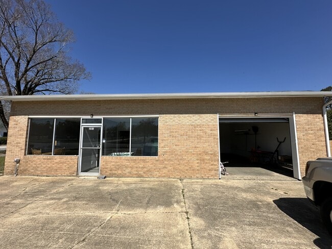
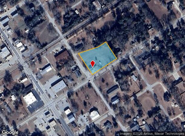
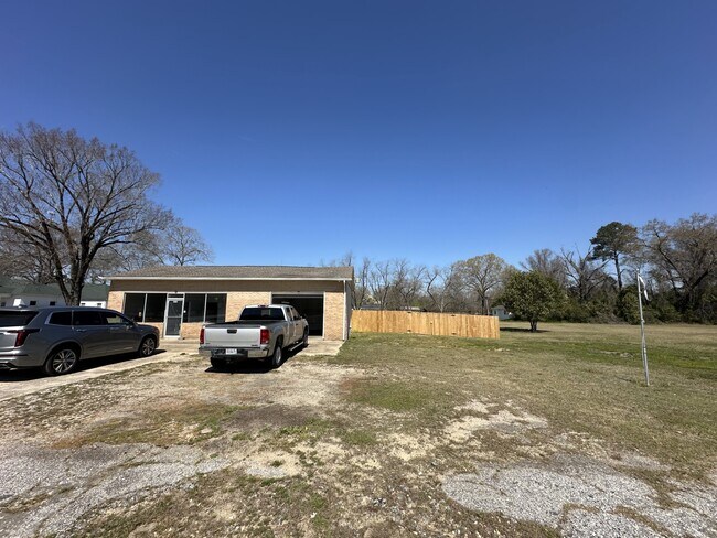
This Property Is For Sale
Current Lease Availabilities
NEARBY LISTINGS FOR SALE OR LEASE
-
-
View all Bethune listings for sale on LoopNet.com
Property Detail
201 King St E
B141-11-00-094
CONTRACT OF SALE
Storebuilding
Kershaw
X
South Carolina
45031C0100C
1.80 AC
2025
Kershaw County
2025
Columbia
970100
Columbia, SC
1,232 SF
DEMOGRAPHICS near 201 King St E
1 mile
3 mile
5 mile
2024 Total Population
441
1,254
1,843
2029 Population
466
1,319
1,930
Pop Growth 2024-2029
+ 5.67%
+ 5.18%
+ 4.72%
Average Age
45
44
43
2024 Total Households
195
533
765
HH Growth 2024-2029
+ 5.64%
+ 5.25%
+ 4.84%
Median Household Inc
$33,076
$36,785
$42,045
Avg Household Size
2.30
2.30
2.40
2024 Avg HH Vehicles
2.00
2.00
2.00
Median Home Value
$110,784
$94,724
$89,457
Median Year Built
1969
1978
1981
Nearby Places
Map Layers
Map Styles
 Street
 Aerial
Transit
 Traffic
 Biking
Places
Listings with unknown addresses are not visible on the map
- Restaurants
- Banks
- Shops
- Fitness
- Groceries
Nearby Properties
Address
Land Use
TOTAL SIZE
Lot Size
Zoning
Address
Land Use
TOTAL SIZE
Lot Size
Zoning
10,857 SF
1.02 AC
MUNICIPAL
Address
Land Use
TOTAL SIZE
Lot Size
Zoning
8,000 SF
1.01 AC
MUNICIPAL
Address
Land Use
TOTAL SIZE
Lot Size
Zoning
6,500 SF
0.28 AC
MUNICIPAL
Address
Land Use
TOTAL SIZE
Lot Size
Zoning
4,236 SF
98.45 AC
RD2
Address
Land Use
TOTAL SIZE
Lot Size
Zoning
3,727 SF
8.87 AC
RD-2
Address
Land Use
TOTAL SIZE
Lot Size
Zoning
2,711 SF
5.10 AC
Address
Land Use
TOTAL SIZE
Lot Size
Zoning
4,152 SF
1.88 AC
MUNICIPAL
Address
Land Use
TOTAL SIZE
Lot Size
Zoning
900 SF
13.80 AC
MUNICIPAL
Address
Land Use
TOTAL SIZE
Lot Size
Zoning
3,000 SF
1.76 AC
MUNICIPAL
Address
Land Use
TOTAL SIZE
Lot Size
Zoning
185 AC
I1
Address
Land Use
TOTAL SIZE
Lot Size
Zoning
2,142 SF
18.42 AC
RD2
Address
Land Use
TOTAL SIZE
Lot Size
Zoning
3,573 SF
8.54 AC
Address
Land Use
TOTAL SIZE
Lot Size
Zoning
5,100 SF
2.03 AC
MUNICIPAL
Address
Land Use
TOTAL SIZE
Lot Size
Zoning
2,201 SF
1.50 AC
MUNICIPAL
Address
Land Use
TOTAL SIZE
Lot Size
Zoning
2,208 SF
24.64 AC
RD2
Address
Land Use
TOTAL SIZE
Lot Size
Zoning
2,414 SF
0.39 AC
MUNICIPAL
Address
Land Use
TOTAL SIZE
Lot Size
Zoning
5,354 SF
4.85 AC
RD2
Address
Land Use
TOTAL SIZE
Lot Size
Zoning
3,897 SF
112.14 AC
RD2
Address
Land Use
TOTAL SIZE
Lot Size
Zoning
133.74 AC
RD-2
Address
Land Use
TOTAL SIZE
Lot Size
Zoning
2,432 SF
Address
Land Use
TOTAL SIZE
Lot Size
Zoning
2,796 SF
7.26 AC
RD2
Address
Land Use
TOTAL SIZE
Lot Size
Zoning
3,606 SF
376.33 AC
RD-2
Address
Land Use
TOTAL SIZE
Lot Size
Zoning
4,332 SF
0.77 AC
MUNICIPAL
Address
Land Use
TOTAL SIZE
Lot Size
Zoning
4,314 SF
8.50 AC
RD2
Address
Land Use
TOTAL SIZE
Lot Size
Zoning
9,496 SF
0.43 AC
MUNICIPAL
Address
Land Use
TOTAL SIZE
Lot Size
Zoning
5,156 SF
6.04 AC
RD2
Address
Land Use
TOTAL SIZE
Lot Size
Zoning
4,808 SF
2.20 AC
MUNICIPAL
Address
Land Use
TOTAL SIZE
Lot Size
Zoning
3,976 SF
3.53 AC
Address
Land Use
TOTAL SIZE
Lot Size
Zoning
2,136 SF
2.14 AC
RD2
Address
Land Use
TOTAL SIZE
Lot Size
Zoning
3,254 SF
42.23 AC
RD2
The World's #1 Commercial Real Estate Marketplace
Connect with us
© 2026 CoStar Group
The information above has been obtained from sources believed reliable. While we do not doubt its accuracy we have not verified it and make no guarantee, warranty or representation about it. It is your responsibility to independently confirm its accuracy and completeness. Any projections, opinions, assumptions, or estimates used are for example only and do not represent the current or future performance of the property. The value of this transaction to you depends on tax and other factors which should be evaluated by your tax, financial, and legal advisors. You and your advisors should conduct a careful, independent investigation of the property to determine to your satisfaction the suitability of the property for your needs.