Property Record
201 Lazy Rd, Georgetown, TX 78626
Save to a Folder
{{folder.Name}}
{{folder.ListingIds.length}} Properties
{{folder.ListingIds.length}} Property
Create a New Folder
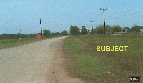
Property Detail
201 Lazy Rd
Austin-Round Rock-San Marcos, TX
AW0051 AW0051 - BERRY, J. SUR., ACRES 39.147
R393531
WILLIAMSON
Vacantlandnec
Texas
B and X Area of moderate flood hazard, usually the area between the limits of the 100-year and 500-year floods.
7.61 AC
2024
Georgetown
2025
Austin
020822
NEARBY LISTINGS FOR SALE OR LEASE
DEMOGRAPHICS near 201 Lazy Rd
1 mile
3 mile
5 mile
2025 Total Population
3,493
26,250
78,482
2030 Population
4,069
30,189
90,645
Pop Growth 2025-2030
+ 16.49%
+ 15.01%
+ 15.50%
Average Age
38
39
42
2025 Total Households
1,278
9,831
31,010
HH Growth 2025-2030
+ 17.06%
+ 15.61%
+ 15.94%
Median Household Inc
$85,390
$90,351
$98,428
Avg Household Size
2.70
2.50
2.40
2025 Avg HH Vehicles
2.00
2.00
2.00
Median Home Value
$300,813
$390,971
$445,449
Median Year Built
2003
2001
2004
Nearby Places
Map Layers
Map Styles
 Street
 Aerial
Layers
 Traffic
 Biking
Places
Listings with unknown addresses are not visible on the map
- Restaurants
- Banks
- Shops
- Fitness
- Groceries
PUBLIC TRANSPORTATION
AIRPORT
Killeen Municipal
Drive
Walk
Distance
Killeen Municipal
51 min
38.9 mi
Robert Gray AAF
Drive
Walk
Distance
Robert Gray AAF
55 min
39.7 mi
Freight Ports
Calhoun Port
Drive
Walk
Distance
Calhoun Port
212 min
186.1 mi
SALE & LEASE HISTORY
LISTING DATE
SALE/LEASE

Mar 04, 2024
For Sale
Nearby Properties
Address
Land Use
TOTAL SIZE
Lot Size
Zoning
Address
Land Use
TOTAL SIZE
Lot Size
Zoning
71.65 AC
1-RS
Address
Land Use
TOTAL SIZE
Lot Size
Zoning
200,200 SF
34.02 AC
Address
Land Use
TOTAL SIZE
Lot Size
Zoning
453,015 SF
22.62 AC
Address
Land Use
TOTAL SIZE
Lot Size
Zoning
326,646 SF
19.33 AC
Address
Land Use
TOTAL SIZE
Lot Size
Zoning
425,144 SF
32.97 AC
Address
Land Use
TOTAL SIZE
Lot Size
Zoning
439,044 SF
32.68 AC
Address
Land Use
TOTAL SIZE
Lot Size
Zoning
252,492 SF
15.35 AC
Address
Land Use
TOTAL SIZE
Lot Size
Zoning
520,121 SF
56.73 AC
Address
Land Use
TOTAL SIZE
Lot Size
Zoning
8,727 SF
89.67 AC
Address
Land Use
TOTAL SIZE
Lot Size
Zoning
193,985 SF
38.17 AC
Address
Land Use
TOTAL SIZE
Lot Size
Zoning
298,302 SF
20.96 AC
Address
Land Use
TOTAL SIZE
Lot Size
Zoning
176,875 SF
14.75 AC
3-C-1
Address
Land Use
TOTAL SIZE
Lot Size
Zoning
241,857 SF
26.60 AC
Address
Land Use
TOTAL SIZE
Lot Size
Zoning
200,746 SF
17.52 AC
Address
Land Use
TOTAL SIZE
Lot Size
Zoning
232,368 SF
16.40 AC
Address
Land Use
TOTAL SIZE
Lot Size
Zoning
592 SF
42.32 AC
Address
Land Use
TOTAL SIZE
Lot Size
Zoning
154,603 SF
20.04 AC
Address
Land Use
TOTAL SIZE
Lot Size
Zoning
121,117 SF
12.04 AC
Address
Land Use
TOTAL SIZE
Lot Size
Zoning
172,657 SF
8.84 AC
Address
Land Use
TOTAL SIZE
Lot Size
Zoning
125,100 SF
4.39 AC
Address
Land Use
TOTAL SIZE
Lot Size
Zoning
167,139 SF
10.35 AC
Address
Land Use
TOTAL SIZE
Lot Size
Zoning
174,955 SF
9.28 AC
Address
Land Use
TOTAL SIZE
Lot Size
Zoning
162,236 SF
8.99 AC
Address
Land Use
TOTAL SIZE
Lot Size
Zoning
90,821 SF
41.97 AC
Address
Land Use
TOTAL SIZE
Lot Size
Zoning
176,065 SF
19.48 AC
Address
Land Use
TOTAL SIZE
Lot Size
Zoning
118,480 SF
10.23 AC
Address
Land Use
TOTAL SIZE
Lot Size
Zoning
160,042 SF
10.15 AC
Address
Land Use
TOTAL SIZE
Lot Size
Zoning
184,242 SF
11 AC
Address
Land Use
TOTAL SIZE
Lot Size
Zoning
139,366 SF
142.80 AC
Address
Land Use
TOTAL SIZE
Lot Size
Zoning
131.22 AC
The World's #1 Commercial Real Estate Marketplace
Connect with us
© 2026 CoStar Group
The information above has been obtained from sources believed reliable. While we do not doubt its accuracy we have not verified it and make no guarantee, warranty or representation about it. It is your responsibility to independently confirm its accuracy and completeness. Any projections, opinions, assumptions, or estimates used are for example only and do not represent the current or future performance of the property. The value of this transaction to you depends on tax and other factors which should be evaluated by your tax, financial, and legal advisors. You and your advisors should conduct a careful, independent investigation of the property to determine to your satisfaction the suitability of the property for your needs.