Property Record
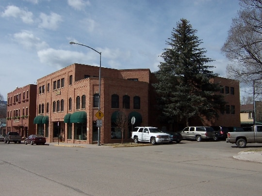
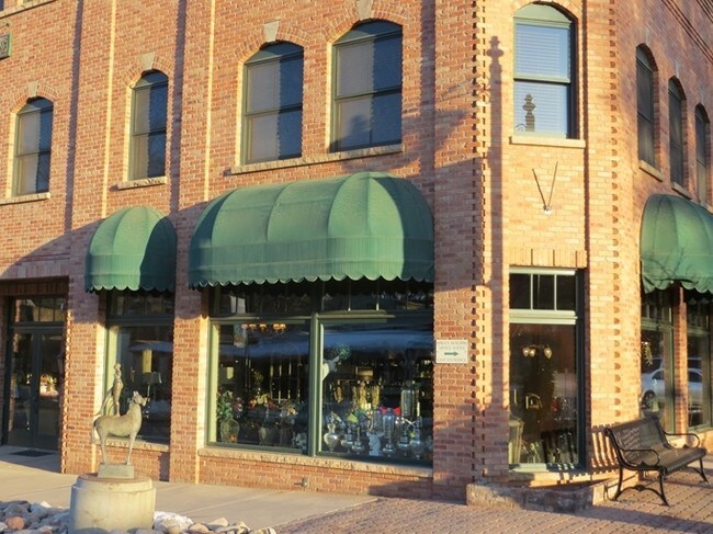
201 Main St, Carbondale, CO 81623
Property Detail
201 Main St
Rifle, CO
SECTION: 34 TOWNSHIP: 7 RANGE: 88 SUBDIVISION: SPRUCE PROFESSIONAL BLDG. CONDOS. UNIT: 201
R007828
Garfield
Commercialcondominium
Colorado
0
0.10 AC
2025
Colorado Northwest Area
951803
Other Market Areas
4,520 SF
NEARBY LISTINGS FOR SALE OR LEASE
-
-
View all Carbondale listings for sale on LoopNet.com
DEMOGRAPHICS near 201 Main St
1 mile
3 mile
5 mile
2025 Total Population
6,587
9,405
11,699
2030 Population
6,802
9,768
12,091
Pop Growth 2025-2030
+ 3.26%
+ 3.86%
+ 3.35%
Average Age
39
40
40
2025 Total Households
2,430
3,495
4,325
HH Growth 2025-2030
+ 3.50%
+ 4.09%
+ 3.51%
Median Household Inc
$98,473
$96,927
$97,128
Avg Household Size
2.60
2.60
2.60
2025 Avg HH Vehicles
2.00
2.00
2.00
Median Home Value
$901,379
$938,976
$953,411
Median Year Built
1995
1995
1994
Nearby Places
Map Layers
Map Styles
 Street
 Aerial
Transit
 Traffic
 Biking
Places
Listings with unknown addresses are not visible on the map
- Restaurants
- Banks
- Shops
- Fitness
- Groceries
PUBLIC TRANSPORTATION
AIRPORT
Aspen-Pitkin County/Sardy Field
Drive
Walk
Distance
Aspen-Pitkin County/Sardy Field
49 min
27.8 mi
Eagle County Regional
Drive
Walk
Distance
Eagle County Regional
60 min
40.1 mi
SALE & LEASE HISTORY
LISTING DATE
SALE/LEASE

Sep 25, 2016
For Lease
Feb 23, 2017
For Lease
Aug 05, 2017
For Sale
Nearby Properties
Address
Land Use
TOTAL SIZE
Lot Size
Zoning
Address
Land Use
TOTAL SIZE
Lot Size
Zoning
69,000 SF
2.60 AC
CG
Address
Land Use
TOTAL SIZE
Lot Size
Zoning
60,565 SF
6.52 AC
Address
Land Use
TOTAL SIZE
Lot Size
Zoning
12,780 SF
4.19 AC
Address
Land Use
TOTAL SIZE
Lot Size
Zoning
4,020 SF
2.15 AC
Address
Land Use
TOTAL SIZE
Lot Size
Zoning
15,428 SF
92.42 AC
Address
Land Use
TOTAL SIZE
Lot Size
Zoning
9,775 SF
4.85 AC
Address
Land Use
TOTAL SIZE
Lot Size
Zoning
12,457 SF
4.67 AC
RU
Address
Land Use
TOTAL SIZE
Lot Size
Zoning
3,456 SF
14.01 AC
R
Address
Land Use
TOTAL SIZE
Lot Size
Zoning
20,461 SF
203.65 AC
Address
Land Use
TOTAL SIZE
Lot Size
Zoning
32,390 SF
8.82 AC
R
Address
Land Use
TOTAL SIZE
Lot Size
Zoning
37,780 SF
3.67 AC
CG
Address
Land Use
TOTAL SIZE
Lot Size
Zoning
14,412 SF
4.41 AC
CG
Address
Land Use
TOTAL SIZE
Lot Size
Zoning
3.86 AC
Address
Land Use
TOTAL SIZE
Lot Size
Zoning
25,596 SF
0.96 AC
Address
Land Use
TOTAL SIZE
Lot Size
Zoning
34,434 SF
4.77 AC
Address
Land Use
TOTAL SIZE
Lot Size
Zoning
16,060 SF
3 AC
Address
Land Use
TOTAL SIZE
Lot Size
Zoning
8.04 AC
ROW
Address
Land Use
TOTAL SIZE
Lot Size
Zoning
192 SF
3.12 AC
Address
Land Use
TOTAL SIZE
Lot Size
Zoning
672 SF
69.75 AC
Address
Land Use
TOTAL SIZE
Lot Size
Zoning
37,666 SF
2.03 AC
Address
Land Use
TOTAL SIZE
Lot Size
Zoning
2,106 SF
7.55 AC
CG
Address
Land Use
TOTAL SIZE
Lot Size
Zoning
18.46 AC
R
Address
Land Use
TOTAL SIZE
Lot Size
Zoning
42,026 SF
3.32 AC
Address
Land Use
TOTAL SIZE
Lot Size
Zoning
2,320 SF
0.45 AC
Address
Land Use
TOTAL SIZE
Lot Size
Zoning
15,200 SF
0.57 AC
Address
Land Use
TOTAL SIZE
Lot Size
Zoning
39,594 SF
2 AC
Address
Land Use
TOTAL SIZE
Lot Size
Zoning
18,000 SF
1.50 AC
Address
Land Use
TOTAL SIZE
Lot Size
Zoning
26,928 SF
0.45 AC
Address
Land Use
TOTAL SIZE
Lot Size
Zoning
904 SF
8.66 AC
Address
Land Use
TOTAL SIZE
Lot Size
Zoning
4,634 SF
0.82 AC
The World's #1 Commercial Real Estate Marketplace
Connect with us
© 2026 CoStar Group
The information above has been obtained from sources believed reliable. While we do not doubt its accuracy we have not verified it and make no guarantee, warranty or representation about it. It is your responsibility to independently confirm its accuracy and completeness. Any projections, opinions, assumptions, or estimates used are for example only and do not represent the current or future performance of the property. The value of this transaction to you depends on tax and other factors which should be evaluated by your tax, financial, and legal advisors. You and your advisors should conduct a careful, independent investigation of the property to determine to your satisfaction the suitability of the property for your needs.