Property Record
201 Main St, Hurt, VA 24563
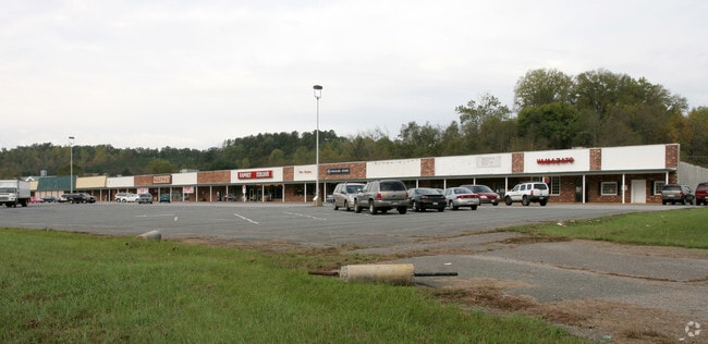

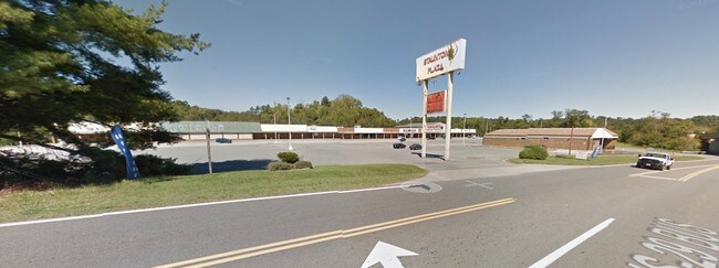
Property Detail
201 Main St
2546-91-0709
MAIN STREET ST BUSINESS 29
Uspostalservice
Pittsylvania
TZ
Virginia
2024
0.46 AC
2025
Virginia South Central
010200
Other Market Areas
3,070 SF
Danville, VA
NEARBY LISTINGS FOR SALE OR LEASE
DEMOGRAPHICS near 201 Main St
1 mile
3 mile
5 mile
2025 Total Population
1,250
6,478
9,327
2030 Population
1,234
6,434
9,267
Pop Growth 2025-2030
(1.28%)
(0.68%)
(0.64%)
Average Age
43
44
44
2025 Total Households
541
2,869
4,116
HH Growth 2025-2030
(1.29%)
(0.66%)
(0.66%)
Median Household Inc
$46,875
$47,007
$48,127
Avg Household Size
2.30
2.20
2.20
2025 Avg HH Vehicles
2.00
2.00
2.00
Median Home Value
$151,754
$145,267
$146,084
Median Year Built
1964
1966
1970
Nearby Places
Map Layers
Map Styles
 Street
 Aerial
Transit
 Traffic
 Biking
Places
Listings with unknown addresses are not visible on the map
- Restaurants
- Banks
- Shops
- Fitness
- Groceries
PUBLIC TRANSPORTATION
AIRPORT
Lynchburg Regional/Preston Glenn Field
Drive
Walk
Distance
Lynchburg Regional/Preston Glenn Field
34 min
22.6 mi
SALE & LEASE HISTORY
LISTING DATE
SALE/LEASE

Sep 23, 2016
For Sale
Mar 14, 2018
For Sale
Aug 16, 2023
For Sale
Nearby Properties
Address
Land Use
TOTAL SIZE
Lot Size
Zoning
Address
Land Use
TOTAL SIZE
Lot Size
Zoning
378,974 SF
99.53 AC
Address
Land Use
TOTAL SIZE
Lot Size
Zoning
60,000 SF
19.33 AC
Address
Land Use
TOTAL SIZE
Lot Size
Zoning
6.68 AC
R-1
Address
Land Use
TOTAL SIZE
Lot Size
Zoning
94,228 SF
32.64 AC
Address
Land Use
TOTAL SIZE
Lot Size
Zoning
19.62 AC
TZ
Address
Land Use
TOTAL SIZE
Lot Size
Zoning
70,966 SF
20.51 AC
Address
Land Use
TOTAL SIZE
Lot Size
Zoning
45,360 SF
16.05 AC
Address
Land Use
TOTAL SIZE
Lot Size
Zoning
44,302 SF
6.60 AC
Address
Land Use
TOTAL SIZE
Lot Size
Zoning
22,714 SF
0.22 AC
Address
Land Use
TOTAL SIZE
Lot Size
Zoning
150,352 SF
24.92 AC
Address
Land Use
TOTAL SIZE
Lot Size
Zoning
8,302 SF
18.07 AC
TZ
Address
Land Use
TOTAL SIZE
Lot Size
Zoning
3,159 SF
1.06 AC
Address
Land Use
TOTAL SIZE
Lot Size
Zoning
13.90 AC
TZ
Address
Land Use
TOTAL SIZE
Lot Size
Zoning
9,724 SF
3.05 AC
Address
Land Use
TOTAL SIZE
Lot Size
Zoning
22,228 SF
0.09 AC
Address
Land Use
TOTAL SIZE
Lot Size
Zoning
35,236 SF
10.04 AC
Address
Land Use
TOTAL SIZE
Lot Size
Zoning
59,598 SF
4.07 AC
Address
Land Use
TOTAL SIZE
Lot Size
Zoning
13,373 SF
0.12 AC
TZ
Address
Land Use
TOTAL SIZE
Lot Size
Zoning
112,536 SF
11.15 AC
Address
Land Use
TOTAL SIZE
Lot Size
Zoning
31,276 SF
12.70 AC
Address
Land Use
TOTAL SIZE
Lot Size
Zoning
3,747 SF
8.34 AC
R-1
Address
Land Use
TOTAL SIZE
Lot Size
Zoning
10,368 SF
2.79 AC
TZ
Address
Land Use
TOTAL SIZE
Lot Size
Zoning
5,160 SF
1.99 AC
Address
Land Use
TOTAL SIZE
Lot Size
Zoning
13,920 SF
3.67 AC
Address
Land Use
TOTAL SIZE
Lot Size
Zoning
10,841 SF
0.59 AC
Address
Land Use
TOTAL SIZE
Lot Size
Zoning
6,600 SF
14.42 AC
RSF
Address
Land Use
TOTAL SIZE
Lot Size
Zoning
4,920 SF
2.90 AC
Address
Land Use
TOTAL SIZE
Lot Size
Zoning
38,972 SF
5.97 AC
Address
Land Use
TOTAL SIZE
Lot Size
Zoning
16,503 SF
0.20 AC
Address
Land Use
TOTAL SIZE
Lot Size
Zoning
2,700 SF
0.94 AC
The World's #1 Commercial Real Estate Marketplace
Connect with us
© 2026 CoStar Group
The information above has been obtained from sources believed reliable. While we do not doubt its accuracy we have not verified it and make no guarantee, warranty or representation about it. It is your responsibility to independently confirm its accuracy and completeness. Any projections, opinions, assumptions, or estimates used are for example only and do not represent the current or future performance of the property. The value of this transaction to you depends on tax and other factors which should be evaluated by your tax, financial, and legal advisors. You and your advisors should conduct a careful, independent investigation of the property to determine to your satisfaction the suitability of the property for your needs.